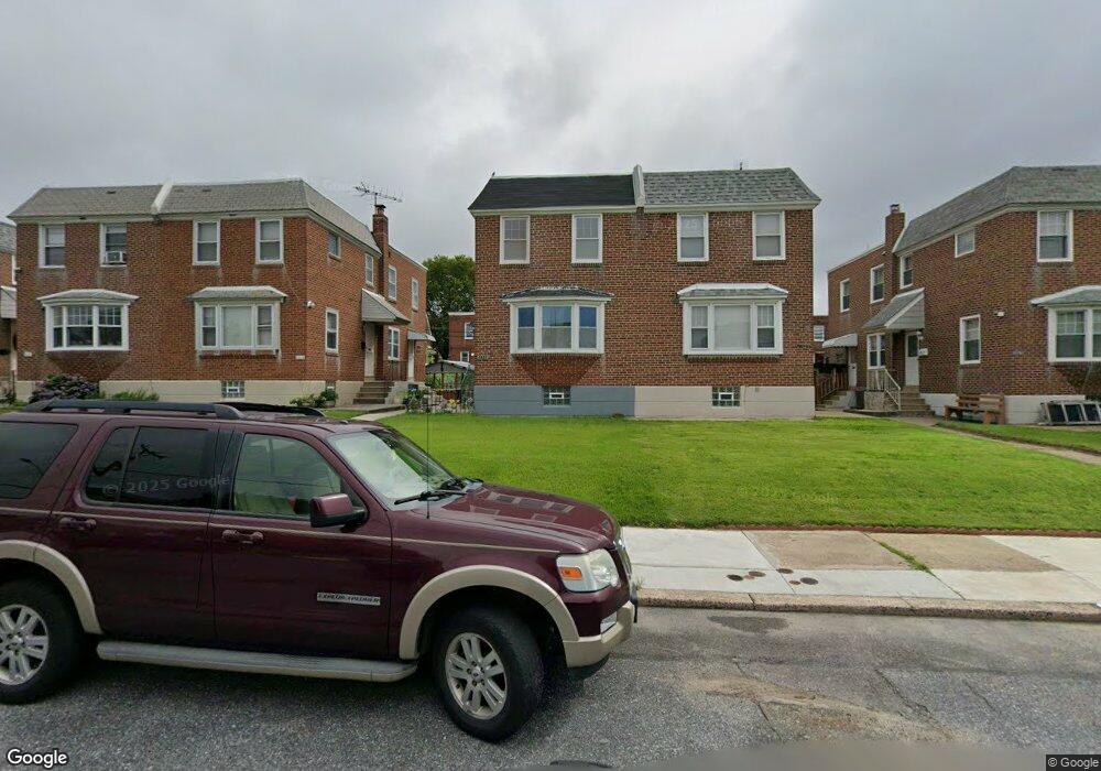
2021 Lansing St Philadelphia, PA 19152
Rhawnhurst NeighborhoodEstimated Value: $299,000 - $318,424
--
Bed
--
Bath
1,306
Sq Ft
$239/Sq Ft
Est. Value
About This Home
This home is located at 2021 Lansing St, Philadelphia, PA 19152 and is currently estimated at $311,606, approximately $238 per square foot. 2021 Lansing St is a home with nearby schools including Rhawnhurst School, Castor Gardens Middle School, and Northeast High School.
Ownership History
Date
Name
Owned For
Owner Type
Purchase Details
Closed on
Oct 11, 2016
Sold by
Addison Albert V and Addison Sengamali
Bought by
Zheng Ming Xin
Current Estimated Value
Home Financials for this Owner
Home Financials are based on the most recent Mortgage that was taken out on this home.
Original Mortgage
$108,500
Outstanding Balance
$50,854
Interest Rate
3.46%
Mortgage Type
Purchase Money Mortgage
Estimated Equity
$260,752
Purchase Details
Closed on
Oct 24, 2003
Sold by
Kenney Raymond D and Kenney Mary Lynn
Bought by
Addison Albert V and Addison Sengamali
Home Financials for this Owner
Home Financials are based on the most recent Mortgage that was taken out on this home.
Original Mortgage
$132,905
Interest Rate
6.5%
Mortgage Type
Purchase Money Mortgage
Create a Home Valuation Report for This Property
The Home Valuation Report is an in-depth analysis detailing your home's value as well as a comparison with similar homes in the area
Home Values in the Area
Average Home Value in this Area
Purchase History
| Date | Buyer | Sale Price | Title Company |
|---|---|---|---|
| Zheng Ming Xin | $155,000 | None Available | |
| Addison Albert V | $139,900 | Landamerica Lawyers Title |
Source: Public Records
Mortgage History
| Date | Status | Borrower | Loan Amount |
|---|---|---|---|
| Open | Zheng Ming Xin | $108,500 | |
| Previous Owner | Addison Albert V | $132,905 |
Source: Public Records
Tax History Compared to Growth
Tax History
| Year | Tax Paid | Tax Assessment Tax Assessment Total Assessment is a certain percentage of the fair market value that is determined by local assessors to be the total taxable value of land and additions on the property. | Land | Improvement |
|---|---|---|---|---|
| 2025 | $3,306 | $280,200 | $56,040 | $224,160 |
| 2024 | $3,306 | $280,200 | $56,040 | $224,160 |
| 2023 | $3,306 | $236,200 | $47,240 | $188,960 |
| 2022 | $3,036 | $236,200 | $47,240 | $188,960 |
| 2021 | $3,036 | $0 | $0 | $0 |
| 2020 | $3,036 | $0 | $0 | $0 |
| 2019 | $2,765 | $0 | $0 | $0 |
| 2018 | $2,377 | $0 | $0 | $0 |
| 2017 | $2,377 | $0 | $0 | $0 |
| 2016 | $1,957 | $0 | $0 | $0 |
| 2015 | $1,873 | $0 | $0 | $0 |
| 2014 | -- | $169,800 | $44,275 | $125,525 |
| 2012 | -- | $21,696 | $4,169 | $17,527 |
Source: Public Records
Map
Nearby Homes
- 2023 Hartel Ave
- 1920 Hartel Ave
- 1919 Lansing St
- 2120 Napfle St
- 7815 Horrocks St
- 1834 Lansing St
- 1917 Griffith St
- 1826 Hartel Ave
- 7912 14 Loretto Ave
- 2029 Loney St
- 1821 Afton St
- 1824 Afton St
- 7528 Loretto Ave
- 1807 Napfle Ave
- 2123 Loney St
- 1858 Glendale Ave
- 2306 Griffith St
- 1931 33 Rhawn St
- 7414 Castor Ave
- 1714 Afton St
- 2019 Lansing St
- 2017 Lansing St
- 2023 Lansing St
- 2015 Lansing St
- 2013 Lansing St
- 2025 Lansing St
- 2027 Lansing St
- 2011 Lansing St
- 2016 Hartel Ave
- 2009 Lansing St
- 2018 Hartel Ave
- 2014 Hartel Ave
- 2029 Lansing St
- 2022 Hartel Ave
- 2012 Hartel Ave
- 2020 Hartel Ave
- 2010 Hartel Ave
- 2031 Lansing St
- 2020 Lansing St
- 2008 Hartel Ave