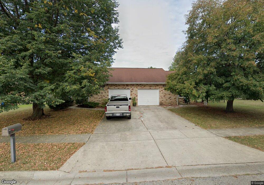
2021 Lynbridge Dr Reynoldsburg, OH 43068
Estimated Value: $183,000 - $241,000
2
Beds
2
Baths
1,103
Sq Ft
$188/Sq Ft
Est. Value
About This Home
This home is located at 2021 Lynbridge Dr, Reynoldsburg, OH 43068 and is currently estimated at $207,528, approximately $188 per square foot. 2021 Lynbridge Dr is a home located in Franklin County with nearby schools including Slate Ridge Elementary School, Baldwin Road Junior High School, and Hannah J Ashton Middle School.
Ownership History
Date
Name
Owned For
Owner Type
Purchase Details
Closed on
Oct 2, 2013
Sold by
Harold David R
Bought by
Harrold Paul L and Harrold Steven J
Current Estimated Value
Home Financials for this Owner
Home Financials are based on the most recent Mortgage that was taken out on this home.
Original Mortgage
$50,000
Interest Rate
4.58%
Mortgage Type
New Conventional
Purchase Details
Closed on
Jul 5, 2011
Sold by
Estate Of Shirley Ann Harrold
Bought by
Harrold Paul I and Harrold Steven J
Purchase Details
Closed on
Aug 3, 1987
Bought by
Harrold Shirley A
Purchase Details
Closed on
Jun 1, 1984
Create a Home Valuation Report for This Property
The Home Valuation Report is an in-depth analysis detailing your home's value as well as a comparison with similar homes in the area
Home Values in the Area
Average Home Value in this Area
Purchase History
| Date | Buyer | Sale Price | Title Company |
|---|---|---|---|
| Harrold Paul L | $22,200 | None Available | |
| Harrold Paul I | -- | None Available | |
| Harrold Shirley A | $61,500 | -- | |
| -- | -- | -- |
Source: Public Records
Mortgage History
| Date | Status | Borrower | Loan Amount |
|---|---|---|---|
| Previous Owner | Harrold Paul L | $50,000 |
Source: Public Records
Tax History Compared to Growth
Tax History
| Year | Tax Paid | Tax Assessment Tax Assessment Total Assessment is a certain percentage of the fair market value that is determined by local assessors to be the total taxable value of land and additions on the property. | Land | Improvement |
|---|---|---|---|---|
| 2024 | $2,201 | $52,790 | $14,180 | $38,610 |
| 2023 | $2,338 | $57,015 | $14,175 | $42,840 |
| 2022 | $1,876 | $37,800 | $5,530 | $32,270 |
| 2021 | $2,451 | $37,800 | $5,530 | $32,270 |
| 2020 | $2,501 | $37,800 | $5,530 | $32,270 |
| 2019 | $2,299 | $31,500 | $4,620 | $26,880 |
| 2018 | $2,195 | $31,500 | $4,620 | $26,880 |
| 2017 | $2,600 | $35,630 | $4,620 | $31,010 |
| 2016 | $2,157 | $26,430 | $4,340 | $22,090 |
| 2015 | $2,090 | $26,430 | $4,340 | $22,090 |
| 2014 | $2,100 | $26,430 | $4,340 | $22,090 |
| 2013 | $1,201 | $31,080 | $5,110 | $25,970 |
Source: Public Records
Map
Nearby Homes
- 6549 Santa Cruz Place
- 6348 E Livingston Ave
- 0 Brice Rd
- 6682 Woodsedge Dr
- 0 Radekin Rd Unit 225029852
- 1550 Idlewild Dr
- 6728 Greenbush Dr
- 6772 Gilette Dr
- 6658 Furth Dr
- 1324 Idlewild Dr
- 1334 Manor Dr
- 1328 Manor Dr
- 1888 Birkdale Dr
- 6793 Laird Ave
- 6584 Benjamin Dr
- 1603 Hallworth Ct Unit 16038
- 1481 Riverton Ct E
- 1748 Sunapple Way Unit 1748
- 5781 Hallridge Cir Unit B
- 1826-1828 Bairsford Dr
- 2019 Lynbridge Dr
- 2029 Lynbridge Dr Unit 31
- 2029-2031 Lynbridge Dr Unit 31
- 2011 Lynbridge Dr
- 2009 Lynbridge Dr
- 2039 Lynbridge Dr Unit 41
- 2012 Lynbridge Dr
- 2032 Lynbridge Dr
- 2041 Lynbridge Dr
- 2040 Lynbridge Dr
- 1999 Lynbridge Dr
- 6405 Birchview Dr N
- 6428 Hurlingham Rd
- 2051 Lynbridge Dr Unit 53
- 2000 Lynbridge Dr
- 2052 Lynbridge Dr
- 6425 Birchview Dr
- 6433 Hurlingham Rd
- 6438 Hurlingham Rd
- 6412 Lanercost Rd