
Seller's Agent in 2026
Timothy Young
Glasshouse Realty Group
(937) 718-4240
31 Total Sales
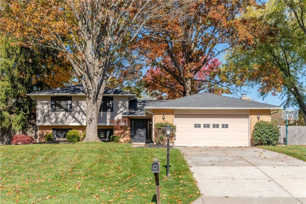
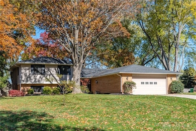
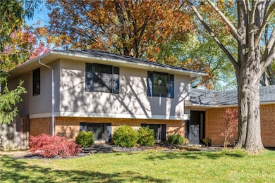
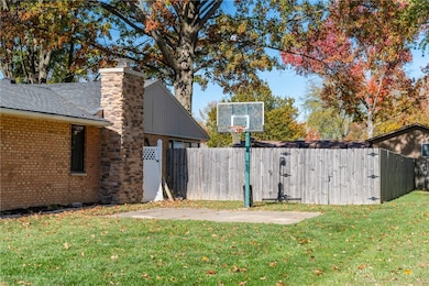
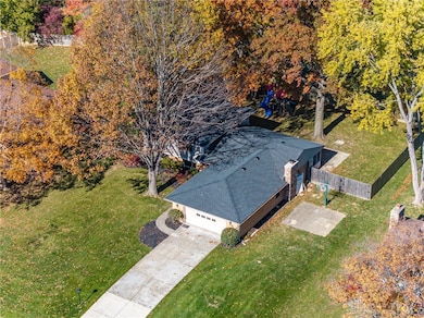
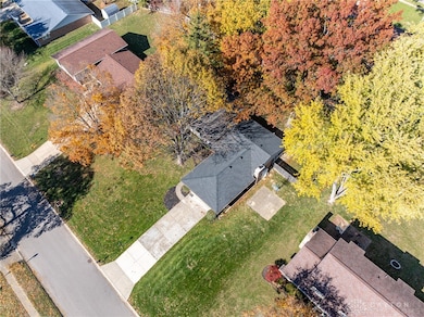
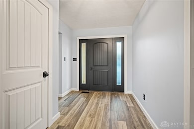
Welcome to 2021 Meadowside Lane, a beautifully maintained home tucked away on a quiet, wooded lot in one of Centerville’s most desirable neighborhoods. Located within the top-rated Centerville School District, this property perfectly blends comfort, convenience, and modern updates. Step inside to find a warm and inviting layout with comfortable living spaces and numerous updates throughout. Enjoy peace of mind with a brand-new HVAC system, roof, windows, and chimney—everything has been done for you! Outside, the fenced backyard offers privacy and room to relax or play, surrounded by mature trees and natural beauty. You’ll love the neighborhood’s direct entries into the Bill Yeck Nature Reserve, giving you easy access to scenic walking trails, open fields, and wooded paths just steps from your door. Perfectly situated near shopping, dining, parks, and major routes, this home combines a serene setting with everyday convenience.
Last Agent to Sell the Property
Glasshouse Realty Group Brokerage Phone: (937) 949-0006 License #2016005369 Listed on: 11/12/2025
| Date | Type | Sale Price | Title Company |
|---|---|---|---|
| Warranty Deed | $355,000 | Southern Ohio Real Estate Titl | |
| Warranty Deed | $210,000 | M & M Title Co | |
| Quit Claim Deed | -- | Attorney | |
| Special Warranty Deed | $133,000 | Lancar Title & Closing | |
| Sheriffs Deed | $133,000 | None Available | |
| Warranty Deed | $205,000 | Attorney |
| Date | Status | Loan Amount | Loan Type |
|---|---|---|---|
| Open | $366,715 | VA | |
| Previous Owner | $203,355 | Purchase Money Mortgage |
| Date | Event | Price | List to Sale | Price per Sq Ft |
|---|---|---|---|---|
| 01/15/2026 01/15/26 | Sold | $355,000 | -2.7% | $147 / Sq Ft |
| 11/25/2025 11/25/25 | Price Changed | $365,000 | -1.4% | $151 / Sq Ft |
| 11/12/2025 11/12/25 | For Sale | $370,000 | -- | $153 / Sq Ft |
| Year | Tax Paid | Tax Assessment Tax Assessment Total Assessment is a certain percentage of the fair market value that is determined by local assessors to be the total taxable value of land and additions on the property. | Land | Improvement |
|---|---|---|---|---|
| 2025 | $6,893 | $102,760 | $18,760 | $84,000 |
| 2024 | $6,334 | $102,760 | $18,760 | $84,000 |
| 2023 | $6,334 | $102,760 | $18,760 | $84,000 |
| 2022 | $5,975 | $76,690 | $14,000 | $62,690 |
| 2021 | $5,991 | $76,690 | $14,000 | $62,690 |
| 2020 | $5,983 | $76,690 | $14,000 | $62,690 |
| 2019 | $5,888 | $67,440 | $14,000 | $53,440 |
| 2018 | $5,259 | $67,440 | $14,000 | $53,440 |
| 2017 | $5,203 | $67,440 | $14,000 | $53,440 |
| 2016 | $4,738 | $57,870 | $14,000 | $43,870 |
| 2015 | $4,662 | $57,870 | $14,000 | $43,870 |
| 2014 | $4,662 | $57,870 | $14,000 | $43,870 |
| 2012 | -- | $62,290 | $14,000 | $48,290 |
Seller's Agent in 2026
Timothy Young
Glasshouse Realty Group
(937) 718-4240
31 Total Sales
Buyer's Agent in 2026
Nancy Farkas
Irongate Inc.
(937) 776-0424
59 Total Sales
Source: Dayton REALTORS®
MLS Number: 946644
APN: O67-21706-0009
Disclaimer: Certain information contained herein is derived from information provided by parties other than Homes.com. All information provided is deemed reliable, but is not guaranteed to be accurate and should be independently verified.
![]() The information is being provided by Dayton Area Board of Realtors MLS. Information deemed reliable but not guaranteed. Information is provided for the consumer's personal, non-commercial use, and may not be used for any purpose other than the identification of potential properties for purchase. Copyright 2026 Dayton Area Board of Realtors MLS. All Rights Reserved.
The information is being provided by Dayton Area Board of Realtors MLS. Information deemed reliable but not guaranteed. Information is provided for the consumer's personal, non-commercial use, and may not be used for any purpose other than the identification of potential properties for purchase. Copyright 2026 Dayton Area Board of Realtors MLS. All Rights Reserved.
Ask me questions while you tour the home.