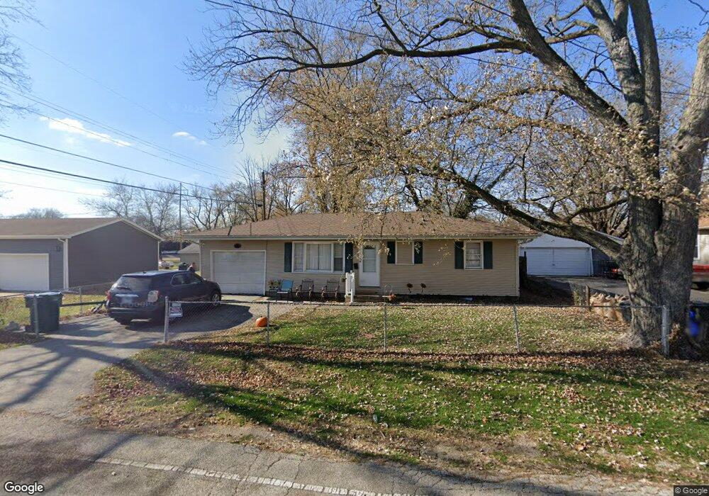
2021 N 31st St Decatur, IL 62526
Spencer Park NeighborhoodEstimated Value: $47,030 - $59,000
--
Bed
--
Bath
864
Sq Ft
$62/Sq Ft
Est. Value
About This Home
This home is located at 2021 N 31st St, Decatur, IL 62526 and is currently estimated at $53,758, approximately $62 per square foot. 2021 N 31st St is a home located in Macon County with nearby schools including Hope Academy and Robertson Charter School.
Ownership History
Date
Name
Owned For
Owner Type
Purchase Details
Closed on
Mar 2, 2023
Sold by
Brown Teaira
Bought by
Perkins Takina
Current Estimated Value
Purchase Details
Closed on
Jan 27, 2023
Sold by
Drake Janae
Bought by
Brown Teaira
Purchase Details
Closed on
Mar 31, 2015
Purchase Details
Closed on
Sep 10, 2008
Sold by
Gall Roger and Gall Poa Karen
Bought by
Jarrett Carolyn
Purchase Details
Closed on
Jul 1, 1993
Create a Home Valuation Report for This Property
The Home Valuation Report is an in-depth analysis detailing your home's value as well as a comparison with similar homes in the area
Home Values in the Area
Average Home Value in this Area
Purchase History
| Date | Buyer | Sale Price | Title Company |
|---|---|---|---|
| Perkins Takina | -- | -- | |
| Brown Teaira | -- | -- | |
| -- | -- | -- | |
| Jarrett Carolyn | -- | None Available | |
| -- | $25,000 | -- |
Source: Public Records
Tax History Compared to Growth
Tax History
| Year | Tax Paid | Tax Assessment Tax Assessment Total Assessment is a certain percentage of the fair market value that is determined by local assessors to be the total taxable value of land and additions on the property. | Land | Improvement |
|---|---|---|---|---|
| 2024 | $1,247 | $12,886 | $1,276 | $11,610 |
| 2023 | $1,237 | $12,430 | $1,231 | $11,199 |
| 2022 | $1,145 | $11,200 | $1,139 | $10,061 |
| 2021 | $1,076 | $10,460 | $1,064 | $9,396 |
| 2020 | $1,061 | $9,974 | $1,015 | $8,959 |
| 2019 | $1,061 | $9,974 | $1,015 | $8,959 |
| 2018 | $1,071 | $10,190 | $1,018 | $9,172 |
| 2017 | $1,096 | $10,462 | $1,045 | $9,417 |
| 2016 | $1,117 | $10,569 | $1,056 | $9,513 |
| 2015 | $1,061 | $10,382 | $1,037 | $9,345 |
| 2014 | $993 | $10,279 | $1,027 | $9,252 |
| 2013 | $1,018 | $10,666 | $1,066 | $9,600 |
Source: Public Records
Map
Nearby Homes
- 2645 E Logan St
- 2625 E Logan St
- 2570 E Olive St
- 2304 E Division St
- 3948 E Grand Ave
- 2918 N 22nd St
- 3760 E William Street Rd
- 464 Woodside Trail Unit A4
- 1537 E Division St
- 421 Woodside Trail Unit 5
- 345 N 34th St
- 1437 E Division St
- 2 Homewood Fishing Club
- 2434 E Prairie St
- 195 N Lake Shore Dr
- 0 E Condor Dr Unit 6255943
- 2819 E Wood St
- 111 S 24th+520 E Division+870 N Union St
- 1157 E Curtis Ave
- 203 S 25th St
- 2001 N 31st St
- 2041 N 31st St
- 3062 E Garfield Ave
- 2002 N 31st St
- 2048 N 31st St
- 3063 E Wallace St
- 3103 E Wallace St
- 3053 E Wallace St
- 3042 E Garfield Ave
- 3105 E Wallace St
- 3120 E Garfield Ave
- 3043 E Wallace St
- 3016 E Garfield Ave
- 3102 E Wallace St
- 3130 E Garfield Ave
- 3033 E Wallace St
- 3008 E Garfield Ave
- 1998 N 31st St
- 3054 E Wallace St
- 3140 E Garfield Ave