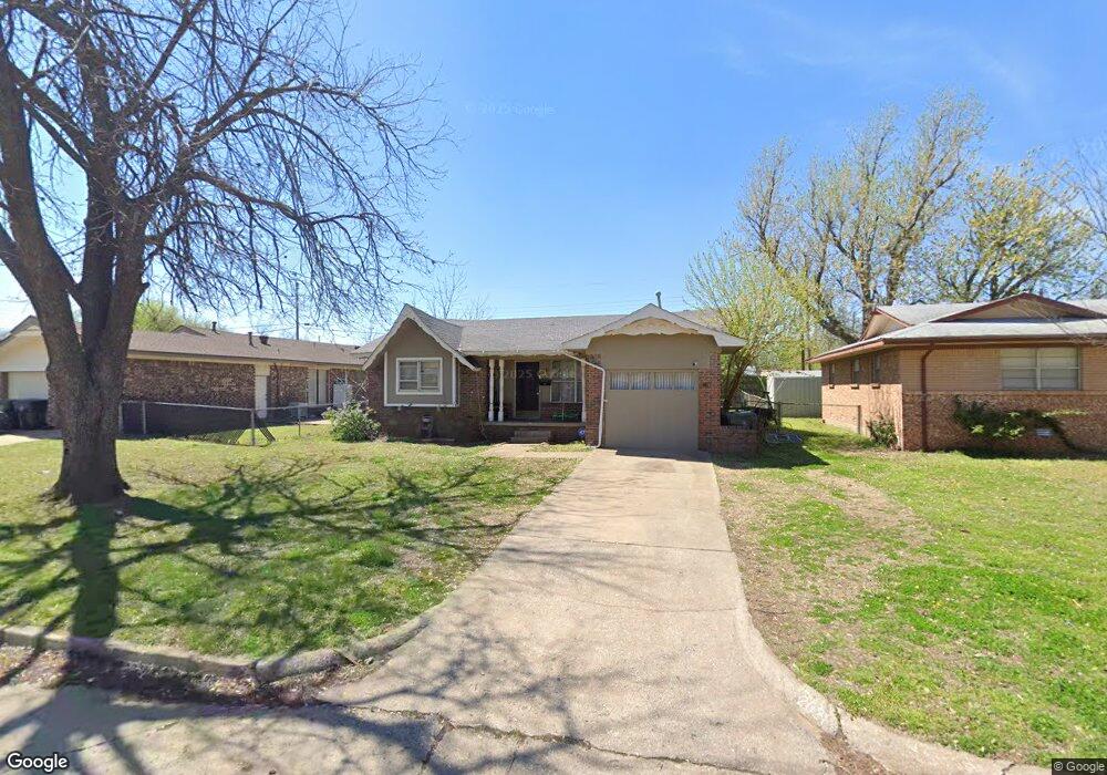
2021 N Mitchell Dr Oklahoma City, OK 73110
Estimated Value: $133,000 - $150,000
3
Beds
1
Bath
928
Sq Ft
$148/Sq Ft
Est. Value
About This Home
This home is located at 2021 N Mitchell Dr, Oklahoma City, OK 73110 and is currently estimated at $137,746, approximately $148 per square foot. 2021 N Mitchell Dr is a home located in Oklahoma County with nearby schools including Midwest City Middle School, Midwest City High School, and St Philip Neri School.
Ownership History
Date
Name
Owned For
Owner Type
Purchase Details
Closed on
Feb 12, 2014
Sold by
Mitchell Family Trust
Bought by
Omega Enterprises Llc
Current Estimated Value
Purchase Details
Closed on
Jul 13, 2009
Sold by
Lepisto Sharon D
Bought by
Mitchell Family Land Trust
Purchase Details
Closed on
Mar 21, 2008
Sold by
Irwin F M and Irwin Opal Lee
Bought by
Lepisto Sharon D
Home Financials for this Owner
Home Financials are based on the most recent Mortgage that was taken out on this home.
Original Mortgage
$31,000
Interest Rate
15%
Mortgage Type
Stand Alone First
Create a Home Valuation Report for This Property
The Home Valuation Report is an in-depth analysis detailing your home's value as well as a comparison with similar homes in the area
Home Values in the Area
Average Home Value in this Area
Purchase History
| Date | Buyer | Sale Price | Title Company |
|---|---|---|---|
| Omega Enterprises Llc | $37,500 | None Available | |
| Mitchell Family Land Trust | -- | None Available | |
| Lepisto Sharon D | $50,000 | American Guaranty Title Co |
Source: Public Records
Mortgage History
| Date | Status | Borrower | Loan Amount |
|---|---|---|---|
| Previous Owner | Lepisto Sharon D | $31,000 |
Source: Public Records
Tax History Compared to Growth
Tax History
| Year | Tax Paid | Tax Assessment Tax Assessment Total Assessment is a certain percentage of the fair market value that is determined by local assessors to be the total taxable value of land and additions on the property. | Land | Improvement |
|---|---|---|---|---|
| 2024 | $1,072 | $9,559 | $1,926 | $7,633 |
| 2023 | $1,072 | $9,104 | $1,202 | $7,902 |
| 2022 | $1,011 | $8,670 | $1,252 | $7,418 |
| 2021 | $986 | $8,258 | $1,384 | $6,874 |
| 2020 | $966 | $7,865 | $1,437 | $6,428 |
| 2019 | $929 | $7,911 | $1,239 | $6,672 |
| 2018 | $831 | $7,535 | $0 | $0 |
| 2017 | $837 | $7,479 | $1,292 | $6,187 |
| 2016 | $829 | $7,204 | $1,292 | $5,912 |
| 2015 | $849 | $7,084 | $1,433 | $5,651 |
| 2014 | $853 | $7,127 | $1,433 | $5,694 |
Source: Public Records
Map
Nearby Homes
- 909 Holoway Dr
- 921 Brown Dr
- 1020 Harold Dr
- 920 Arthur Dr
- 1800 N Mitchell Dr
- 1701 Rulane Dr
- 1613 Sandra Dr
- 412 S Fox Dr
- 6609 SE 15th St
- 5804 SE 7th St
- 208 S Fox Dr
- 816 S Sooner Rd
- 133 W Steed Dr
- 209 W Glenhaven Dr
- 305 W Coe Dr
- 216 W Coe Dr
- 605 S Sooner Rd
- 310 S Sooner Rd
- 3000 N Viewpoint Dr
- 125 W Coe Dr
- 2025 N Mitchell Dr
- 901 Holoway Dr
- 2033 N Mitchell Dr
- 908 W Mitchell Dr
- 913 Holoway Dr
- 2020 N Mitchell Dr
- 2024 N Mitchell Dr
- 2016 N Mitchell Dr
- 900 Holoway Dr
- 912 W Mitchell Dr
- 917 Holoway Dr
- 2028 N Mitchell Dr
- 908 Holoway Dr
- 912 Holoway Dr
- 2008 N Mitchell Dr
- 916 W Mitchell Dr
- 2005 N Mitchell Dr
- 2032 N Mitchell Dr
- 921 Holoway Dr
- 821 Holoway Dr