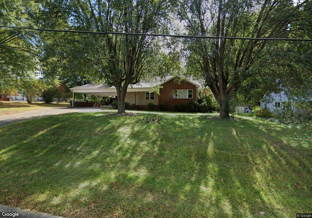
2021 Newton Dr Statesville, NC 28677
Estimated Value: $209,877 - $231,000
2
Beds
1
Bath
3,297
Sq Ft
$67/Sq Ft
Est. Value
About This Home
This home is located at 2021 Newton Dr, Statesville, NC 28677 and is currently estimated at $219,719, approximately $66 per square foot. 2021 Newton Dr is a home located in Iredell County with nearby schools including N.B. Mills Elementary School, West Iredell Middle School, and West Iredell High School.
Ownership History
Date
Name
Owned For
Owner Type
Purchase Details
Closed on
Jul 20, 2006
Sold by
Elliott Lonnie Paul and Elliott James Edwin
Bought by
Ngo Tommy L
Current Estimated Value
Home Financials for this Owner
Home Financials are based on the most recent Mortgage that was taken out on this home.
Original Mortgage
$112,000
Outstanding Balance
$66,087
Interest Rate
6.54%
Mortgage Type
Purchase Money Mortgage
Estimated Equity
$153,632
Purchase Details
Closed on
May 18, 1998
Sold by
Elliott Ruby H
Bought by
Irrevocable Trust Of Ruby Hoover Elliott
Purchase Details
Closed on
Jun 1, 1946
Create a Home Valuation Report for This Property
The Home Valuation Report is an in-depth analysis detailing your home's value as well as a comparison with similar homes in the area
Home Values in the Area
Average Home Value in this Area
Purchase History
| Date | Buyer | Sale Price | Title Company |
|---|---|---|---|
| Ngo Tommy L | $140,000 | None Available | |
| Irrevocable Trust Of Ruby Hoover Elliott | -- | -- | |
| -- | -- | -- |
Source: Public Records
Mortgage History
| Date | Status | Borrower | Loan Amount |
|---|---|---|---|
| Open | Ngo Tommy L | $112,000 |
Source: Public Records
Tax History Compared to Growth
Tax History
| Year | Tax Paid | Tax Assessment Tax Assessment Total Assessment is a certain percentage of the fair market value that is determined by local assessors to be the total taxable value of land and additions on the property. | Land | Improvement |
|---|---|---|---|---|
| 2024 | $1,148 | $106,920 | $22,500 | $84,420 |
| 2023 | $1,148 | $106,920 | $22,500 | $84,420 |
| 2022 | $1,040 | $84,750 | $18,000 | $66,750 |
| 2021 | $1,096 | $84,750 | $18,000 | $66,750 |
| 2020 | $1,096 | $84,750 | $18,000 | $66,750 |
| 2019 | $1,087 | $84,750 | $18,000 | $66,750 |
| 2018 | $604 | $42,810 | $19,500 | $23,310 |
| 2017 | $595 | $42,810 | $19,500 | $23,310 |
| 2016 | $595 | $42,810 | $19,500 | $23,310 |
| 2015 | $453 | $42,810 | $19,500 | $23,310 |
| 2014 | $568 | $57,700 | $29,250 | $28,450 |
Source: Public Records
Map
Nearby Homes
- 1713 Forest Dr
- 2321 Cline St
- 1716 Younger Ave
- 50 S Miller Ave Unit A
- 50 S Miller Ave Unit B
- 1709 Younger Ave
- 328 N Miller Ave
- 127 Bristol Rd
- 417 Central Dr
- 407 Central Dr
- 2607 Moss Rd
- 3 Williams Ave
- 1309 Williams Rd
- 214 H St
- 812 Candy Dr
- 818 Candy Dr
- Robie Plan at Bristol Terrace
- Penwell Plan at Bristol Terrace
- Hayden Plan at Bristol Terrace
- 119 Mary Locke Way
- 2025 Newton Dr
- 2013 Scott St
- 2009 Scott St
- 2020 Newton Dr
- 503 Hawthorne Dr
- 511 Hawthorne Dr
- 2017 Scott St
- 2121 Scott St
- 516 Hawthorne Dr
- 2002 Newton Dr
- 2125 Scott St
- 1907 Newton Dr Unit L2-6 L1 21
- 2010 Gagner St
- 2012 Gagner St
- 2002 Gagner St
- 2000 Gagner St
- 1571 Walker St
- 2028 Gagner St
- 422 Hawthorne Dr
- 2030 Gagner St