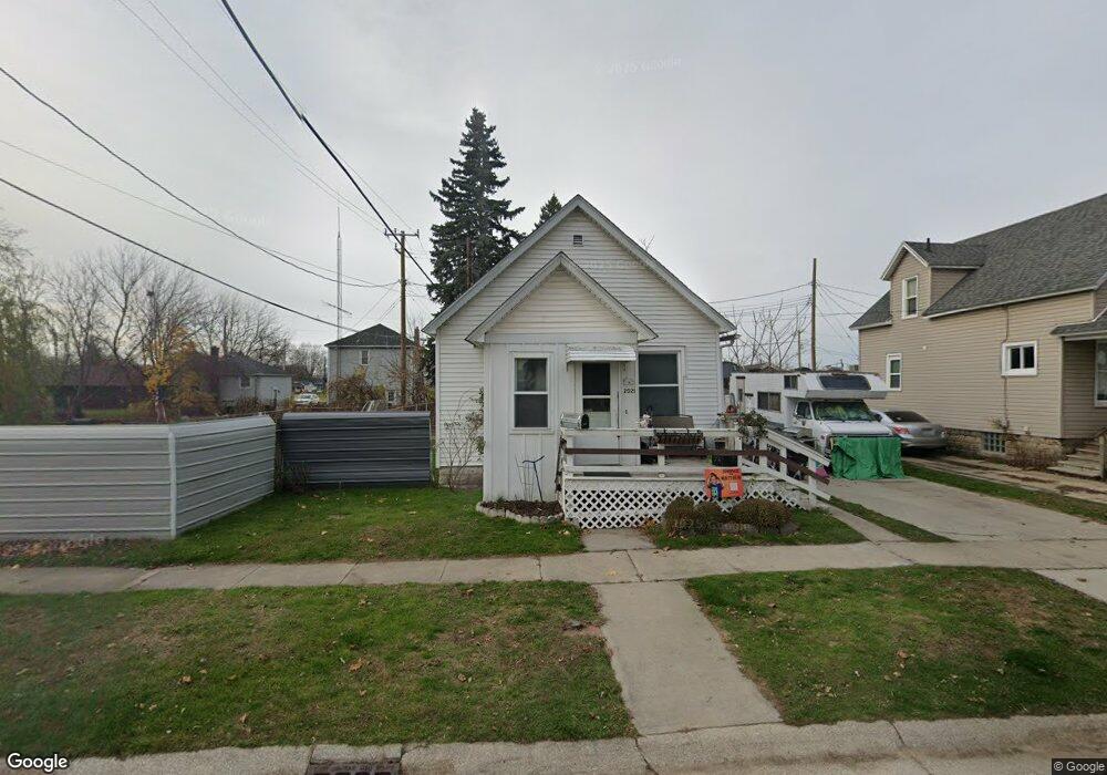
2021 Poplar St Port Huron, MI 48060
Estimated Value: $113,815 - $147,000
2
Beds
1
Bath
728
Sq Ft
$172/Sq Ft
Est. Value
About This Home
This home is located at 2021 Poplar St, Port Huron, MI 48060 and is currently estimated at $125,454, approximately $172 per square foot. 2021 Poplar St is a home located in St. Clair County with nearby schools including H.D. Crull Elementary School, Holland Woods Middle School, and Port Huron Northern High School.
Ownership History
Date
Name
Owned For
Owner Type
Purchase Details
Closed on
Mar 11, 2019
Sold by
Shepherd Eugene T and Shepherd Eugene M
Bought by
Shepherd Eugene T and Shepherd Carol L
Current Estimated Value
Purchase Details
Closed on
Jan 2, 2017
Sold by
Fernstorm Janet Lynn
Bought by
Shepherd Eugene M and Shepherd Eigeme T
Purchase Details
Closed on
Sep 27, 2016
Sold by
Shepherd Eugene M and Shepherd Hilda
Bought by
Shepherd Eugene M and Shepherd Hilda
Purchase Details
Closed on
Jul 15, 2015
Sold by
Horning Louann and Smith Marie
Bought by
Shepherd Eugene and Shepherd Hilda
Create a Home Valuation Report for This Property
The Home Valuation Report is an in-depth analysis detailing your home's value as well as a comparison with similar homes in the area
Home Values in the Area
Average Home Value in this Area
Purchase History
| Date | Buyer | Sale Price | Title Company |
|---|---|---|---|
| Shepherd Eugene T | -- | None Available | |
| Shepherd Eugene M | -- | None Available | |
| Shepherd Eugene M | -- | None Available | |
| Shepherd Eugene | $23,000 | Attorney |
Source: Public Records
Tax History Compared to Growth
Tax History
| Year | Tax Paid | Tax Assessment Tax Assessment Total Assessment is a certain percentage of the fair market value that is determined by local assessors to be the total taxable value of land and additions on the property. | Land | Improvement |
|---|---|---|---|---|
| 2025 | $1,268 | $45,100 | $0 | $0 |
| 2024 | $1,025 | $42,500 | $0 | $0 |
| 2023 | $969 | $37,900 | $0 | $0 |
| 2022 | $955 | $32,600 | $0 | $0 |
| 2021 | $907 | $30,600 | $0 | $0 |
| 2020 | $1,278 | $28,400 | $28,400 | $0 |
| 2019 | $901 | $19,600 | $0 | $0 |
| 2018 | $881 | $19,600 | $0 | $0 |
| 2017 | $788 | $18,500 | $0 | $0 |
| 2016 | $996 | $18,500 | $0 | $0 |
| 2015 | $588 | $16,800 | $16,800 | $0 |
| 2014 | $588 | $16,400 | $16,400 | $0 |
| 2013 | -- | $16,400 | $0 | $0 |
Source: Public Records
Map
Nearby Homes
- 2400 Stone St Unit 2414
- 1620 McBrady St
- 1116 Hancock St
- 2419 Cherry St
- 1649 Whipple St
- 1433 Poplar St
- 1907 Riverside Dr
- 1733 Whipple St
- 1819 Riverside Dr
- 2431 Armour St
- 1417 Kearney St
- 2215 Hancock St
- 2736 17th Ave
- 2913 11th Ave
- 1531 Robinson St
- 0000 Campau Ave
- 1202 Palmer Ct
- 2812 19th Ave
- 2925 Linda Ct
- 1002 Erie St