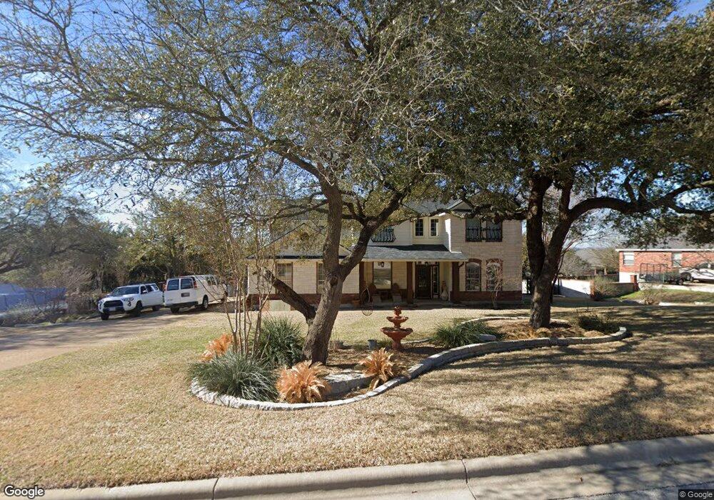
2021 Sandy Point Rd Harker Heights, TX 76548
Estimated Value: $466,368 - $522,000
--
Bed
--
Bath
3,276
Sq Ft
$153/Sq Ft
Est. Value
About This Home
This home is located at 2021 Sandy Point Rd, Harker Heights, TX 76548 and is currently estimated at $500,342, approximately $152 per square foot. 2021 Sandy Point Rd is a home located in Bell County with nearby schools including Skipcha Elementary School, Nolan Middle School, and Harker Heights High School.
Ownership History
Date
Name
Owned For
Owner Type
Purchase Details
Closed on
Oct 17, 2012
Sold by
Means Debra Neil
Bought by
Austin Michael K and Austin Tammy J
Current Estimated Value
Home Financials for this Owner
Home Financials are based on the most recent Mortgage that was taken out on this home.
Original Mortgage
$35,000
Interest Rate
3.55%
Mortgage Type
Purchase Money Mortgage
Purchase Details
Closed on
Jul 31, 2006
Sold by
Centex Homes
Bought by
Austin Michael K and Austin Tammy J
Create a Home Valuation Report for This Property
The Home Valuation Report is an in-depth analysis detailing your home's value as well as a comparison with similar homes in the area
Home Values in the Area
Average Home Value in this Area
Purchase History
| Date | Buyer | Sale Price | Title Company |
|---|---|---|---|
| Austin Michael K | -- | Monteith Abstract & Title Co | |
| Austin Michael K | -- | Commerce Title Company |
Source: Public Records
Mortgage History
| Date | Status | Borrower | Loan Amount |
|---|---|---|---|
| Closed | Austin Michael K | $35,000 |
Source: Public Records
Tax History Compared to Growth
Tax History
| Year | Tax Paid | Tax Assessment Tax Assessment Total Assessment is a certain percentage of the fair market value that is determined by local assessors to be the total taxable value of land and additions on the property. | Land | Improvement |
|---|---|---|---|---|
| 2025 | -- | $504,039 | -- | -- |
| 2024 | -- | $458,217 | -- | -- |
| 2023 | $7,383 | $416,561 | $0 | $0 |
| 2022 | $7,705 | $378,692 | $0 | $0 |
| 2021 | $7,976 | $369,953 | $32,670 | $337,283 |
| 2020 | $7,572 | $317,155 | $43,560 | $273,595 |
| 2019 | $7,200 | $284,516 | $27,225 | $257,291 |
| 2018 | $6,794 | $285,235 | $27,225 | $258,010 |
| 2017 | $6,721 | $280,668 | $27,225 | $253,443 |
| 2016 | $6,514 | $272,014 | $27,225 | $244,789 |
| 2015 | $5,866 | $267,712 | $27,225 | $240,487 |
| 2014 | $5,866 | $263,818 | $0 | $0 |
Source: Public Records
Map
Nearby Homes
- 2011 Sandy Point Rd
- 102 Vista
- 3301 Eagle Ridge
- 2013 Lakefront Dr
- 3313 Eagle Ridge
- 3319 Eagle Ridge
- 3201 Eagle Ridge
- 100 Rustler Cir
- 3331 Eagle Ridge Dr
- 3517 Shoreline Dr
- 3515 Shoreline Dr
- 105 Cedar Bluff Ct
- 1926 Fall Creek Dr
- 5926 Lakeside
- 104 Cedar Bluff Dr
- 3506 Shoreline Dr
- 3410 Shoreline Dr
- 3423 Shoreline Dr
- 2237 Apache Dr
- 5575 Lakeside Dr
- 2023 Sandy Point Rd
- 2019 Sandy Point Rd
- 2016 Blue Heron Ln
- 2022 Sandy Point Rd
- 2014 Blue Heron Ln
- 2024 Sandy Point Rd
- 2020 Sandy Point Rd
- 2018 Blue Heron Ln
- 2018 Sandy Point Rd
- 2026 Sandy Point Rd
- 2017 Sandy Point Rd
- 2025 Sandy Point Rd
- 2012 Blue Heron Ln
- 2015 Blue Heron Ln
- 2028 Sandy Point Rd
- 2011 Blue Heron Ln
- 2015 Sandy Point Rd
- 2013 Blue Heron Ln
- 2009 Blue Heron Ln
- 2016 Sandy Point Rd