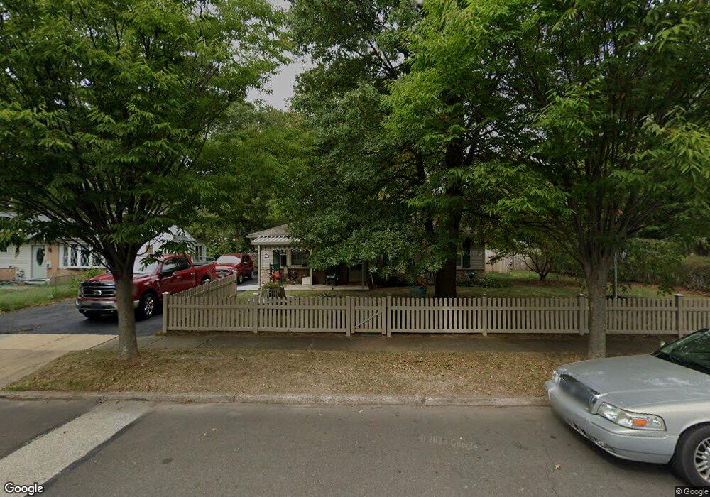
2021 Spencer Dr Croydon, PA 19021
Estimated Value: $287,000 - $336,000
3
Beds
1
Bath
950
Sq Ft
$336/Sq Ft
Est. Value
About This Home
This home is located at 2021 Spencer Dr, Croydon, PA 19021 and is currently estimated at $319,358, approximately $336 per square foot. 2021 Spencer Dr is a home located in Bucks County with nearby schools including Truman Senior High School, Doane Academy, and St. Mark Elementary School.
Ownership History
Date
Name
Owned For
Owner Type
Purchase Details
Closed on
Jan 28, 2015
Sold by
Jessey Margaret and Strange Jesse W
Bought by
Jessey Margaret and Strange Jesse W
Current Estimated Value
Purchase Details
Closed on
Feb 6, 2008
Sold by
Jessey Margaret
Bought by
Jessey Margaret and Strange Jesse W
Purchase Details
Closed on
Apr 20, 2001
Sold by
Bauerle Michelle and Bauerle Michelle E
Bought by
Jessey Margaret
Home Financials for this Owner
Home Financials are based on the most recent Mortgage that was taken out on this home.
Original Mortgage
$50,000
Interest Rate
6.88%
Purchase Details
Closed on
Jun 8, 1998
Sold by
Iversen Stefanie J
Bought by
Bauerle Michelle
Home Financials for this Owner
Home Financials are based on the most recent Mortgage that was taken out on this home.
Original Mortgage
$83,487
Interest Rate
7.11%
Mortgage Type
FHA
Create a Home Valuation Report for This Property
The Home Valuation Report is an in-depth analysis detailing your home's value as well as a comparison with similar homes in the area
Home Values in the Area
Average Home Value in this Area
Purchase History
| Date | Buyer | Sale Price | Title Company |
|---|---|---|---|
| Jessey Margaret | -- | None Available | |
| Jessey Margaret | $74,732 | None Available | |
| Jessey Margaret | $90,000 | Lawyers Title Insurance Co | |
| Bauerle Michelle | $83,750 | -- |
Source: Public Records
Mortgage History
| Date | Status | Borrower | Loan Amount |
|---|---|---|---|
| Closed | Jessey Margaret | $50,000 | |
| Previous Owner | Bauerle Michelle | $83,487 |
Source: Public Records
Tax History Compared to Growth
Tax History
| Year | Tax Paid | Tax Assessment Tax Assessment Total Assessment is a certain percentage of the fair market value that is determined by local assessors to be the total taxable value of land and additions on the property. | Land | Improvement |
|---|---|---|---|---|
| 2025 | $4,027 | $14,830 | $3,440 | $11,390 |
| 2024 | $4,027 | $14,830 | $3,440 | $11,390 |
| 2023 | $3,998 | $14,830 | $3,440 | $11,390 |
| 2022 | $3,998 | $14,830 | $3,440 | $11,390 |
| 2021 | $3,998 | $14,830 | $3,440 | $11,390 |
| 2020 | $3,998 | $14,830 | $3,440 | $11,390 |
| 2019 | $3,983 | $14,830 | $3,440 | $11,390 |
| 2018 | $3,919 | $14,830 | $3,440 | $11,390 |
| 2017 | $3,859 | $14,830 | $3,440 | $11,390 |
| 2016 | $3,859 | $14,830 | $3,440 | $11,390 |
| 2015 | $2,719 | $14,830 | $3,440 | $11,390 |
| 2014 | $2,719 | $14,830 | $3,440 | $11,390 |
Source: Public Records
Map
Nearby Homes
- 2057 Garfield Ave
- 1012 Franklin Ave
- 1 McLevins Ct
- 1719 Dixon Ave
- 302 Grant Ave
- 1503 Moore St Unit 102
- 2307 State Rd
- 807 Arthur Ave
- 917 Spencer Dr
- 1300 Magnolia Ave
- 819 Central Ave
- 0 Newportville Rd Unit PABU487252
- 906 Stephen Ave
- 3303 Glenrose Ave
- 500 Wyoming Ave
- L:15 Dunston Rd
- 4744 Dunston Rd
- 3525 Dixon Ave
- 1901 Summit Ave
- 910 Magnolia Ave