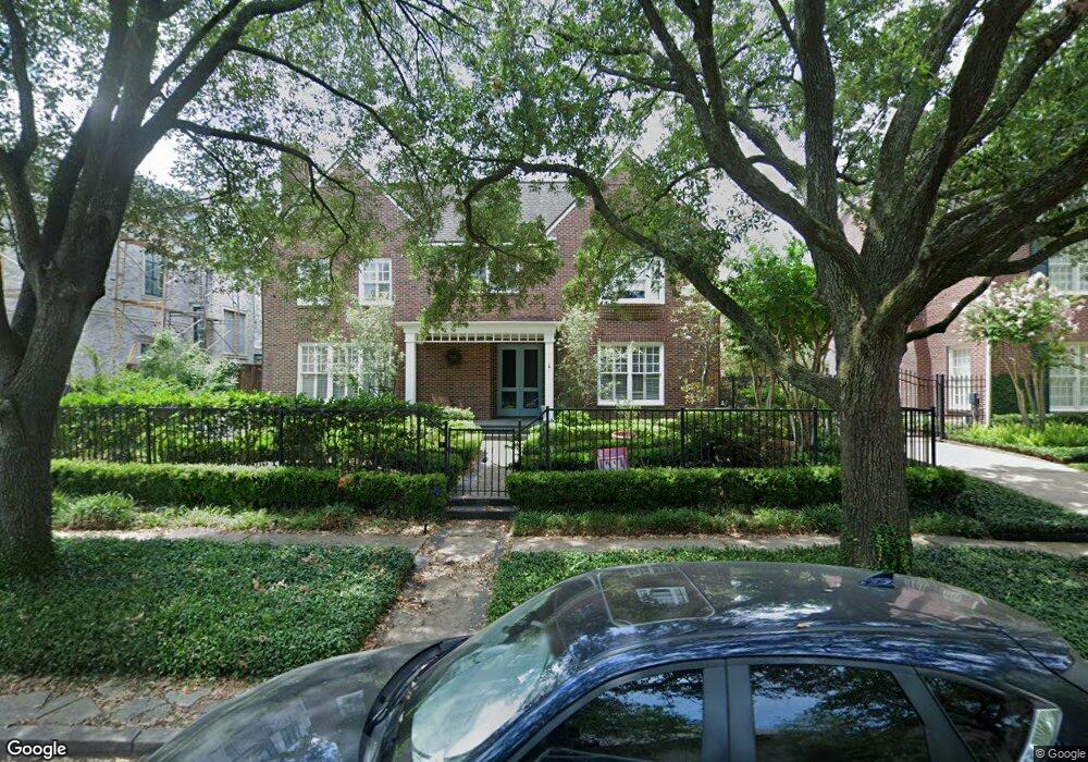
2021 Wroxton Rd Houston, TX 77005
University Place NeighborhoodEstimated Value: $1,898,815 - $2,540,000
4
Beds
5
Baths
4,336
Sq Ft
$499/Sq Ft
Est. Value
About This Home
This home is located at 2021 Wroxton Rd, Houston, TX 77005 and is currently estimated at $2,163,704, approximately $499 per square foot. 2021 Wroxton Rd is a home located in Harris County with nearby schools including Poe Elementary School, Lanier Middle School, and Lamar High School.
Ownership History
Date
Name
Owned For
Owner Type
Purchase Details
Closed on
Apr 4, 2009
Sold by
Jordan J Michael and Jordan Mary Mclean
Bought by
Reardon James D and Reardon Heather C
Current Estimated Value
Home Financials for this Owner
Home Financials are based on the most recent Mortgage that was taken out on this home.
Original Mortgage
$899,500
Outstanding Balance
$589,068
Interest Rate
5.62%
Mortgage Type
Purchase Money Mortgage
Estimated Equity
$1,574,636
Purchase Details
Closed on
Apr 18, 2001
Sold by
Peery James H and Peery Carol S
Bought by
Jordan J Michael and Jordan Mary Mclean
Home Financials for this Owner
Home Financials are based on the most recent Mortgage that was taken out on this home.
Original Mortgage
$650,000
Interest Rate
6.89%
Create a Home Valuation Report for This Property
The Home Valuation Report is an in-depth analysis detailing your home's value as well as a comparison with similar homes in the area
Home Values in the Area
Average Home Value in this Area
Purchase History
| Date | Buyer | Sale Price | Title Company |
|---|---|---|---|
| Reardon James D | -- | Stewart Title | |
| Jordan J Michael | -- | Charter Title Company |
Source: Public Records
Mortgage History
| Date | Status | Borrower | Loan Amount |
|---|---|---|---|
| Open | Reardon James D | $899,500 | |
| Previous Owner | Jordan J Michael | $650,000 | |
| Closed | Jordan J Michael | $171,750 |
Source: Public Records
Tax History Compared to Growth
Tax History
| Year | Tax Paid | Tax Assessment Tax Assessment Total Assessment is a certain percentage of the fair market value that is determined by local assessors to be the total taxable value of land and additions on the property. | Land | Improvement |
|---|---|---|---|---|
| 2025 | $21,501 | $1,816,382 | $900,000 | $916,382 |
| 2024 | $21,501 | $1,690,000 | $900,000 | $790,000 |
| 2023 | $21,501 | $1,640,000 | $900,000 | $740,000 |
| 2022 | $35,329 | $1,604,500 | $900,000 | $704,500 |
| 2021 | $35,720 | $1,632,238 | $810,000 | $822,238 |
| 2020 | $33,740 | $1,393,297 | $780,000 | $613,297 |
| 2019 | $35,426 | $1,400,000 | $690,000 | $710,000 |
| 2018 | $26,145 | $1,300,000 | $690,000 | $610,000 |
| 2017 | $32,871 | $1,300,000 | $690,000 | $610,000 |
| 2016 | $32,871 | $1,300,000 | $690,000 | $610,000 |
| 2015 | $25,291 | $1,668,000 | $690,000 | $978,000 |
| 2014 | $25,291 | $1,321,537 | $558,000 | $763,537 |
Source: Public Records
Map
Nearby Homes
- 2042 Bissonnet St
- 2039 South Blvd
- 2114 Wroxton Rd
- 2122 Wroxton Rd
- 1832 Albans Rd
- 2016 Milford St
- 2205 North Blvd
- 1928 Dunstan Rd
- 2121 Quenby St
- 2127 Milford St
- 2129 Quenby St
- 2135 Quenby St
- 2227 North Blvd
- 1801 Sunset Blvd
- 2224 North Blvd
- 1819 Banks St
- 2247 Bartlett St
- 2102 Banks St
- 1804 Bolsover St
- 1723 Albans Rd
- 2015 Wroxton Rd
- 2025 Wroxton Rd
- 2011 Wroxton Rd
- 2022 Albans Rd
- 2020 Albans Rd
- 2028 Albans Rd
- 2010 Albans Rd
- 2005 Wroxton Rd
- 2020 Wroxton Rd
- 2024 Wroxton Rd
- 2033 Wroxton Rd
- 2014 Wroxton Rd
- 2026 Wroxton Rd
- 2038 Albans Rd
- 2012 Wroxton Rd
- 2030 Wroxton Rd
- 2006 Albans Rd
- 2001 Wroxton Rd
- 2010 Wroxton Rd
- 2034 Wroxton Rd