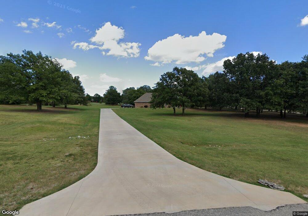
20211 Red Oak Ct Tecumseh, OK 74873
Estimated Value: $309,000 - $375,000
3
Beds
2
Baths
2,210
Sq Ft
$153/Sq Ft
Est. Value
About This Home
This home is located at 20211 Red Oak Ct, Tecumseh, OK 74873 and is currently estimated at $337,839, approximately $152 per square foot. 20211 Red Oak Ct is a home located in Pottawatomie County with nearby schools including Barnard Elementary School, Cross Timbers Elementary School, and Tecumseh Middle School.
Ownership History
Date
Name
Owned For
Owner Type
Purchase Details
Closed on
Sep 15, 2003
Sold by
Meier Mark and Meier Andie
Bought by
Paxson Laurie and Paxson Clinton
Current Estimated Value
Purchase Details
Closed on
Mar 30, 1998
Sold by
Dunning Robert
Bought by
Meier Mark
Purchase Details
Closed on
Jan 3, 1996
Sold by
Jones Leo and Jones Enid
Bought by
Dunning Robert and Dunning Sharlot
Create a Home Valuation Report for This Property
The Home Valuation Report is an in-depth analysis detailing your home's value as well as a comparison with similar homes in the area
Purchase History
| Date | Buyer | Sale Price | Title Company |
|---|---|---|---|
| Paxson Laurie | $180,000 | -- | |
| Meier Mark | $135,000 | -- | |
| Dunning Robert | $10,000 | -- |
Source: Public Records
Tax History
| Year | Tax Paid | Tax Assessment Tax Assessment Total Assessment is a certain percentage of the fair market value that is determined by local assessors to be the total taxable value of land and additions on the property. | Land | Improvement |
|---|---|---|---|---|
| 2025 | $2,470 | $25,422 | $2,400 | $23,022 |
| 2024 | $2,534 | $24,682 | $2,400 | $22,282 |
| 2023 | $2,534 | $24,682 | $2,400 | $22,282 |
| 2022 | $2,431 | $24,682 | $2,400 | $22,282 |
| 2021 | $2,462 | $24,682 | $2,400 | $22,282 |
| 2020 | $2,426 | $24,485 | $2,400 | $22,085 |
| 2019 | $2,481 | $24,781 | $2,400 | $22,381 |
| 2018 | $2,448 | $24,390 | $2,346 | $22,044 |
| 2017 | $2,393 | $23,680 | $2,252 | $21,428 |
| 2016 | $2,084 | $22,990 | $2,161 | $20,829 |
| 2015 | $2,016 | $22,321 | $2,241 | $20,080 |
| 2014 | $1,955 | $21,671 | $2,182 | $19,489 |
Source: Public Records
Map
Nearby Homes
- 0 Willowood Way
- 19708 Persimmon Ln
- 42608 Bob Crouch Rd
- 3000 E Walnut St
- 00 Charleston Pointe
- 19705 Harrison Rd
- 00 Benson Park Rd
- 000 Benson Park Rd
- 214 Emma Kaye
- 45285 Bob Crouch Rd
- 1605 Fieldstone Ln
- 404 W Lakeview Dr
- 44508 Kingsbury Ln
- 1203 Whispering Glen St
- 0 Foggy Bottom Rd
- 18509 Brangus Rd
- 19903 Prairieview Rd
- 21427 S Rock Creek Rd
- 19252 Abigail Dr
- 506 N Sharon St
- 43422 Birchwood Dr
- 43343 Birchwood Dr
- 20187 Red Oak Ct
- 20228 Red Oak Ct
- 20273 Cypress Way
- 43423 Birchwood Dr
- 43330 Willowood Way
- 20309 Cypress Way
- 20186 Ebony Ct
- 20184 Red Oak Ct
- 20332 Pin Oak Ct
- 43465 Birchwood Dr
- 43456 Birchwood Dr
- 5 Willowwood Ct
- 43216 Timberstone Way
- 43217 Cypress Ct
- 20187 Ebony Ct
- 20301 Pin Oak Ct
- 43347 Bob Crouch Rd
- 43395 Bob Crouch Rd
Your Personal Tour Guide
Ask me questions while you tour the home.