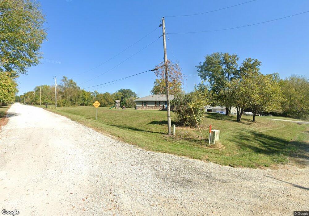
20219 S Johnson Rd Pleasant Hill, MO 64080
Estimated Value: $432,778 - $502,000
4
Beds
3
Baths
1,344
Sq Ft
$343/Sq Ft
Est. Value
About This Home
This home is located at 20219 S Johnson Rd, Pleasant Hill, MO 64080 and is currently estimated at $460,445, approximately $342 per square foot. 20219 S Johnson Rd is a home located in Cass County with nearby schools including Pleasant Hill Primary School, Pleasant Hill Elementary School, and Pleasant Hill Middle School.
Ownership History
Date
Name
Owned For
Owner Type
Purchase Details
Closed on
Oct 25, 2019
Sold by
Rushly Raymond A and Rushly Charity S
Bought by
Keith Paul Bryan and Keith Constance J
Current Estimated Value
Home Financials for this Owner
Home Financials are based on the most recent Mortgage that was taken out on this home.
Original Mortgage
$287,600
Outstanding Balance
$252,974
Interest Rate
3.7%
Mortgage Type
New Conventional
Estimated Equity
$207,471
Purchase Details
Closed on
Dec 3, 2018
Sold by
Wilhite David L
Bought by
Rushly Raymond A and Rushly Charity S
Home Financials for this Owner
Home Financials are based on the most recent Mortgage that was taken out on this home.
Original Mortgage
$180,000
Interest Rate
4.8%
Mortgage Type
Purchase Money Mortgage
Create a Home Valuation Report for This Property
The Home Valuation Report is an in-depth analysis detailing your home's value as well as a comparison with similar homes in the area
Home Values in the Area
Average Home Value in this Area
Purchase History
| Date | Buyer | Sale Price | Title Company |
|---|---|---|---|
| Keith Paul Bryan | -- | None Available | |
| Rushly Raymond A | -- | Crescent Land Title |
Source: Public Records
Mortgage History
| Date | Status | Borrower | Loan Amount |
|---|---|---|---|
| Open | Keith Paul Bryan | $287,600 | |
| Previous Owner | Rushly Raymond A | $180,000 |
Source: Public Records
Tax History Compared to Growth
Tax History
| Year | Tax Paid | Tax Assessment Tax Assessment Total Assessment is a certain percentage of the fair market value that is determined by local assessors to be the total taxable value of land and additions on the property. | Land | Improvement |
|---|---|---|---|---|
| 2024 | $2,256 | $37,320 | $6,140 | $31,180 |
| 2023 | $2,248 | $37,320 | $6,140 | $31,180 |
| 2022 | $2,058 | $33,690 | $6,140 | $27,550 |
| 2021 | $1,990 | $33,690 | $6,140 | $27,550 |
| 2020 | $1,885 | $32,880 | $6,140 | $26,740 |
| 2019 | $1,589 | $28,170 | $6,140 | $22,030 |
| 2018 | $1,507 | $25,330 | $4,910 | $20,420 |
| 2017 | $1,439 | $25,330 | $4,910 | $20,420 |
| 2016 | $1,439 | $24,160 | $4,910 | $19,250 |
| 2015 | $1,461 | $24,160 | $4,910 | $19,250 |
| 2014 | $1,469 | $24,160 | $4,910 | $19,250 |
| 2013 | -- | $24,160 | $4,910 | $19,250 |
Source: Public Records
Map
Nearby Homes
- 0000 E State Route P
- 24908 E 199th St
- Tbd South Pryor Rd
- 0000 S Pryor Rd
- TBD S Pryor Rd
- 24008 E 205th St
- 213 Sitter St
- 201 Sitter St
- 313 Clearview Dr
- 802 Pine St
- 0 Locust St
- 18201 S Hill Top Rd
- 105 N Campbell St
- 122 N Taylor St
- 0 Route 7
- 1704 Mulberry St
- 1700 Mulberry St
- 218 N Boardman St
- 204 Lexington Rd
- 207 Lexington Rd
- 20219 S Johnson Dr
- 27408 E 203rd St
- 20205 S Johnson Rd
- 20205 S Johnson Rd
- 20213 S Johnson Rd
- 20124 S Johnson Rd
- 27702 E 203rd St
- 27906 E 203rd St
- 20221 S State Route 7
- 20201 S State Route 7
- 20101 S Johnson Rd
- 27905 E 203rd St
- 20022 S Johnson Rd
- 20111 S State Route 7
- 20017 S Johnson Rd
- 20012 S Johnson Rd
- 20110 S State Route 7
- 28009 E 203rd St
- 20400 S State Route 7 Unit 20324
- 20021 S State Route 7