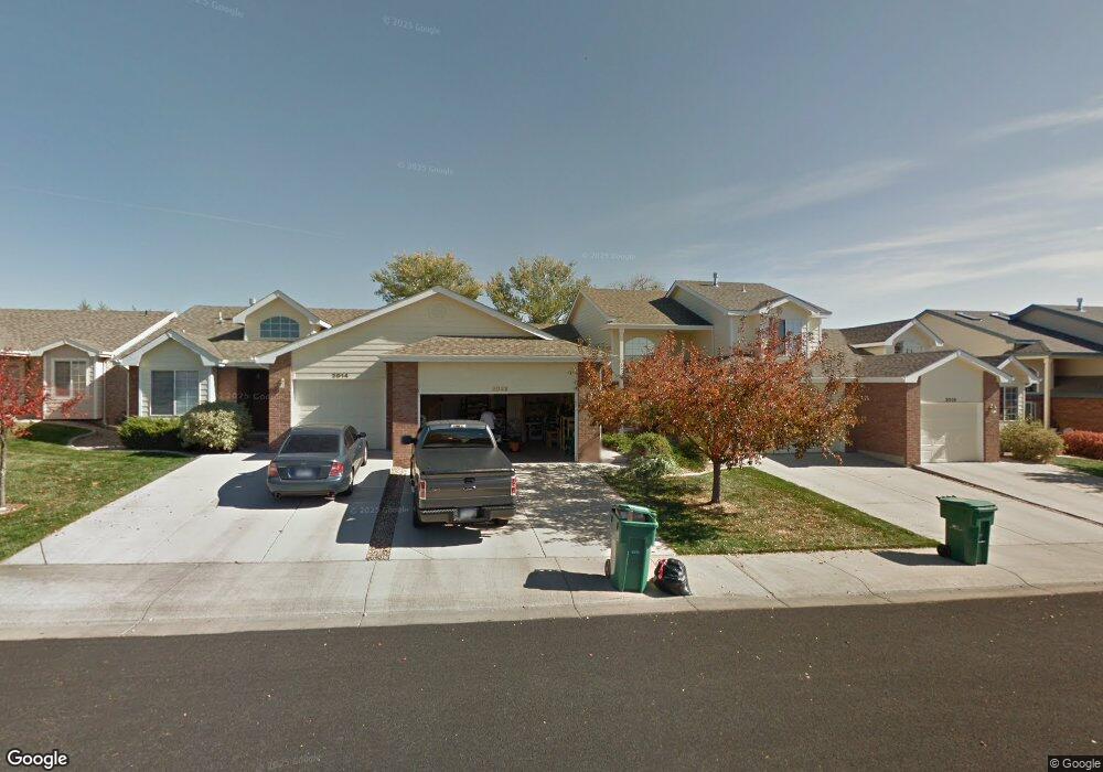
2022 35th Avenue Ct Greeley, CO 80634
Estimated Value: $331,472 - $376,000
2
Beds
2
Baths
1,326
Sq Ft
$265/Sq Ft
Est. Value
About This Home
This home is located at 2022 35th Avenue Ct, Greeley, CO 80634 and is currently estimated at $351,868, approximately $265 per square foot. 2022 35th Avenue Ct is a home located in Weld County with nearby schools including Meeker Elementary School, Brentwood Middle School, and Greeley West High School.
Ownership History
Date
Name
Owned For
Owner Type
Purchase Details
Closed on
Oct 29, 2010
Sold by
Fimple Melvine Dale
Bought by
Gabaldon George F and Gabaldon Madeline
Current Estimated Value
Home Financials for this Owner
Home Financials are based on the most recent Mortgage that was taken out on this home.
Original Mortgage
$106,000
Outstanding Balance
$70,435
Interest Rate
4.41%
Mortgage Type
New Conventional
Estimated Equity
$281,433
Purchase Details
Closed on
Jul 3, 2000
Sold by
Chambers Development Llc
Bought by
The Meadows Project Llc
Home Financials for this Owner
Home Financials are based on the most recent Mortgage that was taken out on this home.
Original Mortgage
$96,512
Interest Rate
8.66%
Create a Home Valuation Report for This Property
The Home Valuation Report is an in-depth analysis detailing your home's value as well as a comparison with similar homes in the area
Home Values in the Area
Average Home Value in this Area
Purchase History
| Date | Buyer | Sale Price | Title Company |
|---|---|---|---|
| Gabaldon George F | $132,500 | North Amer Title Co Of Co | |
| The Meadows Project Llc | -- | -- | |
| Fimple Melvin Dale | $137,760 | -- |
Source: Public Records
Mortgage History
| Date | Status | Borrower | Loan Amount |
|---|---|---|---|
| Open | Gabaldon George F | $106,000 | |
| Previous Owner | Fimple Melvin Dale | $96,512 |
Source: Public Records
Tax History Compared to Growth
Tax History
| Year | Tax Paid | Tax Assessment Tax Assessment Total Assessment is a certain percentage of the fair market value that is determined by local assessors to be the total taxable value of land and additions on the property. | Land | Improvement |
|---|---|---|---|---|
| 2025 | $1,575 | $23,700 | $3,880 | $19,820 |
| 2024 | $1,575 | $23,700 | $3,880 | $19,820 |
| 2023 | $1,502 | $22,470 | $3,720 | $18,750 |
| 2022 | $1,579 | $18,110 | $3,130 | $14,980 |
| 2021 | $1,629 | $18,630 | $3,220 | $15,410 |
| 2020 | $1,641 | $18,830 | $2,860 | $15,970 |
| 2019 | $1,646 | $18,830 | $2,860 | $15,970 |
| 2018 | $1,191 | $14,380 | $2,740 | $11,640 |
| 2017 | $1,198 | $14,380 | $2,740 | $11,640 |
| 2016 | $917 | $12,400 | $2,550 | $9,850 |
| 2015 | $914 | $12,400 | $2,550 | $9,850 |
| 2014 | $808 | $10,690 | $2,550 | $8,140 |
Source: Public Records
Map
Nearby Homes
- 3118 W 19th Street Rd
- 4125 24th Street Rd Unit 16
- 2840 W 21st St Unit 9
- 2840 W 21st St Unit 1
- 3900 W 22nd St
- 1975 28th Ave Unit 31
- 1912 29th Ave
- 3949 W 19th Street Ln
- 1925 28th Ave Unit 36
- 1925 28th Ave Unit 30
- 1925 28th Ave Unit 34
- 1803 30th Ave
- 2402 Mountair Ln
- 1647 36th Avenue Ct
- 2713 W 19th Street Dr Unit 5A
- 1634 41st Ave
- 2701 W 19th Street Dr
- 2738 W 22nd Street Dr
- 2062 27th Ave
- 2132 27th Ave
- 2014 35th Avenue Ct
- 2036 35th Avenue Ct
- 2008 35th Avenue Ct
- 2044 35th Avenue Ct
- 2002 35th Avenue Ct
- 2050 35th Avenue Ct
- 2050 35th Avenue Ct Unit 33
- 3555 W 20th Street Rd
- 2058 35th Ave Unit 32
- 2058 35th Avenue Ct
- 2015 35th Ave
- 2064 35th Ave
- 2009 35th Ave
- 3567 W 20th Street Rd
- 3572 W 20th Street Rd
- 2072 35th Avenue Ct
- 2072 35th Avenue Ct Unit 3
- 2067 35th Avenue Ct
- 3579 W 20th Street Rd
- 3584 W 20th Street Rd