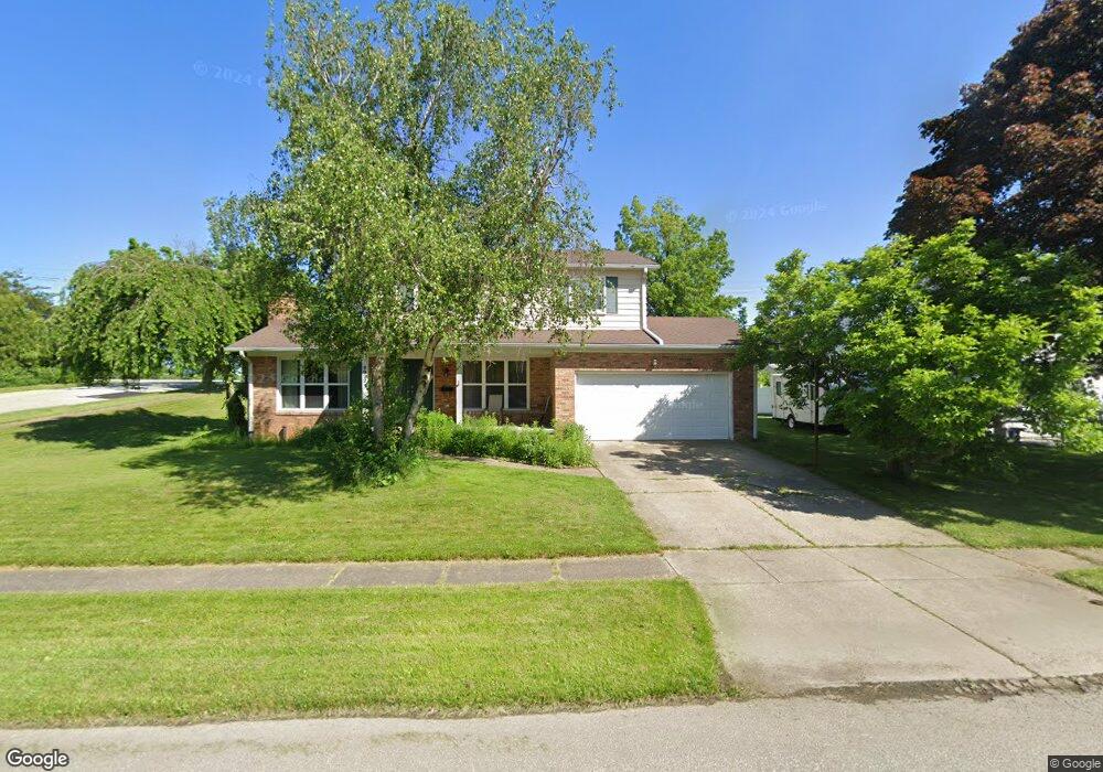
2022 Andover Ln Erie, PA 16509
Millcreek NeighborhoodEstimated Value: $278,000 - $308,000
4
Beds
3
Baths
1,960
Sq Ft
$151/Sq Ft
Est. Value
About This Home
This home is located at 2022 Andover Ln, Erie, PA 16509 and is currently estimated at $295,628, approximately $150 per square foot. 2022 Andover Ln is a home located in Erie County with nearby schools including McDowell High School, Chestnut Hill Elementary School, and James S. Wilson Middle School.
Ownership History
Date
Name
Owned For
Owner Type
Purchase Details
Closed on
Mar 10, 2008
Sold by
Wiley Stanford T and Wiley Ebony R
Bought by
Brandt Robert and Brandt Jennifer
Current Estimated Value
Home Financials for this Owner
Home Financials are based on the most recent Mortgage that was taken out on this home.
Original Mortgage
$143,863
Outstanding Balance
$89,528
Interest Rate
5.72%
Mortgage Type
Purchase Money Mortgage
Estimated Equity
$206,100
Purchase Details
Closed on
Apr 28, 2003
Sold by
Otoole Austin J and Otoole Juanita M
Bought by
Wiley Stanford T and Byarse Ebony R
Purchase Details
Closed on
Jun 28, 1995
Sold by
Not Provided
Bought by
Otoole Austin J Et Obrien J
Create a Home Valuation Report for This Property
The Home Valuation Report is an in-depth analysis detailing your home's value as well as a comparison with similar homes in the area
Home Values in the Area
Average Home Value in this Area
Purchase History
| Date | Buyer | Sale Price | Title Company |
|---|---|---|---|
| Brandt Robert | $145,000 | None Available | |
| Wiley Stanford T | $148,000 | -- | |
| Otoole Austin J Et Obrien J | $141,500 | -- |
Source: Public Records
Mortgage History
| Date | Status | Borrower | Loan Amount |
|---|---|---|---|
| Open | Brandt Robert | $143,863 |
Source: Public Records
Tax History Compared to Growth
Tax History
| Year | Tax Paid | Tax Assessment Tax Assessment Total Assessment is a certain percentage of the fair market value that is determined by local assessors to be the total taxable value of land and additions on the property. | Land | Improvement |
|---|---|---|---|---|
| 2025 | $4,467 | $162,550 | $40,100 | $122,450 |
| 2024 | $4,351 | $162,550 | $40,100 | $122,450 |
| 2023 | $4,107 | $162,550 | $40,100 | $122,450 |
| 2022 | $3,946 | $162,550 | $40,100 | $122,450 |
| 2021 | $3,903 | $162,550 | $40,100 | $122,450 |
| 2020 | $3,863 | $162,550 | $40,100 | $122,450 |
| 2019 | $3,799 | $162,550 | $40,100 | $122,450 |
| 2018 | $3,705 | $162,550 | $40,100 | $122,450 |
| 2017 | $3,697 | $162,550 | $40,100 | $122,450 |
| 2016 | $4,348 | $162,550 | $40,100 | $122,450 |
| 2015 | $4,308 | $162,550 | $40,100 | $122,450 |
| 2014 | $1,379 | $162,550 | $40,100 | $122,450 |
Source: Public Records
Map
Nearby Homes
- 4636 Wynburne Ave
- 1810 W Gore Rd
- 4002 Harvard Rd
- 1729 W 45th St Unit J2
- 1842 Zimmerly Rd
- 1918 W 38th St
- 4333 Caroline Dr
- 4905 Conway St
- 1828 Zimmerly Rd
- 1821 W 37th St
- 4830 Greenwood St
- 3621 Ellsworth Ave
- 3514 Ellsworth Ave
- 5005 Zuck Rd Unit 123
- 5005 Zuck Rd Unit 7
- 1530 W 43rd St
- 1557 W 40th St
- 1718 W 56th St
- 3611 Oakwood St
- 3418 Allegheny Rd
- 2014 Andover Ln
- 2038 Andover Ln
- 2023 Andover Ln
- 2006 Andover Ln
- 2015 Andover Ln
- 2041 Andover Ln
- 2048 Andover Ln
- 2005 Andover Ln
- 2002 Andover Ln
- 2020 Berkshire Ln
- 2028 Berkshire Ln
- 2014 Berkshire Ln
- 2049 Andover Ln
- 2001 Andover Ln
- 2056 Andover Ln
- 2006 Berkshire Ln
- 2046 Berkshire Ln
- 2057 Andover Ln
- 2002 Berkshire Ln
- 2066 Andover Ln