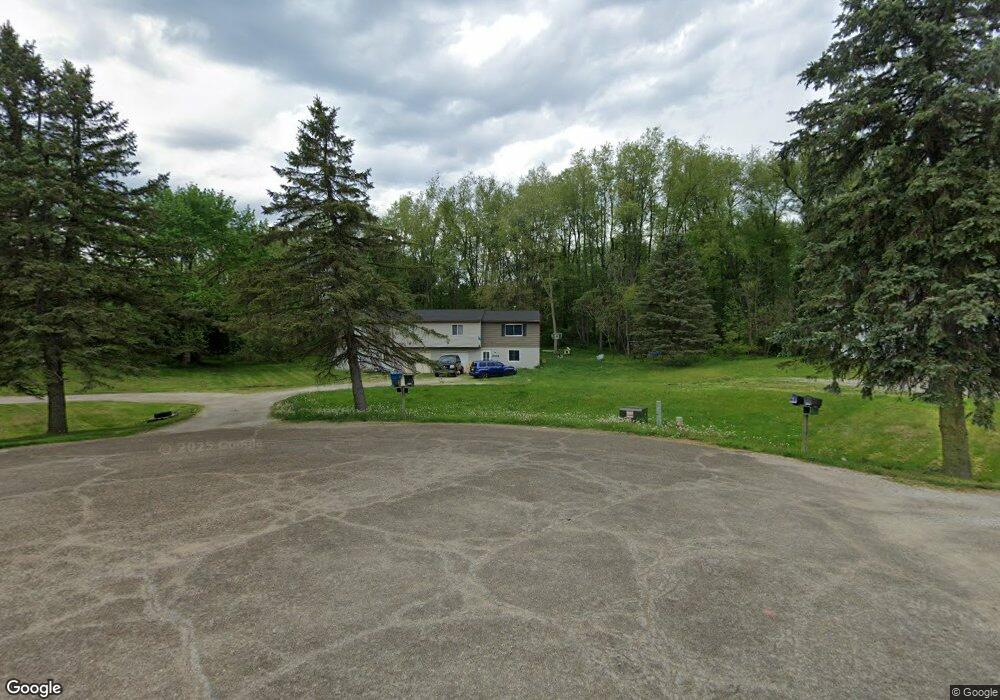
2022 Ayers Dr Unit 2026 Uniontown, OH 44685
Estimated Value: $226,000 - $268,000
4
Beds
4
Baths
1,704
Sq Ft
$148/Sq Ft
Est. Value
About This Home
This home is located at 2022 Ayers Dr Unit 2026, Uniontown, OH 44685 and is currently estimated at $252,267, approximately $148 per square foot. 2022 Ayers Dr Unit 2026 is a home located in Summit County with nearby schools including Greenwood Elementary School, Green Primary School, and Green Intermediate Elementary School.
Ownership History
Date
Name
Owned For
Owner Type
Purchase Details
Closed on
Jul 1, 1999
Sold by
Ayers Frederick G and Ayers Barbara M
Bought by
Bayside Investment Group Ltd
Current Estimated Value
Home Financials for this Owner
Home Financials are based on the most recent Mortgage that was taken out on this home.
Original Mortgage
$106,000
Interest Rate
8%
Mortgage Type
Seller Take Back
Create a Home Valuation Report for This Property
The Home Valuation Report is an in-depth analysis detailing your home's value as well as a comparison with similar homes in the area
Home Values in the Area
Average Home Value in this Area
Purchase History
| Date | Buyer | Sale Price | Title Company |
|---|---|---|---|
| Bayside Investment Group Ltd | $115,000 | Northeast Title Agency Inc |
Source: Public Records
Mortgage History
| Date | Status | Borrower | Loan Amount |
|---|---|---|---|
| Closed | Bayside Investment Group Ltd | $106,000 |
Source: Public Records
Tax History Compared to Growth
Tax History
| Year | Tax Paid | Tax Assessment Tax Assessment Total Assessment is a certain percentage of the fair market value that is determined by local assessors to be the total taxable value of land and additions on the property. | Land | Improvement |
|---|---|---|---|---|
| 2025 | $3,098 | $61,517 | $12,555 | $48,962 |
| 2024 | $2,951 | $61,517 | $12,555 | $48,962 |
| 2023 | $3,098 | $61,517 | $12,555 | $48,962 |
| 2022 | $2,411 | $45,234 | $9,233 | $36,001 |
| 2021 | $2,263 | $45,234 | $9,233 | $36,001 |
| 2020 | $2,220 | $45,230 | $9,230 | $36,000 |
| 2019 | $2,366 | $45,180 | $13,410 | $31,770 |
| 2018 | $2,420 | $45,180 | $13,410 | $31,770 |
| 2017 | $2,629 | $45,180 | $13,410 | $31,770 |
| 2016 | $2,566 | $45,180 | $13,410 | $31,770 |
| 2015 | $2,629 | $45,180 | $13,410 | $31,770 |
| 2014 | $2,613 | $45,180 | $13,410 | $31,770 |
| 2013 | $2,643 | $45,510 | $13,410 | $32,100 |
Source: Public Records
Map
Nearby Homes
- 2664 Pine Lake Trail
- 2619 Henrietta Dr
- 2577 Sweitzer Rd
- 3003 Myersville Rd
- 2864 Pine Lake Rd
- 2771 Superior Dr
- 2944 Sunset Dr
- 13704 Greenland Ave NW
- 2830 Superior Dr
- 2575 Myersville Rd
- 3979 Northdale St NW
- 2273 Dewport Dr
- 3221 Killian Rd
- 2811 Canton Rd
- 2923 Hayne Rd
- 3310 Linden St NW
- 2645 Hayne Rd
- 0 Canton Rd Unit 5124723
- 0 Pine St NW
- 3100 Linden St NW
- 2032 Ayers Dr Unit 2036
- 2023 Ayers Dr Unit 2027
- 2042 Ayers Dr Unit 2046
- 2451 Lyndon Dr
- 2455 Lyndon Dr
- 2033 Ayers Dr Unit 2037
- 2439 Lyndon Dr
- 2471 Lyndon Dr
- 2043 Ayers Dr Unit 2047
- 2429 Lyndon Dr
- 2481 Lyndon Dr
- 2738 Pine Lake Trail
- 2491 Lyndon Dr
- 2718 Pine Lake Trail
- 2432 Pine Lake Trail
- 2432 Pine Lake Trail
- 2706 Pine Lake Trail
- 2466 Twin Lakes Dr
- 2669 Henrietta Dr
- 2478 Twin Lakes Dr