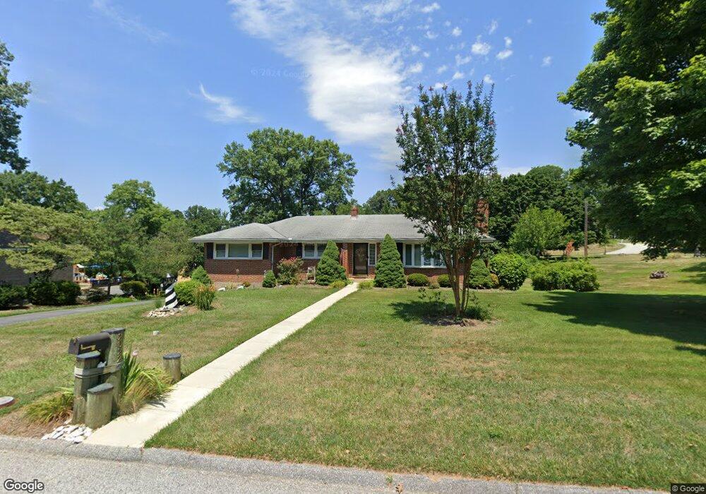
2022 Cedar Circle Dr Catonsville, MD 21228
Estimated Value: $362,855 - $464,000
--
Bed
2
Baths
1,520
Sq Ft
$272/Sq Ft
Est. Value
About This Home
This home is located at 2022 Cedar Circle Dr, Catonsville, MD 21228 and is currently estimated at $413,714, approximately $272 per square foot. 2022 Cedar Circle Dr is a home located in Baltimore County with nearby schools including Woodbridge Elementary School, Southwest Academy, and Woodlawn High School.
Ownership History
Date
Name
Owned For
Owner Type
Purchase Details
Closed on
Oct 21, 2005
Sold by
Browning Barry
Bought by
Browning Barry and Leishear Melinda
Current Estimated Value
Purchase Details
Closed on
Sep 21, 2005
Sold by
Browning Barry
Bought by
Browning Barry and Leishear Melinda
Purchase Details
Closed on
Feb 3, 2005
Sold by
Browning Harold F
Bought by
Browning Barry and Florio Lynne
Purchase Details
Closed on
Jun 27, 2000
Sold by
Browning Harold F
Bought by
Browning Harold F
Create a Home Valuation Report for This Property
The Home Valuation Report is an in-depth analysis detailing your home's value as well as a comparison with similar homes in the area
Home Values in the Area
Average Home Value in this Area
Purchase History
| Date | Buyer | Sale Price | Title Company |
|---|---|---|---|
| Browning Barry | -- | -- | |
| Browning Barry | -- | -- | |
| Browning Barry | -- | -- | |
| Browning Harold F | -- | -- |
Source: Public Records
Tax History Compared to Growth
Tax History
| Year | Tax Paid | Tax Assessment Tax Assessment Total Assessment is a certain percentage of the fair market value that is determined by local assessors to be the total taxable value of land and additions on the property. | Land | Improvement |
|---|---|---|---|---|
| 2025 | $4,722 | $306,933 | -- | -- |
| 2024 | $4,722 | $289,400 | $85,000 | $204,400 |
| 2023 | $2,454 | $286,533 | $0 | $0 |
| 2022 | $4,910 | $283,667 | $0 | $0 |
| 2021 | $4,399 | $280,800 | $85,000 | $195,800 |
| 2020 | $4,399 | $264,767 | $0 | $0 |
| 2019 | $4,113 | $248,733 | $0 | $0 |
| 2018 | $3,892 | $232,700 | $78,000 | $154,700 |
| 2017 | $3,660 | $224,033 | $0 | $0 |
| 2016 | $3,561 | $215,367 | $0 | $0 |
| 2015 | $3,561 | $206,700 | $0 | $0 |
| 2014 | $3,561 | $206,700 | $0 | $0 |
Source: Public Records
Map
Nearby Homes
- 2100 Chantilla Rd
- 2120 Cedar Circle Dr
- 6263 Gilston Park Rd
- 2208 W Geipe Rd
- 14 Madison Mills Ct
- 627 Meyers Dr Unit PARCEL 108
- 627 Meyers Dr
- 6200 Gilston Park Rd
- 2421 Quilting Bee Rd
- 1111 Cummings Ave
- 17 Kimball Ridge Ct
- 1019 Cummings Ave
- 1013 Cummings Ave
- 1916 Old Frederick Rd
- 6031 Burnt Oak Rd
- 2002 Old Frederick Rd
- 4 Rumford Dr Unit 203
- 2203 Rockwell Ave
- 6906 Upper Mills Cir
- 510 Bathurst Rd
- 2001 Fernglen Way
- 2024 Cedar Circle Dr
- 2003 Fernglen Way
- 2023 Cedar Circle Dr
- 2005 Fernglen Way
- 2025 Cedar Circle Dr
- 2021 Cedar Circle Dr
- 2026 Cedar Circle Dr
- 2007 Fernglen Way
- 2027 Cedar Circle Dr
- 2018 Cedar Circle Dr
- 1212 Corolla Ct
- 1212 Corolla Ct Unit 1212
- 2006 Fernglen Way
- 1200 Wisteria Dr
- 1209 Pear Blossum Ct Unit 1209
- 2008 Fernglen Way
- 2019 Cedar Circle Dr
- 1201 Wisteria Dr
- 1210 Pear Blossum Ct