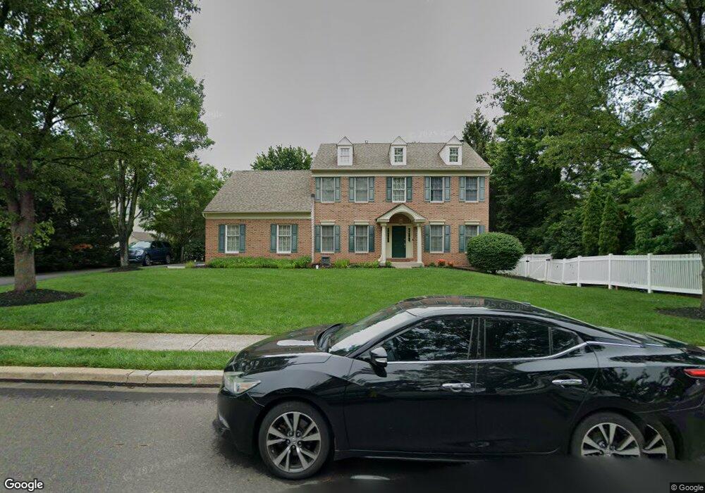
2022 Cedar Dr Warrington, PA 18976
Estimated Value: $755,000 - $867,000
4
Beds
3
Baths
2,556
Sq Ft
$314/Sq Ft
Est. Value
About This Home
This home is located at 2022 Cedar Dr, Warrington, PA 18976 and is currently estimated at $802,146, approximately $313 per square foot. 2022 Cedar Dr is a home located in Bucks County with nearby schools including Barclay Elementary School, Tamanend Middle School, and Central Bucks High School - South.
Ownership History
Date
Name
Owned For
Owner Type
Purchase Details
Closed on
Jul 15, 1994
Sold by
Warwick Estates
Bought by
Callaghan Joseph M and Callaghan Cindi L
Current Estimated Value
Home Financials for this Owner
Home Financials are based on the most recent Mortgage that was taken out on this home.
Original Mortgage
$193,000
Interest Rate
8.25%
Purchase Details
Closed on
Jul 17, 1992
Bought by
Warwick Estates L P
Create a Home Valuation Report for This Property
The Home Valuation Report is an in-depth analysis detailing your home's value as well as a comparison with similar homes in the area
Home Values in the Area
Average Home Value in this Area
Purchase History
| Date | Buyer | Sale Price | Title Company |
|---|---|---|---|
| Callaghan Joseph M | $241,350 | -- | |
| Warwick Estates L P | $1,997,500 | -- |
Source: Public Records
Mortgage History
| Date | Status | Borrower | Loan Amount |
|---|---|---|---|
| Closed | Callaghan Joseph M | $193,000 |
Source: Public Records
Tax History Compared to Growth
Tax History
| Year | Tax Paid | Tax Assessment Tax Assessment Total Assessment is a certain percentage of the fair market value that is determined by local assessors to be the total taxable value of land and additions on the property. | Land | Improvement |
|---|---|---|---|---|
| 2025 | $8,418 | $48,360 | $9,080 | $39,280 |
| 2024 | $8,418 | $48,360 | $9,080 | $39,280 |
| 2023 | $8,151 | $48,360 | $9,080 | $39,280 |
| 2022 | $8,060 | $48,360 | $9,080 | $39,280 |
| 2021 | $7,970 | $48,360 | $9,080 | $39,280 |
| 2020 | $7,970 | $48,360 | $9,080 | $39,280 |
| 2019 | $7,921 | $48,360 | $9,080 | $39,280 |
| 2018 | $7,921 | $48,360 | $9,080 | $39,280 |
| 2017 | $7,861 | $48,360 | $9,080 | $39,280 |
| 2016 | $7,861 | $48,360 | $9,080 | $39,280 |
| 2015 | -- | $48,360 | $9,080 | $39,280 |
| 2014 | -- | $48,360 | $9,080 | $39,280 |
Source: Public Records
Map
Nearby Homes
- 2226 Orchard Hill Cir
- 1656 S Ash Cir
- 1447 Bentley Dr
- 1992 Falabella Cir
- 1402 Valley View
- 2234 Evin Dr
- 2302 MacIs Cir
- 1917 Brook Ln
- Kingswood Plan at Breton Hill
- Mayweather Plan at Breton Hill
- Cloverfield Plan at Breton Hill
- Raintree Plan at Breton Hill
- Rollins Plan at Breton Hill
- 0 W Bristol Rd
- 1805 Roan Dr
- 1105 Madison Cir
- 1559 Deer Run Rd
- 200 Beech Blvd Unit 202
- 200 Beech Blvd Unit 301
- 100 Ginko St Unit 303