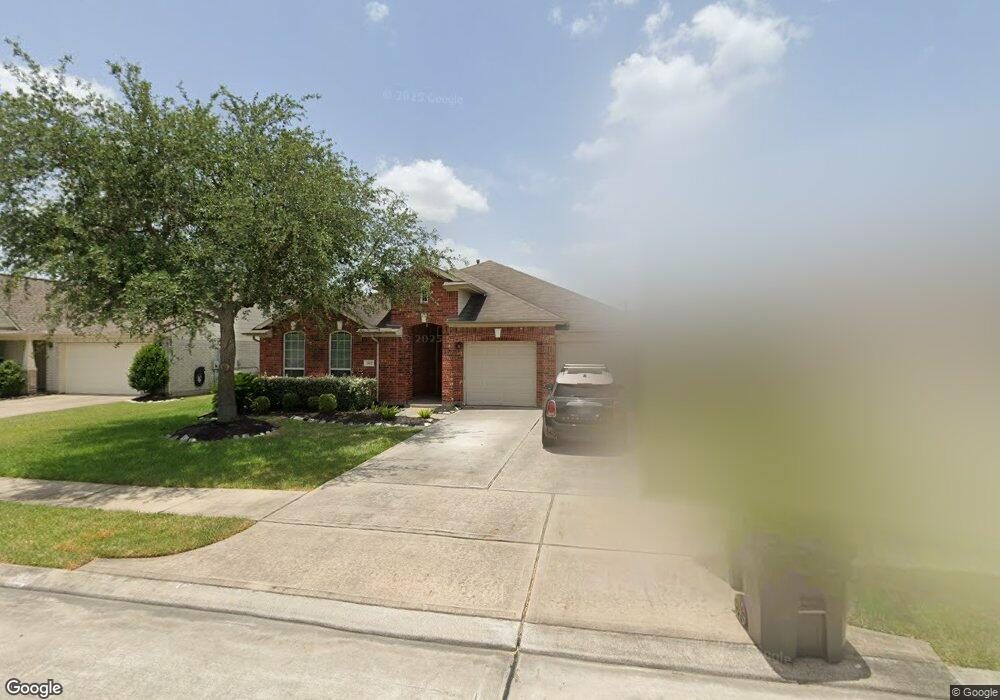
2022 Creek Shore Ln Pearland, TX 77581
Outlying Friendswood City NeighborhoodEstimated Value: $318,851 - $355,000
--
Bed
1
Bath
1,965
Sq Ft
$171/Sq Ft
Est. Value
About This Home
This home is located at 2022 Creek Shore Ln, Pearland, TX 77581 and is currently estimated at $336,463, approximately $171 per square foot. 2022 Creek Shore Ln is a home located in Brazoria County with nearby schools including C.J. Harris Elementary School, Leon H. Sablatura Middle School, and Pearland Junior High School West.
Ownership History
Date
Name
Owned For
Owner Type
Purchase Details
Closed on
Aug 31, 2005
Sold by
Rh Of Texas Lp
Bought by
Garcia Eleazar and Garcia Erin D
Current Estimated Value
Home Financials for this Owner
Home Financials are based on the most recent Mortgage that was taken out on this home.
Original Mortgage
$162,905
Outstanding Balance
$86,771
Interest Rate
5.78%
Mortgage Type
FHA
Estimated Equity
$249,692
Create a Home Valuation Report for This Property
The Home Valuation Report is an in-depth analysis detailing your home's value as well as a comparison with similar homes in the area
Home Values in the Area
Average Home Value in this Area
Purchase History
| Date | Buyer | Sale Price | Title Company |
|---|---|---|---|
| Garcia Eleazar | -- | -- |
Source: Public Records
Mortgage History
| Date | Status | Borrower | Loan Amount |
|---|---|---|---|
| Open | Garcia Eleazar | $162,905 |
Source: Public Records
Tax History Compared to Growth
Tax History
| Year | Tax Paid | Tax Assessment Tax Assessment Total Assessment is a certain percentage of the fair market value that is determined by local assessors to be the total taxable value of land and additions on the property. | Land | Improvement |
|---|---|---|---|---|
| 2025 | $6,718 | $308,310 | $26,570 | $281,740 |
| 2023 | $6,718 | $281,603 | $24,150 | $289,000 |
| 2022 | $8,104 | $256,003 | $24,150 | $260,040 |
| 2021 | $7,905 | $232,730 | $24,150 | $208,580 |
| 2020 | $7,698 | $235,070 | $24,150 | $210,920 |
| 2019 | $6,999 | $198,910 | $24,150 | $174,760 |
| 2018 | $6,863 | $195,700 | $24,150 | $171,550 |
| 2017 | $6,711 | $190,650 | $24,150 | $166,500 |
| 2016 | $6,711 | $190,650 | $24,150 | $166,500 |
| 2014 | $5,353 | $161,390 | $24,150 | $137,240 |
Source: Public Records
Map
Nearby Homes
- 1915 Stable Stone Ln
- 1910 Stable Stone Ln
- 3026 Ripple Bend Ct
- 2008 Foxglove Oaks Ct
- 1813 Gable Stone Ln
- 3122 Creek Bank Ln
- 3207 Mossy Bend Ln
- 3119 Pilgrims Point Ln
- 000 Pearland Pkwy
- 3306 Cactus Heights Ln
- 2108 Asbury Ct
- 2008 Plantain Lily Ct
- 1805 Jasmine Hollow Ln
- 2885 Mystic Ridge Ct
- 2814 Baywater Creek Ln
- 2806 Oakheath Crest Ct
- 3407 Snowblossom Ct
- 2107 Old Alvin Rd
- 1705 White Willow Ln
- 1415 Laurel Leaf Ln
- 2024 Creek Shore Ln
- 2020 Creek Shore Ln
- 2026 Creek Shore Ln
- 2018 Creek Shore Ln
- 1913 Keswick Ct
- 2001 Tall Timbers Ln
- 2028 Creek Shore Ln
- 2021 Creek Shore Ln
- 2016 Creek Shore Ln
- 2015 Creek Shore Ln
- 2023 Creek Shore Ln
- 3002 Keswick Dr
- 1911 Keswick Ct
- 3001 Broken Bridge Ln
- 2013 Creek Shore Ln
- 2014 Creek Shore Ln
- 2030 Creek Shore Ln
- 2025 Creek Shore Ln
- 2003 Tall Timbers Ln
- 1909 Keswick Ct