Estimated Value: $105,000 - $140,051
3
Beds
5
Baths
984
Sq Ft
$126/Sq Ft
Est. Value
About This Home
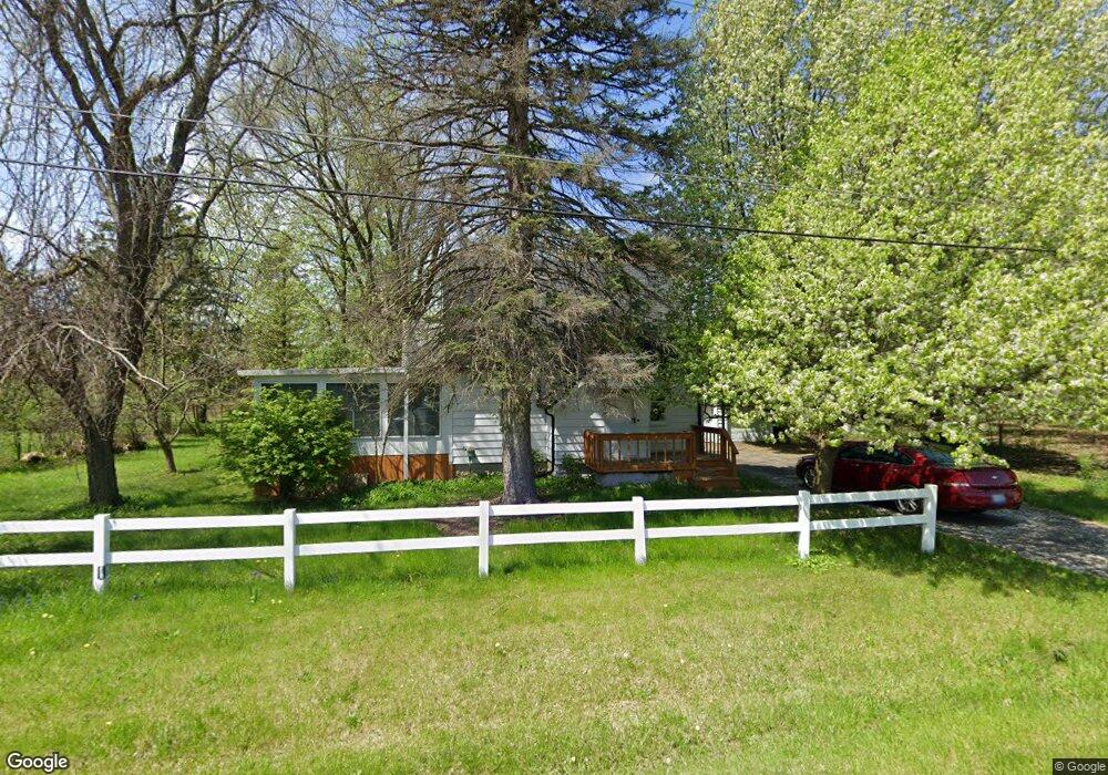
This home is located at 2022 Roland Ave, Flint, MI 48532 and is currently estimated at $124,263, approximately $126 per square foot. 2022 Roland Ave is a home located in Genesee County with nearby schools including Carman-Ainsworth High School, Genesee STEM Academy, and Genesee Academy.
Ownership History
Date
Name
Owned For
Owner Type
Purchase Details
Closed on
May 22, 2025
Sold by
Harvey Clifford L
Bought by
Harvey Seth Lucas
Current Estimated Value
Purchase Details
Closed on
Jan 25, 2018
Sold by
Harvey Seth Lucas
Bought by
Harvey Clifford L and Harvey Sara L
Purchase Details
Closed on
Sep 8, 2016
Sold by
Olney Sharon A and Olney Harold R
Bought by
Harvey Clifford L and Harvey Sara L
Create a Home Valuation Report for This Property
The Home Valuation Report is an in-depth analysis detailing your home's value as well as a comparison with similar homes in the area
Home Values in the Area
Average Home Value in this Area
Purchase History
| Date | Buyer | Sale Price | Title Company |
|---|---|---|---|
| Harvey Seth Lucas | -- | None Listed On Document | |
| Harvey Clifford L | -- | None Available | |
| Harvey Clifford L | -- | None Available |
Source: Public Records
Mortgage History
| Date | Status | Borrower | Loan Amount |
|---|---|---|---|
| Closed | Harvey Clifford L | $0 |
Source: Public Records
Tax History Compared to Growth
Tax History
| Year | Tax Paid | Tax Assessment Tax Assessment Total Assessment is a certain percentage of the fair market value that is determined by local assessors to be the total taxable value of land and additions on the property. | Land | Improvement |
|---|---|---|---|---|
| 2025 | $1,966 | $48,200 | $0 | $0 |
| 2024 | $1,144 | $42,600 | $0 | $0 |
| 2023 | $1,055 | $37,600 | $0 | $0 |
| 2022 | $727 | $35,000 | $0 | $0 |
| 2021 | $1,891 | $33,900 | $0 | $0 |
| 2020 | $946 | $33,600 | $0 | $0 |
| 2019 | $1,009 | $33,400 | $0 | $0 |
| 2018 | $1,373 | $31,200 | $0 | $0 |
| 2017 | $1,895 | $31,200 | $0 | $0 |
| 2016 | $1,325 | $31,100 | $0 | $0 |
| 2015 | $1,188 | $31,100 | $0 | $0 |
| 2014 | $705 | $30,100 | $0 | $0 |
| 2012 | -- | $28,400 | $28,400 | $0 |
Source: Public Records
Map
Nearby Homes
- 00 Corunna Rd
- 000 Corunna Rd
- 6098 Corunna Rd
- 6172 W Court St
- 6007 Corunna Rd
- 6507 Corunna Rd Unit 6493 Corunna Rd.
- 6456 W Court St
- 6090 Lancaster Dr
- 1442 Mintola Ave
- 7042 Corunna Rd
- 5503 Westchester Dr
- 5489 Brobeck St
- 1417 Grassmere Ave
- 5406 Litchfield Dr
- 7035 Saratoga Dr
- 7030 Saratoga Dr
- 7070 Aldredge Dr
- 7075 Saratoga Dr
- 7042 Saratoga Dr
- 1165 S Elms Rd
- 2022 Roland Ave
- 2036 Roland Ave
- 2029 Roland Ave
- V/L Corunna Rd
- 6168 Corunna Rd
- 1 Corunna Rd
- 2043 Roland Ave
- 2048 Roland Ave
- 6277 Corunna Rd
- 2046 Roslyn Ave
- 2053 Roland Ave
- 2052 Roslyn Ave
- 6209 Corunna Rd
- 2061 Roland Ave
- 2029 Roslyn Ave
- 2062 Roland Ave
- 2062 Roland Ave
- 2056 Roslyn Ave
- 2047 Roslyn Ave
- 1539 Dorellen Ave