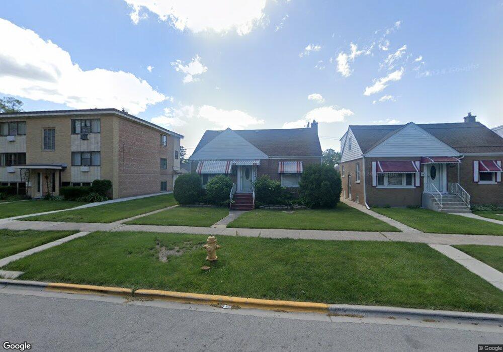
2022 S 13th Ave Broadview, IL 60155
South Maywood NeighborhoodEstimated Value: $290,000 - $321,000
3
Beds
2
Baths
1,160
Sq Ft
$265/Sq Ft
Est. Value
About This Home
This home is located at 2022 S 13th Ave, Broadview, IL 60155 and is currently estimated at $307,541, approximately $265 per square foot. 2022 S 13th Ave is a home located in Cook County with nearby schools including Roosevelt Elementary School, Irving Middle School, and Proviso East High School.
Ownership History
Date
Name
Owned For
Owner Type
Purchase Details
Closed on
Apr 28, 2004
Sold by
Smart Kimmaro
Bought by
Martin N C and Martin Gary Ellaweese
Current Estimated Value
Home Financials for this Owner
Home Financials are based on the most recent Mortgage that was taken out on this home.
Original Mortgage
$186,966
Outstanding Balance
$87,661
Interest Rate
5.5%
Mortgage Type
FHA
Estimated Equity
$219,880
Purchase Details
Closed on
Dec 30, 1996
Sold by
Morrison Edward
Bought by
Smart Kimmaro
Home Financials for this Owner
Home Financials are based on the most recent Mortgage that was taken out on this home.
Original Mortgage
$66,769
Interest Rate
7.6%
Mortgage Type
FHA
Create a Home Valuation Report for This Property
The Home Valuation Report is an in-depth analysis detailing your home's value as well as a comparison with similar homes in the area
Home Values in the Area
Average Home Value in this Area
Purchase History
| Date | Buyer | Sale Price | Title Company |
|---|---|---|---|
| Martin N C | $190,000 | Multiple | |
| Smart Kimmaro | $67,000 | Chicago Title Insurance Co |
Source: Public Records
Mortgage History
| Date | Status | Borrower | Loan Amount |
|---|---|---|---|
| Open | Martin N C | $186,966 | |
| Previous Owner | Smart Kimmaro | $66,769 |
Source: Public Records
Tax History Compared to Growth
Tax History
| Year | Tax Paid | Tax Assessment Tax Assessment Total Assessment is a certain percentage of the fair market value that is determined by local assessors to be the total taxable value of land and additions on the property. | Land | Improvement |
|---|---|---|---|---|
| 2024 | $4,685 | $23,000 | $3,175 | $19,825 |
| 2023 | $3,353 | $23,000 | $3,175 | $19,825 |
| 2022 | $3,353 | $16,237 | $2,514 | $13,723 |
| 2021 | $3,824 | $17,924 | $2,513 | $15,411 |
| 2020 | $3,854 | $17,924 | $2,513 | $15,411 |
| 2019 | $2,353 | $13,000 | $2,249 | $10,751 |
| 2018 | $2,275 | $13,000 | $2,249 | $10,751 |
| 2017 | $2,280 | $13,000 | $2,249 | $10,751 |
| 2016 | $2,186 | $10,562 | $1,984 | $8,578 |
| 2015 | $2,084 | $10,562 | $1,984 | $8,578 |
| 2014 | $2,058 | $10,562 | $1,984 | $8,578 |
| 2013 | $2,528 | $12,709 | $1,984 | $10,725 |
Source: Public Records
Map
Nearby Homes
- 2036 S 15th Ave
- 2130 S 13th Ave
- 2015 S 11th Ave
- 2035 S 11th Ave
- 2010 S 16th Ave
- 2219 S 13th Ave
- 1927 S 17th Ave
- 2218 S 11th Ave
- 2003 S 18th Ave
- 2007 S 9th Ave
- 1927 S 18th Ave
- 1902 S 9th Ave
- 1911 S 18th Ave
- 2204 S 9th Ave Unit 2
- 2227 S 10th Ave
- 1627 S 14th Ave
- 2010 S 7th Ave
- 2235 S 18th Ave
- 1926 S 19th Ave
- 2234 S 18th Ave
- 2020 S 13th Ave
- 2016 S 13th Ave
- 2008 S 13th Ave
- 2031 S 14th Ave
- 2029 S 14th Ave
- 2027 S 14th Ave
- 2027 S 14th Ave
- 2035 S 14th Ave
- 2006 S 13th Ave
- 2006 S 13th Ave Unit 2E
- 2006 S 13th Ave Unit B
- 2040 S 13th Ave
- 2040 S 13th Ave
- 2011 S 14th Ave
- 2021 S 13th Ave
- 2019 S 13th Ave
- 2023 S 13th Ave
- 2015 S 13th Ave
- 2025 S 13th Ave