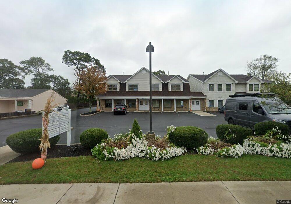
2022 State Route 71 Unit 203 Spring Lake, NJ 07762
--
Bed
--
Bath
11,675
Sq Ft
0.42
Acres
About This Home
This home is located at 2022 State Route 71 Unit 203, Spring Lake, NJ 07762. 2022 State Route 71 Unit 203 is a home located in Monmouth County with nearby schools including Spring Lake Heights Elementary School and St. Catharine School.
Ownership History
Date
Name
Owned For
Owner Type
Purchase Details
Closed on
Nov 10, 2010
Sold by
Shore Professional Offices
Bought by
Amoscato Family Llc
Create a Home Valuation Report for This Property
The Home Valuation Report is an in-depth analysis detailing your home's value as well as a comparison with similar homes in the area
Home Values in the Area
Average Home Value in this Area
Purchase History
| Date | Buyer | Sale Price | Title Company |
|---|---|---|---|
| Amoscato Family Llc | -- | None Available |
Source: Public Records
Tax History Compared to Growth
Tax History
| Year | Tax Paid | Tax Assessment Tax Assessment Total Assessment is a certain percentage of the fair market value that is determined by local assessors to be the total taxable value of land and additions on the property. | Land | Improvement |
|---|---|---|---|---|
| 2025 | $23,175 | $2,261,200 | $1,222,100 | $1,039,100 |
| 2024 | $23,893 | $2,200,900 | $1,166,600 | $1,034,300 |
| 2023 | $23,893 | $2,133,300 | $1,111,000 | $1,022,300 |
| 2022 | $31,550 | $2,000,000 | $977,700 | $1,022,300 |
| 2021 | $31,550 | $2,337,000 | $888,800 | $1,448,200 |
| 2020 | $31,352 | $2,308,700 | $888,800 | $1,419,900 |
| 2019 | $31,287 | $2,280,400 | $888,800 | $1,391,600 |
| 2018 | $31,408 | $2,227,500 | $888,800 | $1,338,700 |
| 2017 | $30,197 | $2,220,400 | $888,800 | $1,331,600 |
| 2016 | $29,964 | $2,176,000 | $844,400 | $1,331,600 |
| 2015 | $29,266 | $2,131,500 | $799,900 | $1,331,600 |
| 2014 | $28,626 | $2,131,500 | $799,900 | $1,331,600 |
Source: Public Records
Map
Nearby Homes
- 15 Wyckham Rd
- 12 Wyckham Rd
- 1905 3rd Ave
- 905 Wall Rd
- 1027 2nd Ave
- 2419 Kipling Ave
- 613 Warren Ave
- 737 20th Ave
- 1813 Margerum Ave
- 19 Willow Ln
- 513 Mercer Ave
- 1838 Highway 35 Unit 36
- 1211 18th Ave
- 24 Old Mill Ct
- 1012 Glenn St
- 1014 Glenn St
- 708 18th Ave
- 118 Warren Ave
- 1820 New Jersey 35 Unit 34
- 1820 New Jersey 35 Unit Home Site 26
- 2022 State Route 71
- 2022 New Jersey 71
- 2018 New Jersey 71 Unit 6
- 2008 State Route 71
- 2014 State Route 71
- 601 Pitney Dr
- 556 Church St
- 2023 State Route 71 Unit REAR
- 2023 State Route 71
- 2023 State Route 71 Unit Back
- 2023 State Route 71 Unit Front
- 554 Church St
- 554 Church St
- 2019 Highway 71
- 2025 State Route 71 Unit Front
- 2025 State Route 71 Unit 2nd Floor
- 558 Church St
- 605 Pitney Dr
- 2012 State Route 71
- 560 Church St