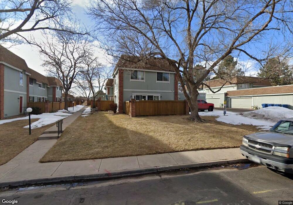
2022 W 101st Ave Thornton, CO 80260
Estimated Value: $288,000 - $331,000
2
Beds
2
Baths
--
Sq Ft
1,133
Sq Ft Lot
About This Home
This home is located at 2022 W 101st Ave, Thornton, CO 80260 and is currently estimated at $315,737. 2022 W 101st Ave is a home located in Adams County with nearby schools including Hillcrest Elementary School, Silver Hills Middle School, and Northglenn High School.
Ownership History
Date
Name
Owned For
Owner Type
Purchase Details
Closed on
Dec 13, 2019
Sold by
Newman Natalie J and Bashaw Natalie J
Bought by
Keck Sarah E
Current Estimated Value
Home Financials for this Owner
Home Financials are based on the most recent Mortgage that was taken out on this home.
Original Mortgage
$204,400
Interest Rate
3.7%
Mortgage Type
New Conventional
Purchase Details
Closed on
Aug 4, 2016
Sold by
Kalk Constance J
Bought by
Newman Natalie J
Home Financials for this Owner
Home Financials are based on the most recent Mortgage that was taken out on this home.
Original Mortgage
$180,000
Interest Rate
3.41%
Mortgage Type
New Conventional
Purchase Details
Closed on
Nov 29, 2010
Sold by
Secretary Of Housing & Urban Development
Bought by
Kalk Constance J
Home Financials for this Owner
Home Financials are based on the most recent Mortgage that was taken out on this home.
Original Mortgage
$64,501
Interest Rate
4.22%
Mortgage Type
VA
Purchase Details
Closed on
Aug 5, 2010
Sold by
Kovacs Roger and Kovacs Lesli
Bought by
The Secretary Of Housing & Urban Develop
Purchase Details
Closed on
Apr 30, 2004
Sold by
Parson Valerie
Bought by
Kovacs Roger and Kovacs Lesli
Home Financials for this Owner
Home Financials are based on the most recent Mortgage that was taken out on this home.
Original Mortgage
$108,000
Interest Rate
6.49%
Mortgage Type
Unknown
Purchase Details
Closed on
Oct 4, 2000
Sold by
Project Heritage
Bought by
Parson Valerie
Home Financials for this Owner
Home Financials are based on the most recent Mortgage that was taken out on this home.
Original Mortgage
$118,520
Interest Rate
7.86%
Mortgage Type
FHA
Purchase Details
Closed on
Jun 7, 2000
Sold by
Hud
Bought by
Project Heritage Inc
Purchase Details
Closed on
Mar 8, 2000
Sold by
Colorado Housing & Finance Authority
Bought by
Hud
Purchase Details
Closed on
Jul 29, 1999
Sold by
Kucera William E
Bought by
Hud
Purchase Details
Closed on
Nov 25, 1997
Sold by
Lee Robert E A and Lee Andrews Judith
Bought by
Kucera William E
Home Financials for this Owner
Home Financials are based on the most recent Mortgage that was taken out on this home.
Original Mortgage
$89,050
Interest Rate
7.3%
Mortgage Type
FHA
Create a Home Valuation Report for This Property
The Home Valuation Report is an in-depth analysis detailing your home's value as well as a comparison with similar homes in the area
Home Values in the Area
Average Home Value in this Area
Purchase History
| Date | Buyer | Sale Price | Title Company |
|---|---|---|---|
| Keck Sarah E | $255,507 | Fidelity National Title | |
| Newman Natalie J | $190,000 | Land Title Guarantee Co | |
| Kalk Constance J | $64,501 | Wtg | |
| The Secretary Of Housing & Urban Develop | -- | None Available | |
| Kovacs Roger | $135,000 | Chicago Title Insurance Co | |
| Parson Valerie | $119,900 | -- | |
| Project Heritage Inc | -- | -- | |
| Hud | -- | -- | |
| Hud | -- | -- | |
| Kucera William E | $89,500 | -- |
Source: Public Records
Mortgage History
| Date | Status | Borrower | Loan Amount |
|---|---|---|---|
| Open | Keck Sarah E | $204,400 | |
| Previous Owner | Newman Natalie J | $180,000 | |
| Previous Owner | Kovacs Roger | $108,000 | |
| Previous Owner | Parson Valerie | $118,520 | |
| Previous Owner | Kucera William E | $89,050 | |
| Closed | Parson Valerie | $2,997 | |
| Closed | Kovacs Roger | $27,000 |
Source: Public Records
Tax History Compared to Growth
Tax History
| Year | Tax Paid | Tax Assessment Tax Assessment Total Assessment is a certain percentage of the fair market value that is determined by local assessors to be the total taxable value of land and additions on the property. | Land | Improvement |
|---|---|---|---|---|
| 2024 | $2,306 | $21,870 | $4,560 | $17,310 |
| 2023 | $2,283 | $24,970 | $3,520 | $21,450 |
| 2022 | $2,103 | $18,240 | $3,610 | $14,630 |
| 2021 | $2,173 | $18,240 | $3,610 | $14,630 |
| 2020 | $1,982 | $16,990 | $3,720 | $13,270 |
| 2019 | $1,890 | $16,170 | $3,720 | $12,450 |
| 2018 | $1,492 | $12,380 | $1,440 | $10,940 |
| 2017 | $1,358 | $12,380 | $1,440 | $10,940 |
| 2016 | $1,052 | $9,320 | $1,590 | $7,730 |
| 2015 | $1,050 | $9,320 | $1,590 | $7,730 |
| 2014 | $899 | $7,750 | $1,590 | $6,160 |
Source: Public Records
Map
Nearby Homes
- 2029 W 102nd Ave
- 2012 W 101st Ave
- 2025 W 102nd Ave
- 1923 W 101st Ave
- 1945 W 102nd Ave
- 1935 W 102nd Ave
- 2123 W 101st Cir
- 10143 Quivas St
- 10072 Wyandott Cir S
- 1707 W 102nd Ave
- 10211 Ura Ln Unit 4-107
- 10211 Ura Ln Unit 204
- 10211 Ura Ln Unit 5-206
- 10211 Ura Ln Unit 6-307
- 10211 Ura Ln Unit 7-108
- 10211 Ura Ln Unit 104
- 10211 Ura Ln Unit 101
- 10211 Ura Ln Unit 7-204
- 10211 Ura Ln Unit 8-207
- 10204 Quivas St
- 2044 W 101st Ave
- 2038 W 101st Ave
- 2036 W 101st Ave
- 2042 W 101st Ave
- 2040 W 101st Ave
- 2028 W 101st Ave
- 2026 W 101st Ave
- 1946 W 102nd Ave
- 2020 W 101st Ave
- 2032 W 101st Ave
- 2034 W 101st Ave
- 2018 W 101st Ave
- 1951 W 102nd Ave
- 2030 W 101st Ave
- 1949 W 102nd Ave
- 2027 W 102nd Ave
- 2014 W 101st Ave
- 1947 W 102nd Ave
- 2043 W 102nd Ave
- 1921 W 101st Ave