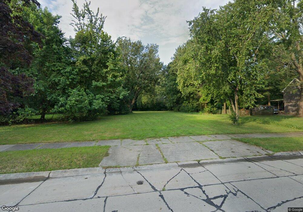
20220 Eastwood Dr Harper Woods, MI 48225
Estimated Value: $244,000 - $294,000
--
Bed
2
Baths
2,568
Sq Ft
$106/Sq Ft
Est. Value
About This Home
This home is located at 20220 Eastwood Dr, Harper Woods, MI 48225 and is currently estimated at $271,667, approximately $105 per square foot. 20220 Eastwood Dr is a home located in Wayne County with nearby schools including Beacon Elementary School, Tyrone Elementary School, and Harper Woods Middle School.
Ownership History
Date
Name
Owned For
Owner Type
Purchase Details
Closed on
Sep 17, 2008
Sold by
Federal Home Loan Mortgage Corporation
Bought by
Bassett Davis Stephanie
Current Estimated Value
Home Financials for this Owner
Home Financials are based on the most recent Mortgage that was taken out on this home.
Original Mortgage
$100,000
Outstanding Balance
$66,163
Interest Rate
6.41%
Mortgage Type
Purchase Money Mortgage
Estimated Equity
$205,504
Purchase Details
Closed on
May 30, 2007
Sold by
Mai Abdel Moez Samer M and Mai Elias
Bought by
Federal Home Loan Mortgage Corporation
Purchase Details
Closed on
Jun 27, 2005
Sold by
Halim Mohamed H and Halim Bahira
Bought by
Moez Samer M Abdel
Create a Home Valuation Report for This Property
The Home Valuation Report is an in-depth analysis detailing your home's value as well as a comparison with similar homes in the area
Home Values in the Area
Average Home Value in this Area
Purchase History
| Date | Buyer | Sale Price | Title Company |
|---|---|---|---|
| Bassett Davis Stephanie | $119,900 | Attorneys Title | |
| Federal Home Loan Mortgage Corporation | $152,100 | None Available | |
| Moez Samer M Abdel | $188,000 | First Michigan Title Inc |
Source: Public Records
Mortgage History
| Date | Status | Borrower | Loan Amount |
|---|---|---|---|
| Open | Bassett Davis Stephanie | $100,000 |
Source: Public Records
Tax History Compared to Growth
Tax History
| Year | Tax Paid | Tax Assessment Tax Assessment Total Assessment is a certain percentage of the fair market value that is determined by local assessors to be the total taxable value of land and additions on the property. | Land | Improvement |
|---|---|---|---|---|
| 2025 | $702 | $37,000 | $0 | $0 |
| 2024 | $702 | $32,900 | $0 | $0 |
| 2023 | $672 | $30,500 | $0 | $0 |
| 2022 | $1,218 | $28,600 | $0 | $0 |
| 2021 | $1,315 | $24,800 | $0 | $0 |
| 2019 | $1,287 | $21,600 | $0 | $0 |
| 2018 | $543 | $23,200 | $0 | $0 |
| 2017 | $2,078 | $23,200 | $0 | $0 |
| 2016 | $3,002 | $30,300 | $0 | $0 |
| 2015 | $3,992 | $52,800 | $0 | $0 |
| 2013 | $3,870 | $38,700 | $0 | $0 |
| 2012 | $1,027 | $44,700 | $20,600 | $24,100 |
Source: Public Records
Map
Nearby Homes
- 19726 Eastwood Dr
- 19945 Woodside St
- 19926 Damman St
- 19780 Beaconsfield St
- 20048 Woodside St
- 20522 Woodmont St
- 20202 Hunt Club Dr
- 19645 Woodmont St
- 20000 Roscommon St
- 19711 Damman St
- 19703 Roscommon St
- 20696 Huntington Ave
- 19969 Elkhart St
- 20611 Damman St
- 20432 Hunt Club Dr
- 20006 Lochmoor St
- 20602 Kenmore Ave
- 19984 Elkhart St
- 20688 Woodland St
- 20635 Woodside St
- 20040 Eastwood Dr
- 20260 Eastwood Dr
- 20215 Eastwood Dr
- 20045 Eastwood Dr
- 20020 Eastwood Dr
- 20041 Old Homestead Dr
- 20211 Old Homestead Dr
- 20025 Eastwood Dr
- 20243 Old Homestead Dr
- 20261 Old Homestead Dr
- 20235 Eastwood Dr
- 20278 Eastwood Dr
- 20255 Eastwood Dr
- 20000 Eastwood Dr
- 20279 Old Homestead Dr
- 20005 Eastwood Dr
- 20021 Old Homestead Dr
- 20386 Eastwood Dr
- 20001 Old Homestead Dr
- 20275 Eastwood Dr
