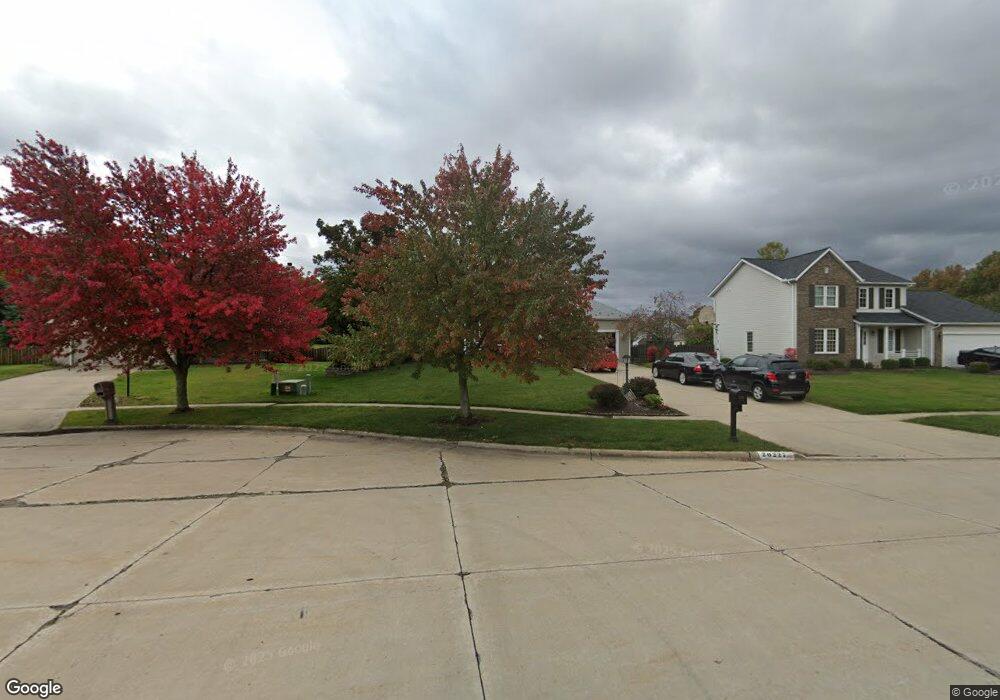
20227 Cardinal Cir Strongsville, OH 44149
Estimated Value: $378,000 - $475,000
4
Beds
3
Baths
2,347
Sq Ft
$179/Sq Ft
Est. Value
About This Home
This home is located at 20227 Cardinal Cir, Strongsville, OH 44149 and is currently estimated at $420,453, approximately $179 per square foot. 20227 Cardinal Cir is a home located in Cuyahoga County with nearby schools including Strongsville High School, Sts Joseph & John Interparochial School, and St Mary School.
Ownership History
Date
Name
Owned For
Owner Type
Purchase Details
Closed on
Dec 8, 2005
Sold by
Lewis Robert A and Lewis Theresa A
Bought by
Basnett Robert K and Basnett Susan
Current Estimated Value
Home Financials for this Owner
Home Financials are based on the most recent Mortgage that was taken out on this home.
Original Mortgage
$151,000
Interest Rate
5.75%
Mortgage Type
Purchase Money Mortgage
Purchase Details
Closed on
Jun 30, 1994
Sold by
W Bishop Co
Bought by
Lewis Robert A and Lewis Theresa A
Home Financials for this Owner
Home Financials are based on the most recent Mortgage that was taken out on this home.
Original Mortgage
$116,000
Interest Rate
8.66%
Mortgage Type
New Conventional
Purchase Details
Closed on
Mar 31, 1994
Sold by
S N R
Bought by
The W Bishop Co
Purchase Details
Closed on
Jan 1, 1993
Bought by
S N R
Create a Home Valuation Report for This Property
The Home Valuation Report is an in-depth analysis detailing your home's value as well as a comparison with similar homes in the area
Home Values in the Area
Average Home Value in this Area
Purchase History
| Date | Buyer | Sale Price | Title Company |
|---|---|---|---|
| Basnett Robert K | $241,000 | Executive Title Agency | |
| Lewis Robert A | $170,675 | -- | |
| The W Bishop Co | $32,800 | -- | |
| S N R | -- | -- |
Source: Public Records
Mortgage History
| Date | Status | Borrower | Loan Amount |
|---|---|---|---|
| Closed | Basnett Robert K | $151,000 | |
| Closed | Lewis Robert A | $116,000 |
Source: Public Records
Tax History Compared to Growth
Tax History
| Year | Tax Paid | Tax Assessment Tax Assessment Total Assessment is a certain percentage of the fair market value that is determined by local assessors to be the total taxable value of land and additions on the property. | Land | Improvement |
|---|---|---|---|---|
| 2024 | $6,143 | $130,830 | $22,575 | $108,255 |
| 2023 | $5,867 | $93,700 | $21,810 | $71,890 |
| 2022 | $5,824 | $93,700 | $21,810 | $71,890 |
| 2021 | $5,778 | $93,700 | $21,810 | $71,890 |
| 2020 | $5,937 | $85,160 | $19,810 | $65,350 |
| 2019 | $5,762 | $243,300 | $56,600 | $186,700 |
| 2018 | $2,615 | $85,160 | $19,810 | $65,350 |
| 2017 | $5,001 | $75,390 | $16,030 | $59,360 |
| 2016 | $4,961 | $75,390 | $16,030 | $59,360 |
| 2015 | $4,884 | $75,390 | $16,030 | $59,360 |
| 2014 | $4,884 | $73,190 | $15,580 | $57,610 |
Source: Public Records
Map
Nearby Homes
- 9401 Pheasant Run Place
- 20424 Scotch Pine Way
- 19890 Idlewood Trail
- 20050 Idlewood Trail
- 19997 Idlewood Trail
- 10986 Fawn Meadow Ln
- 20684 Albion Rd
- 11179 Fawn Meadow Ln
- 10839 Prospect Rd
- 21292 Creekside Dr
- 21176 Hickory Branch Trail
- 19240 Briarwood Ln
- 8627 Courtland Dr
- 11432 Pearl Rd
- 10353 Oak Branch Trail
- 18433 Whitney Rd
- 11499 Pearl Rd Unit A106
- 11479 Pearl Rd Unit A101
- 18737 Evergreen Dr
- 84 Sprague Rd
- 20239 Cardinal Cir
- 20215 Cardinal Cir
- 9725 Woodhurst Dr
- 20251 Cardinal Cir
- 20203 Cardinal Cir
- 9757 Woodhurst Dr
- 20196 Cardinal Cir
- 20232 Cardinal Cir
- 9789 Woodhurst Dr
- 20244 Cardinal Cir
- 9676 Woodhurst Dr
- 20220 Cardinal Cir
- 20256 Cardinal Cir
- 20208 Cardinal Cir
- 9821 Woodhurst Dr
- 9740 Woodhurst Dr
- 9644 Woodhurst Dr
- 9772 Woodhurst Dr
- 9612 Woodhurst Dr
- 20225 Ashley Cir