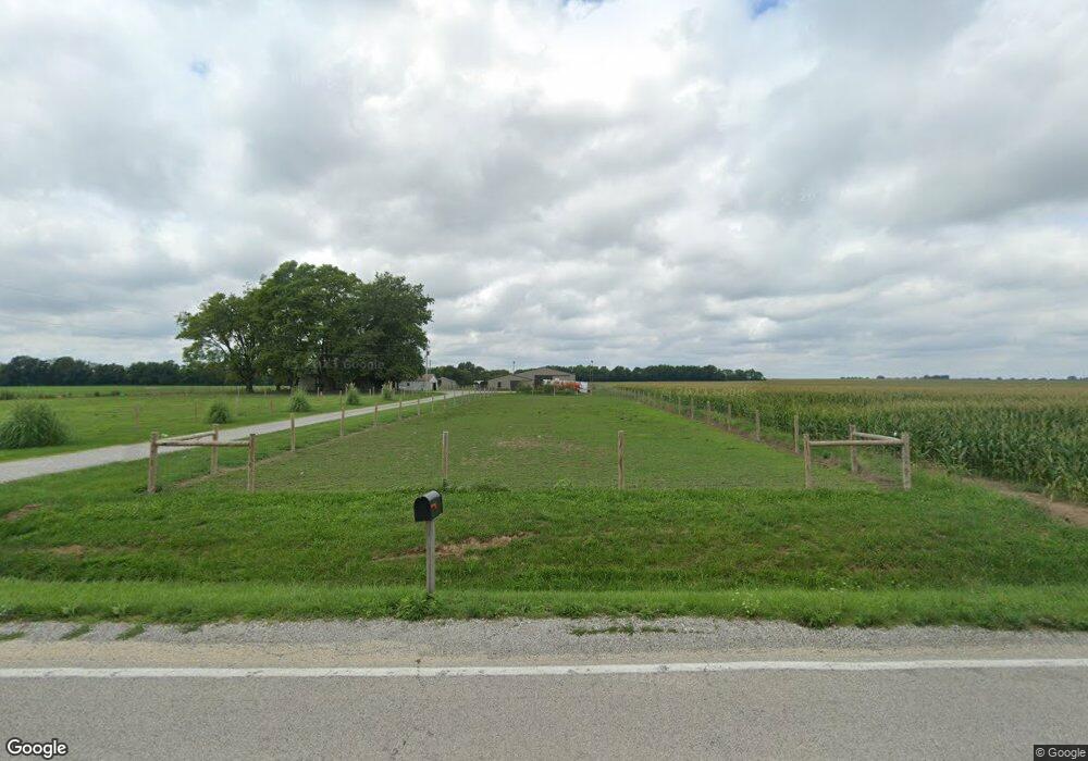
20227 Jamestown Rd Breese, IL 62230
Estimated Value: $135,000 - $208,000
--
Bed
1
Bath
1,230
Sq Ft
$135/Sq Ft
Est. Value
About This Home
This home is located at 20227 Jamestown Rd, Breese, IL 62230 and is currently estimated at $166,485, approximately $135 per square foot. 20227 Jamestown Rd is a home located in Clinton County with nearby schools including St Rose Elementary School and Central Community High School.
Ownership History
Date
Name
Owned For
Owner Type
Purchase Details
Closed on
Feb 26, 2025
Sold by
Voss Tina M and Tina M Voss Living Trust Tina M Voss Living T
Bought by
Voss Ryan and Voss Kara
Current Estimated Value
Purchase Details
Closed on
Aug 2, 2024
Sold by
Voss Tina M and Tina M Voss Living Trust Tina M Voss Living T
Bought by
Meyer Vms Dairy Inc
Purchase Details
Closed on
May 5, 2014
Sold by
Voss Steven J and Voss Tina M
Bought by
Voss Tina M
Create a Home Valuation Report for This Property
The Home Valuation Report is an in-depth analysis detailing your home's value as well as a comparison with similar homes in the area
Home Values in the Area
Average Home Value in this Area
Purchase History
| Date | Buyer | Sale Price | Title Company |
|---|---|---|---|
| Voss Ryan | $200,000 | None Available | |
| Meyer Vms Dairy Inc | -- | None Available | |
| Voss Tina M | -- | None Available |
Source: Public Records
Tax History Compared to Growth
Tax History
| Year | Tax Paid | Tax Assessment Tax Assessment Total Assessment is a certain percentage of the fair market value that is determined by local assessors to be the total taxable value of land and additions on the property. | Land | Improvement |
|---|---|---|---|---|
| 2024 | $1,906 | $33,490 | $5,640 | $27,850 |
| 2023 | $1,719 | $30,550 | $5,090 | $25,460 |
| 2022 | $1,719 | $29,880 | $5,560 | $24,320 |
| 2021 | $1,544 | $27,980 | $5,150 | $22,830 |
| 2020 | $1,384 | $26,220 | $4,800 | $21,420 |
| 2019 | $1,401 | $26,138 | $4,718 | $21,420 |
| 2018 | $1,291 | $23,434 | $4,314 | $19,120 |
| 2017 | $1,321 | $23,367 | $4,247 | $19,120 |
| 2016 | $1,308 | $23,396 | $4,276 | $19,120 |
| 2015 | -- | $23,324 | $4,204 | $19,120 |
| 2013 | -- | $25,376 | $4,126 | $21,250 |
Source: Public Records
Map
Nearby Homes
- 17811 East St
- 22809 Saint Rose Rd
- 4 Hill Valley Dr
- 000 Hug Cemetery Rd
- 13642 Saint Rose Rd
- 10675 Buckingham Ct
- 13964 Best One Dr
- 13613 Alpine Way
- 13636 Alpine Way
- 13898 Lincoln Dr
- 24 Lori Ann Ct
- 30 Frey Boys Ln
- 923 N 6th St
- 12740 Iberg Rd
- 255 Regency Ct
- 325 N Walnut St
- 290 N Elm St
- 305 Kingsbury Ct
- 112 Blaine St
- 371 Frey Meadows Rd
- 20220 Jamestown Rd
- 20194 Jamestown Rd
- 20505 Jamestown Rd
- 20818 Low Bridge Rd
- 19900 Jamestown Rd
- 20719 Jamestown Rd
- 19808 Jamestown Rd
- 19816 Jamestown Rd
- 20775 Jamestown Rd
- 19824 Jamestown Rd
- 19820 Jamestown Rd
- 20626 Low Bridge Rd
- 20615 Low Bridge Rd
- 10218 Surge Rd
- 9919 Surge Rd
- 20700 Low Bridge Rd
- 19675 Jamestown Rd
- 10225 Surge Rd
- 10221 Surge Rd
- 9408 Surge Rd
