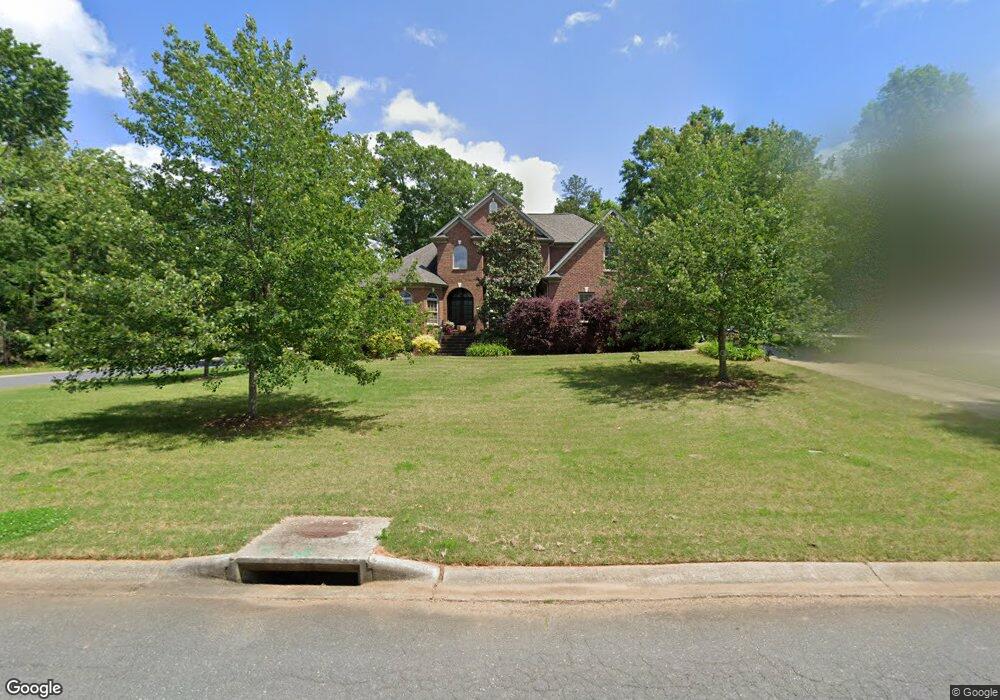
2023 Farrow Dr Rock Hill, SC 29732
Estimated Value: $663,000 - $773,000
--
Bed
1
Bath
3,773
Sq Ft
$195/Sq Ft
Est. Value
About This Home
This home is located at 2023 Farrow Dr, Rock Hill, SC 29732 and is currently estimated at $735,541, approximately $194 per square foot. 2023 Farrow Dr is a home with nearby schools including Rawlinson Road Middle School and Northwestern High School.
Ownership History
Date
Name
Owned For
Owner Type
Purchase Details
Closed on
Jun 20, 2008
Sold by
J W Neal Construction Llc
Bought by
Martin Erik K and Martin Kimberly C
Current Estimated Value
Home Financials for this Owner
Home Financials are based on the most recent Mortgage that was taken out on this home.
Original Mortgage
$394,450
Outstanding Balance
$253,505
Interest Rate
6.08%
Mortgage Type
New Conventional
Estimated Equity
$482,036
Purchase Details
Closed on
Jul 12, 2007
Sold by
Jackson William P and Jackson Elease
Bought by
L W Neal Construction Llc
Home Financials for this Owner
Home Financials are based on the most recent Mortgage that was taken out on this home.
Original Mortgage
$382,322
Interest Rate
6.71%
Mortgage Type
Construction
Purchase Details
Closed on
Jul 12, 2006
Sold by
Meadow Lakes Partners
Bought by
Jackson William P and Jackson Elease
Create a Home Valuation Report for This Property
The Home Valuation Report is an in-depth analysis detailing your home's value as well as a comparison with similar homes in the area
Home Values in the Area
Average Home Value in this Area
Purchase History
| Date | Buyer | Sale Price | Title Company |
|---|---|---|---|
| Martin Erik K | $493,073 | -- | |
| L W Neal Construction Llc | $66,500 | Attorney | |
| Jackson William P | $62,000 | None Available |
Source: Public Records
Mortgage History
| Date | Status | Borrower | Loan Amount |
|---|---|---|---|
| Open | Martin Erik K | $394,450 | |
| Previous Owner | L W Neal Construction Llc | $382,322 |
Source: Public Records
Tax History Compared to Growth
Tax History
| Year | Tax Paid | Tax Assessment Tax Assessment Total Assessment is a certain percentage of the fair market value that is determined by local assessors to be the total taxable value of land and additions on the property. | Land | Improvement |
|---|---|---|---|---|
| 2024 | $3,679 | $16,767 | $2,894 | $13,873 |
| 2023 | $3,689 | $16,767 | $2,894 | $13,873 |
| 2022 | $3,714 | $16,767 | $2,894 | $13,873 |
| 2021 | -- | $16,767 | $2,894 | $13,873 |
| 2020 | $3,722 | $16,767 | $0 | $0 |
| 2019 | $3,339 | $14,580 | $0 | $0 |
| 2018 | $3,334 | $14,580 | $0 | $0 |
| 2017 | $3,212 | $14,580 | $0 | $0 |
| 2016 | $3,183 | $14,580 | $0 | $0 |
| 2014 | $3,436 | $14,580 | $3,000 | $11,580 |
| 2013 | $3,436 | $16,520 | $3,000 | $13,520 |
Source: Public Records
Map
Nearby Homes
- 1593 Worthington Crossing
- 1594 Summit View Dr
- 1548 Summit View Dr
- 1487 The Crossing
- 2069 Landry Ln Unit 233
- 2076 Landry Ln Unit 232
- 1189 Quiet Acres Rd
- 1122 Wendy Rd
- 1183 Quiet Acres Rd
- 2765 Dogwood Cir
- 2615 Oakhurst Dr
- 926 Meadow Lakes Rd
- 1085 Pinecrest Dr
- 981 Meadowlark Dr
- 2358 Sparrow Dr
- 829 Rawlinson Rd
- 985 Montgomery Dr
- 1545 Patio Point
- 1391 Colwick Ln
- 446 Guiness Place
- 2013 Farrow Dr
- 2026 Olde Oxford Ct
- 2018 Olde Oxford Ct
- 1646 Cunningham Dr Unit 221
- 1646 Cunningham Dr
- 1636 The Crossing
- 2016 Farrow Dr
- 1658 Cunningham Dr
- 2003 Farrow Dr
- 1630 The Crossing
- 1630 the Crossing
- 1624 The Crossing
- 1617 The Crossing
- 1617 the Crossing
- 2002 Olde Oxford Ct
- 1669 Cunningham Dr
- 1624 the Crossing
- 2006 Farrow Dr
- Lt 121 Herndon Heritage Rd
- Lot 17 Herndon Heritage Rd