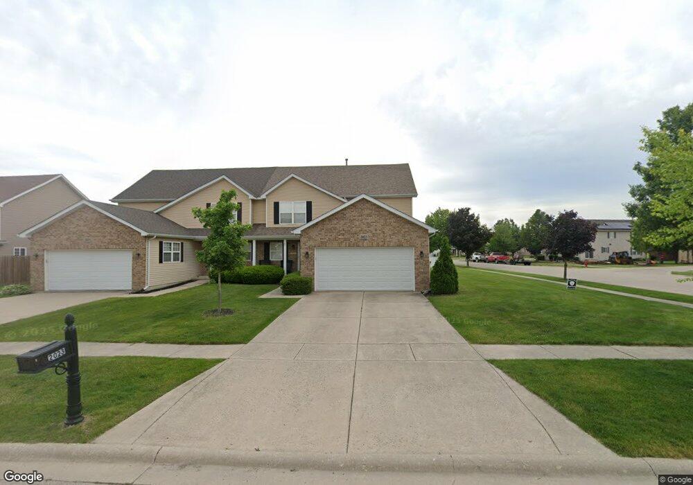
2023 Mountain Rd Unit R Morris, IL 60450
Estimated Value: $296,000 - $326,000
3
Beds
3
Baths
1,826
Sq Ft
$169/Sq Ft
Est. Value
About This Home
This home is located at 2023 Mountain Rd Unit R, Morris, IL 60450 and is currently estimated at $309,019, approximately $169 per square foot. 2023 Mountain Rd Unit R is a home located in Grundy County with nearby schools including Saratoga Elementary School, Morris Community High School, and Immaculate Conception School.
Ownership History
Date
Name
Owned For
Owner Type
Purchase Details
Closed on
Jun 6, 2025
Sold by
Buesinger Gary L
Bought by
Ruby Robert T
Current Estimated Value
Home Financials for this Owner
Home Financials are based on the most recent Mortgage that was taken out on this home.
Original Mortgage
$296,287
Outstanding Balance
$295,499
Interest Rate
6.63%
Mortgage Type
FHA
Estimated Equity
$13,520
Purchase Details
Closed on
Dec 17, 2014
Sold by
Daniel J Daniel J and Baker Elizabeth M
Bought by
Buesinger Gary L and Buesinger Martha K
Purchase Details
Closed on
Dec 19, 2011
Sold by
Pnc Mortgage Nancy Collett
Bought by
Baker Daniel J and Jaschke Elizabeth M
Home Financials for this Owner
Home Financials are based on the most recent Mortgage that was taken out on this home.
Original Mortgage
$130,000
Interest Rate
3.98%
Mortgage Type
New Conventional
Create a Home Valuation Report for This Property
The Home Valuation Report is an in-depth analysis detailing your home's value as well as a comparison with similar homes in the area
Purchase History
| Date | Buyer | Sale Price | Title Company |
|---|---|---|---|
| Ruby Robert T | $302,500 | National Title Solutions | |
| Buesinger Gary L | $170,000 | -- | |
| Baker Daniel J | $130,000 | -- |
Source: Public Records
Mortgage History
| Date | Status | Borrower | Loan Amount |
|---|---|---|---|
| Open | Ruby Robert T | $296,287 | |
| Previous Owner | Baker Daniel J | $130,000 |
Source: Public Records
Tax History
| Year | Tax Paid | Tax Assessment Tax Assessment Total Assessment is a certain percentage of the fair market value that is determined by local assessors to be the total taxable value of land and additions on the property. | Land | Improvement |
|---|---|---|---|---|
| 2024 | $5,948 | $81,964 | $7,182 | $74,782 |
| 2023 | $5,591 | $77,048 | $8,335 | $68,713 |
| 2022 | $3,056 | $72,475 | $7,840 | $64,635 |
| 2021 | $3,102 | $66,981 | $7,339 | $59,642 |
| 2020 | $3,166 | $63,190 | $6,924 | $56,266 |
| 2019 | $3,145 | $63,190 | $6,924 | $56,266 |
| 2018 | $3,156 | $56,797 | $6,944 | $49,853 |
| 2017 | $3,145 | $55,596 | $6,797 | $48,799 |
| 2016 | $3,143 | $53,877 | $9,429 | $44,448 |
| 2015 | $1,579 | $53,112 | $9,295 | $43,817 |
| 2014 | $1,864 | $50,467 | $8,832 | $41,635 |
| 2013 | $3,841 | $52,400 | $9,170 | $43,230 |
Source: Public Records
Map
Nearby Homes
- 2068 Locust Rd
- 1932 Mountain Rd
- Lot 79.2 Periwinkle Ct
- Lot 79.1 Periwinkle Ct
- 1648 Periwinkle Dr
- 1539 W Us Route 6
- 1605-1607 Schubert Dr
- 0 Anne Ln
- 374 Edgewater Dr
- Lot 3,4,5,7,8 Edgewater Dr
- 2099 Kingtree Dr
- 1028 Oakwood Dr
- 1054 Oakwood Dr
- 1094 Oakwood Dr
- 1007 Oakwood Dr
- 1027 Westwood Dr
- 1058 Westwood Dr
- 1010 Westwood Dr
- Lot 58 Timber Edge Dr
- 2666 Beyer Rd
- 2023 Mountain Rd Unit 2023
- 2021 Mountain Rd Unit L
- 2021 Mountain Rd
- 2017 Mountain Rd
- 1921 Eagle Dr
- 1933 Eagle Dr
- 2011 Mountain Rd Unit L
- 1945 Eagle Dr Unit L
- 1945 Eagle Dr
- 0000 Locust Rd
- 1909 Eagle Dr
- 2024 Mountain Rd
- 2020 Mountain Rd
- 2016 Mountain Rd
- 1957 Eagle Dr Unit R
- 1997 Mountain Rd Unit L
- 1997 Mountain Rd
- 2012 Mountain Rd Unit R
- 1901 Eagle Dr
- 1914 Eagle Dr
Your Personal Tour Guide
Ask me questions while you tour the home.