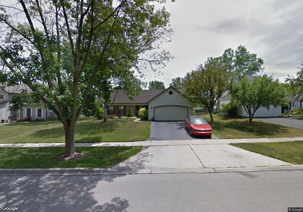
2023 Scottdale Cir Wheaton, IL 60189
Estimated Value: $390,406 - $466,000
Studio
--
Bath
1,298
Sq Ft
$338/Sq Ft
Est. Value
About This Home
This home is located at 2023 Scottdale Cir, Wheaton, IL 60189 and is currently estimated at $438,102, approximately $337 per square foot. 2023 Scottdale Cir is a home located in DuPage County with nearby schools including Arbor View Elementary School, Glen Crest Middle School, and Glenbard South High School.
Ownership History
Date
Name
Owned For
Owner Type
Purchase Details
Closed on
Nov 14, 2020
Sold by
Mazurski Lindsey M and Nicholson Dustin E
Bought by
Nicholson Dustin E and Nicholson Lindsey M
Current Estimated Value
Home Financials for this Owner
Home Financials are based on the most recent Mortgage that was taken out on this home.
Original Mortgage
$161,000
Outstanding Balance
$144,404
Interest Rate
3.25%
Mortgage Type
New Conventional
Estimated Equity
$293,698
Purchase Details
Closed on
Aug 26, 2014
Sold by
Williams Daniel and Williams Colleen
Bought by
Mazurski Lindsey M
Home Financials for this Owner
Home Financials are based on the most recent Mortgage that was taken out on this home.
Original Mortgage
$174,840
Interest Rate
4.37%
Mortgage Type
New Conventional
Create a Home Valuation Report for This Property
The Home Valuation Report is an in-depth analysis detailing your home's value as well as a comparison with similar homes in the area
Home Values in the Area
Average Home Value in this Area
Purchase History
| Date | Buyer | Sale Price | Title Company |
|---|---|---|---|
| Nicholson Dustin E | -- | Carrington Ttl Partners Llc | |
| Mazurski Lindsey M | $248,000 | Ctic |
Source: Public Records
Mortgage History
| Date | Status | Borrower | Loan Amount |
|---|---|---|---|
| Open | Nicholson Dustin E | $161,000 | |
| Closed | Mazurski Lindsey M | $174,840 |
Source: Public Records
Tax History
| Year | Tax Paid | Tax Assessment Tax Assessment Total Assessment is a certain percentage of the fair market value that is determined by local assessors to be the total taxable value of land and additions on the property. | Land | Improvement |
|---|---|---|---|---|
| 2024 | $8,225 | $108,879 | $36,970 | $71,909 |
| 2023 | $7,893 | $100,220 | $34,030 | $66,190 |
| 2022 | $6,986 | $94,710 | $32,160 | $62,550 |
| 2021 | $6,985 | $92,470 | $31,400 | $61,070 |
| 2020 | $7,051 | $91,610 | $31,110 | $60,500 |
| 2019 | $6,865 | $89,190 | $30,290 | $58,900 |
| 2018 | $7,047 | $90,370 | $28,540 | $61,830 |
| 2017 | $6,555 | $87,040 | $27,490 | $59,550 |
| 2016 | $6,451 | $83,560 | $26,390 | $57,170 |
| 2015 | $6,397 | $79,720 | $25,180 | $54,540 |
| 2014 | $6,225 | $76,630 | $22,820 | $53,810 |
| 2013 | $6,037 | $76,860 | $22,890 | $53,970 |
Source: Public Records
Map
Nearby Homes
- 23W070 Mulberry Ln
- 1580 College Ln S
- 2S744 Lakeside Dr Unit 21
- 3S481 Osage Dr
- 23W160 Woodcroft Dr
- 22W425 Arbor Ln
- 3S240 Burr Oak Dr
- 1922 Cambridge Ln
- 953 Cordova Ct
- 453 Raintree Dr Unit 5A
- 453 Raintree Dr Unit 1H
- 448 Raintree Ct Unit 1C
- 470 Fawell Blvd Unit 203
- 429 Sandhurst Cir Unit 1
- 131 Christina Cir
- 2266 Pebble Creek Dr
- 440 Raintree Ct Unit 1G
- 1927 Warrenville Rd
- 478 Raintree Ct Unit 2B
- 450 Raintree Ct Unit 2M
- 2017 Scottdale Cir
- 2031 Scottdale Cir
- 2009 Scottdale Cir
- 2037 Scottdale Cir
- 2110 Kentucky Ct
- 1988 Shetland Dr
- 2245 Blacksmith Dr
- 2116 Kentucky Ct
- 2107 Kentucky Ct
- 2045 Scottdale Cir Unit 5
- 2003 Scottdale Cir
- 1983 Shetland Dr
- 1960 Shetland Dr
- 2241 Blacksmith Dr
- 2051 Scottdale Cir
- 2233 Blacksmith Dr
- 2050 Stallion Ct
- 2122 Kentucky Ct
- 2119 Kentucky Ct
- 1948 Shetland Dr