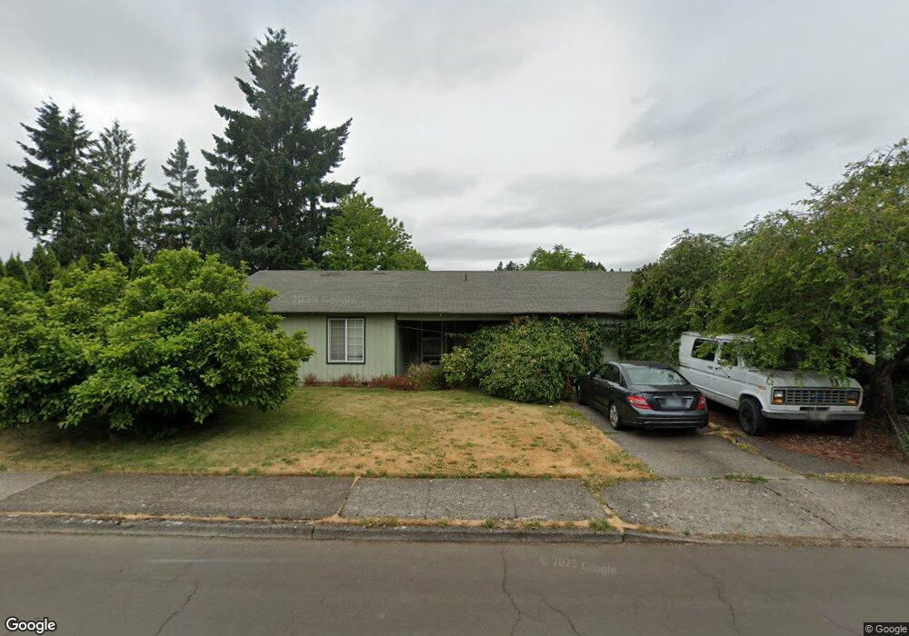
2023 SE 53rd Ave Hillsboro, OR 97123
Southeast Hillsboro NeighborhoodEstimated Value: $474,000 - $498,000
3
Beds
2
Baths
1,389
Sq Ft
$350/Sq Ft
Est. Value
About This Home
This home is located at 2023 SE 53rd Ave, Hillsboro, OR 97123 and is currently estimated at $485,930, approximately $349 per square foot. 2023 SE 53rd Ave is a home located in Washington County with nearby schools including Ladd Acres Elementary School, R.A. Brown Middle School, and Century High School.
Ownership History
Date
Name
Owned For
Owner Type
Purchase Details
Closed on
Feb 19, 1999
Sold by
Motter Stanley Dean and Motter Patricia L
Bought by
Cowles William Dennis
Current Estimated Value
Home Financials for this Owner
Home Financials are based on the most recent Mortgage that was taken out on this home.
Original Mortgage
$142,800
Outstanding Balance
$33,887
Interest Rate
6.77%
Mortgage Type
VA
Estimated Equity
$452,043
Create a Home Valuation Report for This Property
The Home Valuation Report is an in-depth analysis detailing your home's value as well as a comparison with similar homes in the area
Home Values in the Area
Average Home Value in this Area
Purchase History
| Date | Buyer | Sale Price | Title Company |
|---|---|---|---|
| Cowles William Dennis | $140,000 | First American Title Ins Co |
Source: Public Records
Mortgage History
| Date | Status | Borrower | Loan Amount |
|---|---|---|---|
| Open | Cowles William Dennis | $142,800 |
Source: Public Records
Tax History Compared to Growth
Tax History
| Year | Tax Paid | Tax Assessment Tax Assessment Total Assessment is a certain percentage of the fair market value that is determined by local assessors to be the total taxable value of land and additions on the property. | Land | Improvement |
|---|---|---|---|---|
| 2025 | $3,256 | $199,210 | -- | -- |
| 2024 | $3,164 | $193,410 | -- | -- |
| 2023 | $3,164 | $187,780 | $0 | $0 |
| 2022 | $3,078 | $187,780 | $0 | $0 |
| 2021 | $3,016 | $177,010 | $0 | $0 |
| 2020 | $2,951 | $171,860 | $0 | $0 |
| 2019 | $2,866 | $166,860 | $0 | $0 |
| 2018 | $2,744 | $162,000 | $0 | $0 |
| 2017 | $2,644 | $157,290 | $0 | $0 |
| 2016 | $2,572 | $152,710 | $0 | $0 |
| 2015 | $2,468 | $148,270 | $0 | $0 |
| 2014 | $2,454 | $143,960 | $0 | $0 |
Source: Public Records
Map
Nearby Homes
- 2130 SE 52nd Ave
- 1746 SE Brookwood Ave
- 1801 SE Brookwood Ave
- 5477 SE Rancho St
- 5080 SE Drake Rd
- 5795 SE Drake Rd
- 8431 SE Blanton St
- 2330 SE Brookwood Ave Unit 222
- 2073 SE 48th Ave
- 5728 SE Popes Place
- 4744 SE Maxwell St
- 5744 SE Popes Place
- 5396 SE Frances Ct
- 192 SE 47th Ave
- 1420 SE 51st Ave
- 184 SE 47th Ave
- 5619 SE Lexington Dr
- 1974 SE 60th Ave
- 2114 SE 60th Ave
- 2170 SE 61st Dr
- 2015 SE 53rd Ave
- 2051 SE 53rd Ave
- 2022 SE 52nd Ave
- 2056 SE 52nd Ave
- 2010 SE 52nd Ave
- 1941 SE 53rd Ave
- 2085 SE 53rd Ave
- 2024 SE 53rd Ave
- 2048 SE 53rd Ave
- 1946 SE 52nd Ave
- 2088 SE 52nd Ave
- 1976 SE 53rd Ave
- 2076 SE 53rd Ave
- 5188 SE Cascade Ct
- 2113 SE 53rd Ave
- 1938 SE 52nd Ave
- 5311 SE Del Rio Ct
- 5185 SE Montego St
- 2114 SE 52nd Ave
- 1923 SE 53rd Ave