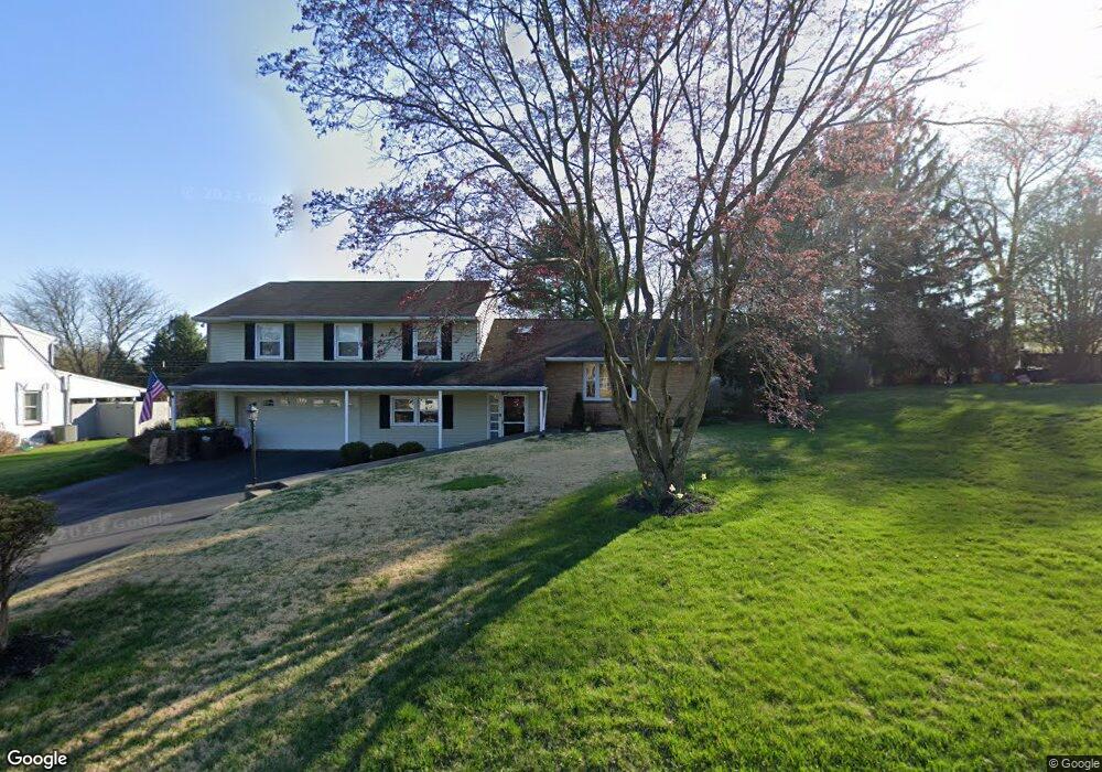
2024 Ardin Dr Norristown, PA 19403
West Norriton Township NeighborhoodEstimated Value: $526,988 - $571,000
3
Beds
3
Baths
2,397
Sq Ft
$229/Sq Ft
Est. Value
About This Home
This home is located at 2024 Ardin Dr, Norristown, PA 19403 and is currently estimated at $548,497, approximately $228 per square foot. 2024 Ardin Dr is a home located in Montgomery County with nearby schools including Whitehall Elementary School, Charles Blockson Middle School, and East Norriton Middle School.
Ownership History
Date
Name
Owned For
Owner Type
Purchase Details
Closed on
Mar 15, 2005
Sold by
Cendant Mobility Fin Corp
Bought by
Dare Robert H and Dare Cheryl W
Current Estimated Value
Home Financials for this Owner
Home Financials are based on the most recent Mortgage that was taken out on this home.
Original Mortgage
$256,000
Interest Rate
5.95%
Mortgage Type
New Conventional
Purchase Details
Closed on
Feb 23, 2005
Sold by
Puzas Linda J
Bought by
Cendant Mobility Fin Corp
Home Financials for this Owner
Home Financials are based on the most recent Mortgage that was taken out on this home.
Original Mortgage
$256,000
Interest Rate
5.95%
Mortgage Type
New Conventional
Purchase Details
Closed on
Jan 21, 1995
Sold by
Bean Edward D and Bean Kathleen S
Bought by
Puzas Linda J
Create a Home Valuation Report for This Property
The Home Valuation Report is an in-depth analysis detailing your home's value as well as a comparison with similar homes in the area
Home Values in the Area
Average Home Value in this Area
Purchase History
| Date | Buyer | Sale Price | Title Company |
|---|---|---|---|
| Dare Robert H | $320,000 | -- | |
| Cendant Mobility Fin Corp | $320,000 | -- | |
| Puzas Linda J | $171,500 | -- |
Source: Public Records
Mortgage History
| Date | Status | Borrower | Loan Amount |
|---|---|---|---|
| Closed | Cendant Mobility Fin Corp | $48,000 | |
| Previous Owner | Dare Robert H | $256,000 | |
| Previous Owner | Cendant Mobility Fin Corp | $256,000 |
Source: Public Records
Tax History Compared to Growth
Tax History
| Year | Tax Paid | Tax Assessment Tax Assessment Total Assessment is a certain percentage of the fair market value that is determined by local assessors to be the total taxable value of land and additions on the property. | Land | Improvement |
|---|---|---|---|---|
| 2025 | $7,606 | $155,670 | $45,270 | $110,400 |
| 2024 | $7,606 | $155,670 | $45,270 | $110,400 |
| 2023 | $7,521 | $155,670 | $45,270 | $110,400 |
| 2022 | $7,471 | $155,670 | $45,270 | $110,400 |
| 2021 | $7,426 | $155,670 | $45,270 | $110,400 |
| 2020 | $7,204 | $155,670 | $45,270 | $110,400 |
| 2019 | $7,043 | $155,670 | $45,270 | $110,400 |
| 2018 | $5,500 | $155,670 | $45,270 | $110,400 |
| 2017 | $6,649 | $155,670 | $45,270 | $110,400 |
| 2016 | $6,588 | $155,670 | $45,270 | $110,400 |
| 2015 | $6,104 | $155,670 | $45,270 | $110,400 |
| 2014 | $6,104 | $155,670 | $45,270 | $110,400 |
Source: Public Records
Map
Nearby Homes
- 2025 Sterigere St
- 1104 Arden Dr Unit METHACTON SCHOOL
- 1613 Countryside Ln
- 709 Middleton Place
- 37 Burnside Ave
- 166 Hoover Ave
- 805 Stonybrook Dr
- 145 Colonial Ave
- 214 Oxford Cir
- 1219 Stonybrook Dr Unit 1219
- 1749 W Marshall St
- 501 Stonybrook Dr
- 2515 Fieldcrest Ave
- 1635 W Marshall W Marshall St
- 550 Burnside Ave
- 612 Glen Ln Unit 56A
- 511 Faith Dr
- 1448 W James St
- 805 Sandra Ln
- 1924 Juniata Rd
- 2022 Ardin Dr
- 2030 Ardin Dr
- 2018 Ardin Dr
- 2025 Ardin Dr
- 206 Burnside Ave
- 2029 Ardin Dr
- 2021 Ardin Dr
- 2029 Sterigere St
- 2033 Sterigere St
- 2017 Ardin Dr
- 214 Burnside Ave
- 2014 Ardin Dr
- 2021 Sterigere St
- 2041 Sterigere St
- 2013 Ardin Dr
- 2037 Sterigere St
- 209 Burnside Ave
- 218 Burnside Ave
- 2017 Sterigere St
- 2010 Ardin Dr