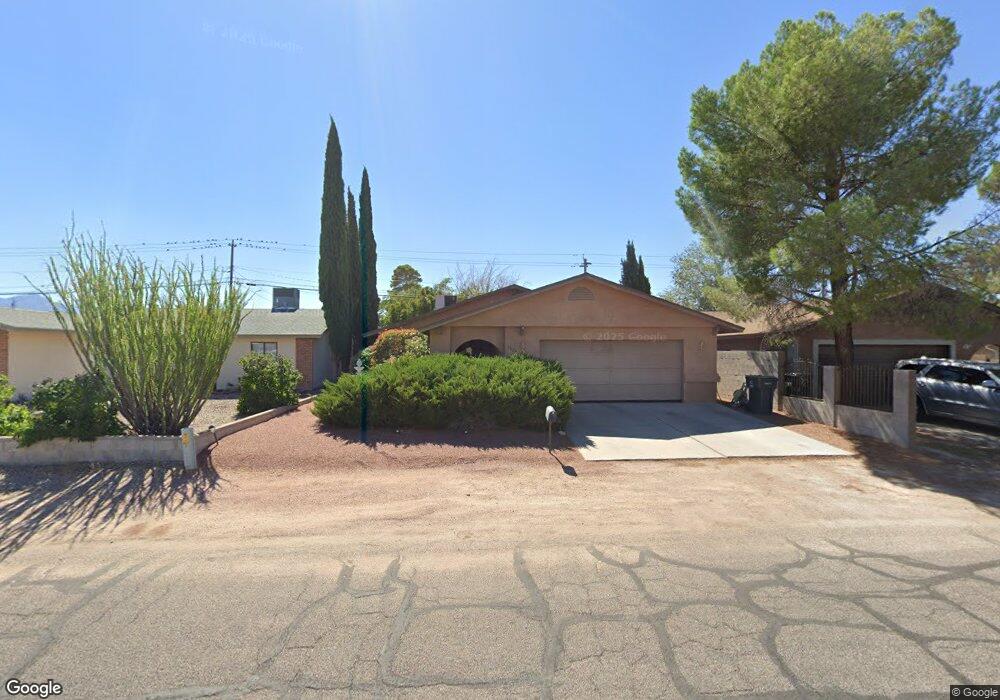
2024 Atlantic Ave Kingman, AZ 86401
Estimated Value: $204,411 - $261,000
--
Bed
1
Bath
1,331
Sq Ft
$169/Sq Ft
Est. Value
About This Home
This home is located at 2024 Atlantic Ave, Kingman, AZ 86401 and is currently estimated at $224,603, approximately $168 per square foot. 2024 Atlantic Ave is a home located in Mohave County with nearby schools including Manzanita Elementary School, Kingman Middle School, and Kingman High School.
Ownership History
Date
Name
Owned For
Owner Type
Purchase Details
Closed on
Apr 3, 2001
Sold by
Russell Hazel V
Bought by
Humphrey James A and Humphrey Cynthia J
Current Estimated Value
Home Financials for this Owner
Home Financials are based on the most recent Mortgage that was taken out on this home.
Original Mortgage
$77,850
Outstanding Balance
$28,613
Interest Rate
6.98%
Estimated Equity
$195,990
Purchase Details
Closed on
Feb 19, 1999
Sold by
Romero John A and Romero Linda
Bought by
Russell Hazel
Create a Home Valuation Report for This Property
The Home Valuation Report is an in-depth analysis detailing your home's value as well as a comparison with similar homes in the area
Home Values in the Area
Average Home Value in this Area
Purchase History
| Date | Buyer | Sale Price | Title Company |
|---|---|---|---|
| Humphrey James A | $86,500 | Chicago Title Insurance Co | |
| Russell Hazel | $83,159 | Chicago Title Insurance Co |
Source: Public Records
Mortgage History
| Date | Status | Borrower | Loan Amount |
|---|---|---|---|
| Open | Humphrey James A | $77,850 |
Source: Public Records
Tax History Compared to Growth
Tax History
| Year | Tax Paid | Tax Assessment Tax Assessment Total Assessment is a certain percentage of the fair market value that is determined by local assessors to be the total taxable value of land and additions on the property. | Land | Improvement |
|---|---|---|---|---|
| 2026 | $315 | -- | -- | -- |
| 2025 | $650 | $18,888 | $0 | $0 |
| 2024 | $650 | $20,732 | $0 | $0 |
| 2023 | $650 | $15,875 | $0 | $0 |
| 2022 | $595 | $12,938 | $0 | $0 |
| 2021 | $631 | $11,492 | $0 | $0 |
| 2019 | $568 | $10,531 | $0 | $0 |
| 2018 | $593 | $9,794 | $0 | $0 |
| 2017 | $538 | $8,679 | $0 | $0 |
| 2016 | $517 | $8,200 | $0 | $0 |
| 2015 | $541 | $7,049 | $0 | $0 |
Source: Public Records
Map
Nearby Homes
- 1962 Hope Ave Unit 7
- 1951 Motor Ave
- 2041 Chicago Ave
- 1926 Hope Ave
- 1916 Pacific Ave
- 1939 Chicago Ave
- 1953 Club Ave
- 2130 Club Ave
- 2209 Los Angeles St
- 2727 Mullen Dr Unit 1
- 2221 Golden Gate Ave
- 1946 Gates Ave
- 1827 Davis Ave
- 1820 Motor Ave
- 2418 Kemp Ave
- 1816 Motor Ave
- 1834 Club Ave
- 2414 Ricca Dr
- 000 Crozier Ave
- 1737 Atlantic Ave
- 2028 Atlantic Ave
- 2020 Atlantic Ave
- 2016 Atlantic Ave
- 2032 Atlantic Ave
- 2023 Airfield Ave
- 2027 Airfield Ave
- 2017 Airfield Ave
- 2012 Atlantic Ave
- 2019 Atlantic Ave
- 2025 Atlantic Ave
- 2029 Airfield Ave
- 2015 Airfield Ave
- 2017 Atlantic Ave
- 2038 Atlantic Ave
- 2029 Atlantic Ave
- 2011 Airfield Ave
- 2011 Atlantic Ave
- 2716 Main St
- 2710 Main St
- 2039 Airfield Ave