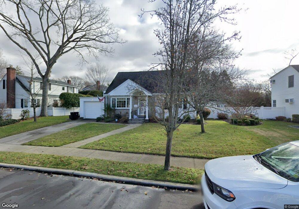
2024 Brian Dr Merrick, NY 11566
Estimated Value: $710,000 - $732,575
--
Bed
2
Baths
1,198
Sq Ft
$602/Sq Ft
Est. Value
About This Home
This home is located at 2024 Brian Dr, Merrick, NY 11566 and is currently estimated at $721,288, approximately $602 per square foot. 2024 Brian Dr is a home located in Nassau County with nearby schools including Burcham Elementary School, Merrick Avenue Middle School, and Waynoka High School.
Ownership History
Date
Name
Owned For
Owner Type
Purchase Details
Closed on
Dec 5, 2013
Sold by
Greenfield Carole
Bought by
Greenfield Kenneth and Greenfield Carole N
Current Estimated Value
Purchase Details
Closed on
Aug 27, 1996
Sold by
Beil Michael and Beil Judy
Bought by
Russo Stephen and Putignano Kristina
Home Financials for this Owner
Home Financials are based on the most recent Mortgage that was taken out on this home.
Original Mortgage
$193,500
Interest Rate
8.11%
Create a Home Valuation Report for This Property
The Home Valuation Report is an in-depth analysis detailing your home's value as well as a comparison with similar homes in the area
Home Values in the Area
Average Home Value in this Area
Purchase History
| Date | Buyer | Sale Price | Title Company |
|---|---|---|---|
| Greenfield Kenneth | -- | -- | |
| Russo Stephen | $215,000 | -- |
Source: Public Records
Mortgage History
| Date | Status | Borrower | Loan Amount |
|---|---|---|---|
| Previous Owner | Russo Stephen | $193,500 |
Source: Public Records
Tax History Compared to Growth
Tax History
| Year | Tax Paid | Tax Assessment Tax Assessment Total Assessment is a certain percentage of the fair market value that is determined by local assessors to be the total taxable value of land and additions on the property. | Land | Improvement |
|---|---|---|---|---|
| 2025 | $11,293 | $424 | $182 | $242 |
| 2024 | $3,427 | $471 | $202 | $269 |
| 2023 | $10,377 | $479 | $205 | $274 |
| 2022 | $10,377 | $499 | $214 | $285 |
| 2021 | $14,039 | $476 | $204 | $272 |
| 2020 | $9,269 | $527 | $506 | $21 |
| 2019 | $8,409 | $527 | $474 | $53 |
| 2018 | $7,832 | $562 | $0 | $0 |
| 2017 | $5,256 | $597 | $478 | $119 |
| 2016 | $7,926 | $632 | $456 | $176 |
| 2015 | $2,755 | $667 | $481 | $186 |
| 2014 | $2,755 | $667 | $481 | $186 |
| 2013 | $2,708 | $702 | $506 | $196 |
Source: Public Records
Map
Nearby Homes
- 37 Orchard St
- 1531 Merrick Ave
- 2207 Van Nostrand Ave
- 1360 Powell Ave
- 2005 Abbot Ave
- 1580 Little Whaleneck Rd
- 843 Jerusalem Ave
- 526 Park Ave
- 2245 Van Nostrand Ave
- 2360 Hamilton Rd
- 1617 Richard Ave
- 1680 Lake Ave
- 1706 Old Mill Rd
- 101 Northridge Ave
- 1448 Dewey Ave
- 1750 Henry Rd
- 1346 Bellmore Ave
- 12 Washington Dr
- 1974 Monroe Ave
- 2327 Cleveland St
- 1370 Clark St
- 2018 Brian Dr
- 1382 Clark St
- 1401 Van Nostrand Place
- 2012 Brian Dr
- 2025 Brian Dr
- 1388 Clark St
- 2019 Brian Dr
- 1396 Van Nostrand Place
- 2031 Brian Dr
- 2013 Brian Dr
- 1405 Van Nostrand Place
- 1371 Clark St
- 2037 Brian Dr
- 1387 Clark St
- 1394 Clark St
- 2006 Brian Dr
- 2007 Brian Dr
- 1402 Van Nostrand Place
- 2012 Debra Ct