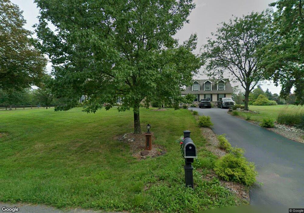
2024 Hollis Rd Lansdale, PA 19446
Estimated Value: $889,000 - $1,025,000
4
Beds
4
Baths
4,117
Sq Ft
$232/Sq Ft
Est. Value
About This Home
This home is located at 2024 Hollis Rd, Lansdale, PA 19446 and is currently estimated at $956,842, approximately $232 per square foot. 2024 Hollis Rd is a home located in Montgomery County with nearby schools including Worcester Elementary School, Skyview Upper Elementary School, and Arcola Intermediate School.
Ownership History
Date
Name
Owned For
Owner Type
Purchase Details
Closed on
Dec 5, 2012
Sold by
Nelson Steve K and Umile Nelson Lisa R
Bought by
Nelson Steve K and Umile Nelson Lisa R
Current Estimated Value
Home Financials for this Owner
Home Financials are based on the most recent Mortgage that was taken out on this home.
Original Mortgage
$217,300
Outstanding Balance
$40,001
Interest Rate
3.38%
Mortgage Type
New Conventional
Estimated Equity
$916,841
Purchase Details
Closed on
Aug 22, 2003
Sold by
Trofa J Eileen and Trofa Robert P
Bought by
Nelson Steve K and Umile Lisa R
Purchase Details
Closed on
Aug 13, 1998
Sold by
Delgrippo Leonard
Bought by
Trofa Robert P and Eileen Trofa J
Purchase Details
Closed on
Sep 30, 1994
Sold by
Hollis Hills Inc
Bought by
Delgrippo Leonard
Create a Home Valuation Report for This Property
The Home Valuation Report is an in-depth analysis detailing your home's value as well as a comparison with similar homes in the area
Home Values in the Area
Average Home Value in this Area
Purchase History
| Date | Buyer | Sale Price | Title Company |
|---|---|---|---|
| Nelson Steve K | -- | None Available | |
| Nelson Steve K | $462,000 | -- | |
| Trofa Robert P | $278,282 | -- | |
| Delgrippo Leonard | $296,000 | -- |
Source: Public Records
Mortgage History
| Date | Status | Borrower | Loan Amount |
|---|---|---|---|
| Open | Nelson Steve K | $217,300 |
Source: Public Records
Tax History Compared to Growth
Tax History
| Year | Tax Paid | Tax Assessment Tax Assessment Total Assessment is a certain percentage of the fair market value that is determined by local assessors to be the total taxable value of land and additions on the property. | Land | Improvement |
|---|---|---|---|---|
| 2025 | $11,654 | $307,690 | $108,380 | $199,310 |
| 2024 | $11,654 | $307,690 | $108,380 | $199,310 |
| 2023 | $11,178 | $307,690 | $108,380 | $199,310 |
| 2022 | $10,962 | $307,690 | $108,380 | $199,310 |
| 2021 | $10,746 | $307,690 | $108,380 | $199,310 |
| 2020 | $10,547 | $307,690 | $108,380 | $199,310 |
| 2019 | $10,444 | $307,690 | $108,380 | $199,310 |
| 2018 | $1,199 | $307,690 | $108,380 | $199,310 |
| 2017 | $10,043 | $307,690 | $108,380 | $199,310 |
| 2016 | $9,922 | $307,690 | $108,380 | $199,310 |
| 2015 | $9,664 | $307,690 | $108,380 | $199,310 |
| 2014 | $9,570 | $307,690 | $108,380 | $199,310 |
Source: Public Records
Map
Nearby Homes
- 1811 Hollow Rd
- 3180 Zacharias Rd
- 3235 Heebner Rd
- 3053 Sunny Ayre Dr
- LOT 28 Heebner Rd
- 557 Broxton Ct
- 0 Ashland Dr Unit PAMC2148822
- 592 Blackmoor Ct
- 205 Green Bank Way
- 1825 Flintlock Cir
- 1716 Landis Rd
- 1939 Penngrove Terrace
- 20 Township Line Rd
- 1019 Anders Rd
- 3919 Gatehouse Ln
- 1653 Bridle Path Dr
- 937 General Nash Dr
- 901 Ashbourne Way
- 2203 Weber Rd
- 2061 Integrity Ave
- 2022 Hollis Rd
- 2027 Hollis Rd
- 2026 Hollis Rd
- 2025 Hollis Rd
- 2023 Hollis Rd
- 2028 Hollis Rd
- 2029 Hollis Rd
- 2033 Hollis Rd
- 2061 Bustard Rd
- 2033 Cedars Hill Rd
- 2067 Bustard Rd
- 2069 Bustard Rd
- 2055 Bustard Rd
- 3273 Barley Ln
- 2073 Bustard Rd
- 3269 Barley Ln
- 2030 Hollis Rd
- 2032 Cedars Hill Rd
- 2041 Bustard Rd
- 2041 Bustard Rd