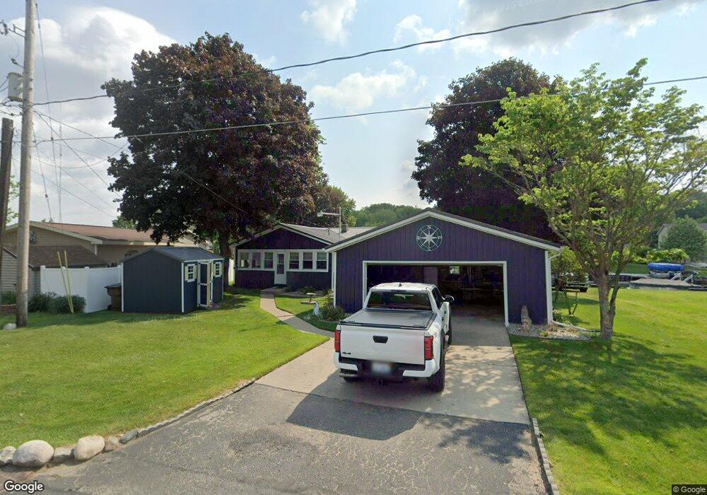
2024 Island Dr Wayland, MI 49348
Estimated Value: $326,000 - $398,000
2
Beds
1
Bath
1,040
Sq Ft
$353/Sq Ft
Est. Value
About This Home
This home is located at 2024 Island Dr, Wayland, MI 49348 and is currently estimated at $367,157, approximately $353 per square foot. 2024 Island Dr is a home located in Barry County with nearby schools including Wayland High School.
Ownership History
Date
Name
Owned For
Owner Type
Purchase Details
Closed on
Aug 21, 2019
Sold by
Green Kenneth and Green Margaret
Bought by
Green Kenneth E and Green Margaret H
Current Estimated Value
Purchase Details
Closed on
May 1, 2009
Sold by
Mortgage Electronic Registration Systems
Bought by
Lsf6 Mercury Reo Investments Trust Serie
Purchase Details
Closed on
Apr 9, 2009
Sold by
Beltz Daniel
Bought by
Mortgage Electronic Registration Systems
Purchase Details
Closed on
Aug 31, 2006
Sold by
Zimmerman Annie M and Fulkerson Callie Lanell
Bought by
Beltz Daniel
Home Financials for this Owner
Home Financials are based on the most recent Mortgage that was taken out on this home.
Original Mortgage
$34,600
Interest Rate
6.7%
Mortgage Type
Unknown
Create a Home Valuation Report for This Property
The Home Valuation Report is an in-depth analysis detailing your home's value as well as a comparison with similar homes in the area
Home Values in the Area
Average Home Value in this Area
Purchase History
| Date | Buyer | Sale Price | Title Company |
|---|---|---|---|
| Green Kenneth E | -- | Michigan Title Ins Agcy Inc | |
| Lsf6 Mercury Reo Investments Trust Serie | -- | None Available | |
| Mortgage Electronic Registration Systems | $85,682 | None Available | |
| Beltz Daniel | $173,000 | Title Agency |
Source: Public Records
Mortgage History
| Date | Status | Borrower | Loan Amount |
|---|---|---|---|
| Previous Owner | Beltz Daniel | $34,600 | |
| Previous Owner | Beltz Daniel | $138,400 |
Source: Public Records
Tax History Compared to Growth
Tax History
| Year | Tax Paid | Tax Assessment Tax Assessment Total Assessment is a certain percentage of the fair market value that is determined by local assessors to be the total taxable value of land and additions on the property. | Land | Improvement |
|---|---|---|---|---|
| 2025 | $3,218 | $166,000 | $0 | $0 |
| 2024 | $3,218 | $153,300 | $0 | $0 |
| 2023 | $3,024 | $104,400 | $0 | $0 |
| 2022 | $3,024 | $104,400 | $0 | $0 |
| 2021 | $3,024 | $95,100 | $0 | $0 |
| 2020 | $3,038 | $89,900 | $0 | $0 |
| 2019 | $3,038 | $85,000 | $0 | $0 |
| 2018 | $3,514 | $80,800 | $51,000 | $29,800 |
| 2017 | $3,514 | $80,800 | $0 | $0 |
| 2016 | -- | $73,300 | $0 | $0 |
| 2015 | -- | $71,800 | $0 | $0 |
| 2014 | -- | $71,800 | $0 | $0 |
Source: Public Records
Map
Nearby Homes
- 12712 Sunrise Ct
- 1736 Parker Dr
- 1980 Parker Dr
- 35 Cannonball Ln
- 2724 Pasture Ln
- 12169 Pine Meadows Dr
- 3140 Sandy Beach St
- 12940 Cleland Ave
- 12031 Sandstone Dr
- 11065 W M 179 Hwy
- 3298 Elmwood Beach Rd
- 2919 Beatrice Ave
- 2919 Beatrice Ave
- 11908 Erica Ln Unit Site 66
- 11617 Winchester Dr
- 11633 Marsh Rd
- 590 129th Ave
- 4304 Trails End Rd
- 12720 S Grey Ct
- 1164 E Bernie Ct