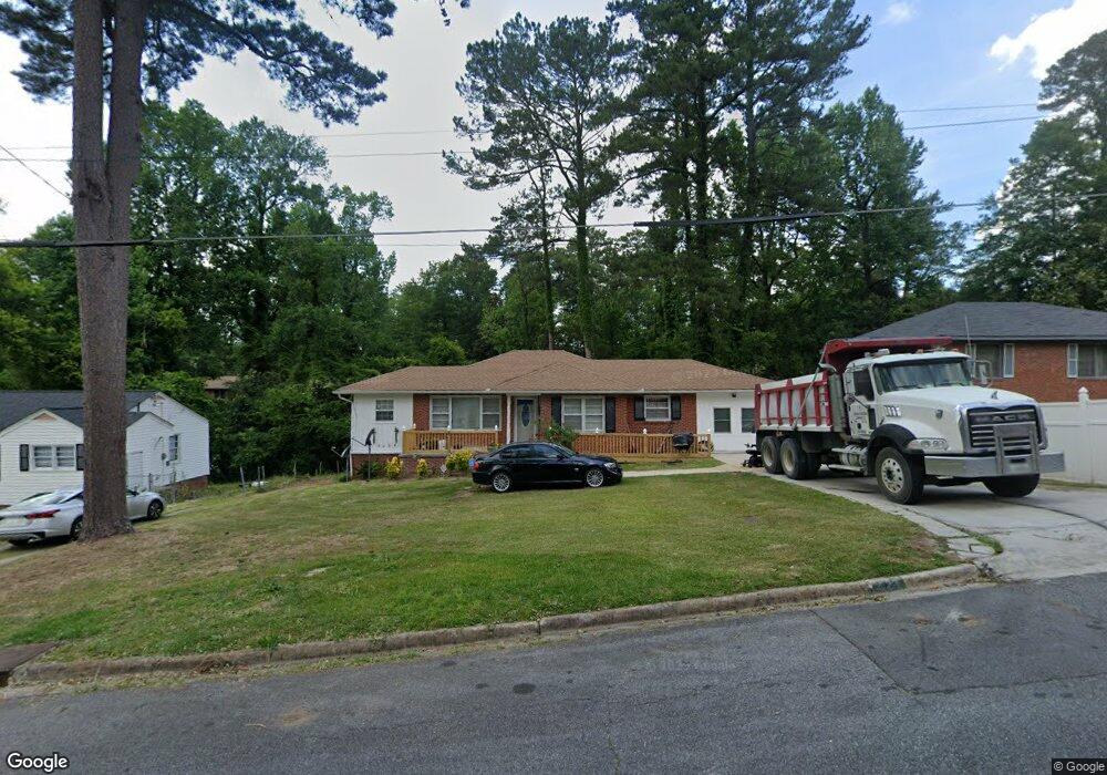
2024 Knightsbridge Rd Macon, GA 31211
Estimated Value: $78,231 - $146,000
2
Beds
1
Bath
1,089
Sq Ft
$90/Sq Ft
Est. Value
About This Home
This home is located at 2024 Knightsbridge Rd, Macon, GA 31211 and is currently estimated at $97,808, approximately $89 per square foot. 2024 Knightsbridge Rd is a home located in Bibb County with nearby schools including Martin Luther King Jr. Elementary School, Appling Middle School, and Northeast High School.
Ownership History
Date
Name
Owned For
Owner Type
Purchase Details
Closed on
Dec 1, 2016
Sold by
George W
Bought by
Abram Cedric S and Abram April R
Current Estimated Value
Home Financials for this Owner
Home Financials are based on the most recent Mortgage that was taken out on this home.
Original Mortgage
$50,000
Outstanding Balance
$21,067
Interest Rate
3.54%
Mortgage Type
New Conventional
Estimated Equity
$76,741
Purchase Details
Closed on
May 7, 2003
Bought by
Sawyer George W and Sawyer Janet B
Create a Home Valuation Report for This Property
The Home Valuation Report is an in-depth analysis detailing your home's value as well as a comparison with similar homes in the area
Home Values in the Area
Average Home Value in this Area
Purchase History
| Date | Buyer | Sale Price | Title Company |
|---|---|---|---|
| Abram Cedric S | $60,000 | -- | |
| Sawyer George W | $45,000 | -- |
Source: Public Records
Mortgage History
| Date | Status | Borrower | Loan Amount |
|---|---|---|---|
| Open | Abram Cedric S | $50,000 |
Source: Public Records
Tax History Compared to Growth
Tax History
| Year | Tax Paid | Tax Assessment Tax Assessment Total Assessment is a certain percentage of the fair market value that is determined by local assessors to be the total taxable value of land and additions on the property. | Land | Improvement |
|---|---|---|---|---|
| 2025 | $625 | $32,413 | $4,160 | $28,253 |
| 2024 | $546 | $28,499 | $2,600 | $25,899 |
| 2023 | $3 | $25,104 | $1,560 | $23,544 |
| 2022 | $348 | $17,044 | $2,588 | $14,456 |
| 2021 | $221 | $12,821 | $1,650 | $11,171 |
| 2020 | $175 | $11,506 | $1,650 | $9,856 |
| 2019 | $176 | $11,506 | $1,650 | $9,856 |
| 2018 | $450 | $11,506 | $1,650 | $9,856 |
| 2017 | $431 | $11,506 | $1,650 | $9,856 |
| 2016 | $381 | $11,021 | $1,650 | $9,371 |
| 2015 | $540 | $11,021 | $1,650 | $9,371 |
| 2014 | $839 | $14,894 | $2,400 | $12,494 |
Source: Public Records
Map
Nearby Homes
- 2458 Tredway Dr
- 2371 Kensington Rd
- 2630 Pauladale Dr
- 2761 Walnut Creek Rd
- 2557 Hyde Park Rd
- 2792 Skyline Dr
- 2229 New Clinton Rd
- 2815 New Clinton Rd
- 2146 Melton Ave
- 240 Neptune Ct
- 2130 New Clinton Rd
- 2029 Kitchens Rd
- 2066 Melton Ave
- 837 Artic Cir
- 1840 Kinder Kare Dr
- 1818 Kinder Kare Dr
- 1957 Kitchens Rd
- 875 Artic Cir
- 131 Sun Valley Dr
- 875 Artic Place
- 2016 Knightsbridge Rd
- 2016 Knightsbridge Rd Unit C227
- 2032 Knightsbridge Rd
- 2010 Knightsbridge Rd
- 2040 Knightsbridge Rd
- 2495 Tredway Dr
- 2479 Tredway Dr
- 0 Knightsbridge Rd Unit 8515059
- 2023 Knightsbridge Rd
- 2503 Tredway Dr
- 2031 Knightsbridge Rd
- 2015 Knightsbridge Rd
- 2471 Tredway Dr
- 2004 Knightsbridge Rd
- 2048 Knightsbridge Rd
- 2039 Knightsbridge Rd
- 2009 Knightsbridge Rd
- 2511 Tredway Dr
- 2463 Tredway Dr
- 2047 Knightsbridge Rd