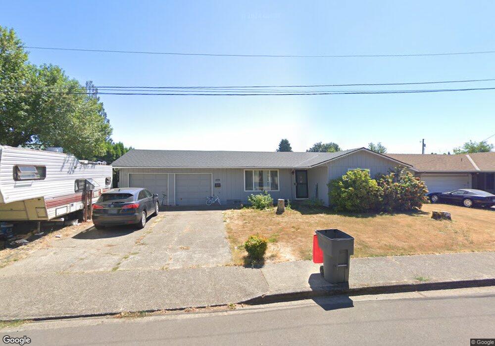
2024 NW Alder St McMinnville, OR 97128
Estimated Value: $328,000 - $427,000
3
Beds
1
Bath
1,024
Sq Ft
$375/Sq Ft
Est. Value
About This Home
This home is located at 2024 NW Alder St, McMinnville, OR 97128 and is currently estimated at $384,397, approximately $375 per square foot. 2024 NW Alder St is a home located in Yamhill County with nearby schools including Memorial Elementary School, Patton Middle School, and McMinnville High School.
Ownership History
Date
Name
Owned For
Owner Type
Purchase Details
Closed on
Nov 28, 2006
Sold by
Bennett Larry W and Bennett Mary E
Bought by
Teafatiller William J and Teafatiller Jennifer E
Current Estimated Value
Home Financials for this Owner
Home Financials are based on the most recent Mortgage that was taken out on this home.
Original Mortgage
$17,500
Outstanding Balance
$10,498
Interest Rate
6.37%
Mortgage Type
Credit Line Revolving
Estimated Equity
$373,899
Create a Home Valuation Report for This Property
The Home Valuation Report is an in-depth analysis detailing your home's value as well as a comparison with similar homes in the area
Home Values in the Area
Average Home Value in this Area
Purchase History
| Date | Buyer | Sale Price | Title Company |
|---|---|---|---|
| Teafatiller William J | $117,000 | Western Title & Escrow |
Source: Public Records
Mortgage History
| Date | Status | Borrower | Loan Amount |
|---|---|---|---|
| Open | Teafatiller William J | $17,500 | |
| Open | Teafatiller William J | $93,600 |
Source: Public Records
Tax History Compared to Growth
Tax History
| Year | Tax Paid | Tax Assessment Tax Assessment Total Assessment is a certain percentage of the fair market value that is determined by local assessors to be the total taxable value of land and additions on the property. | Land | Improvement |
|---|---|---|---|---|
| 2024 | $2,824 | $162,468 | -- | -- |
| 2023 | $2,666 | $157,736 | $0 | $0 |
| 2022 | $2,526 | $153,142 | $0 | $0 |
| 2021 | $2,466 | $148,682 | $0 | $0 |
| 2020 | $2,446 | $144,351 | $0 | $0 |
| 2019 | $2,380 | $140,147 | $0 | $0 |
| 2018 | $2,333 | $136,065 | $0 | $0 |
| 2017 | $2,252 | $132,102 | $0 | $0 |
| 2016 | $2,171 | $128,254 | $0 | $0 |
| 2015 | $2,118 | $124,520 | $0 | $0 |
| 2014 | $2,004 | $120,895 | $0 | $0 |
Source: Public Records
Map
Nearby Homes
- 1786 NW Landon St
- 1850 NW Landon St
- 2221 NW Elm St
- 149 NW 25th St
- 1672 NW Landon St
- 700 NW 18th Place
- 629 NE 19th St
- 1975 NE Galloway St
- 2286 NW Michelbook Ln
- 1970 NW Mercia St
- 1139 NW Yamhill St
- 2735 NW Pinehurst Dr Unit 5
- 3192 NW Pinehurst Dr Unit 76
- 1564 NW Pinehurst Dr Unit 106
- 2799 NW Pinehurst Dr Unit 11
- 2787 NW Pinehurst Dr Unit 10
- 2897 NW Pinehurst Dr Unit 13
- 2719 NW Pinehurst Dr Unit 3
- 2743 NW Pinehurst Dr Unit 6
- 3106 NW Pinehurst Dr Unit 49
- 2008 NW Alder St
- 2040 NW Alder St
- 109 NW 20th St
- 2041 NW Adams St
- 142 NW 21st St
- 2035 NW Adams St
- 116 NW 21st St
- 144 NW 20th St
- 128 NW 20th St
- 223 NW 20th St
- 202 NW 20th St
- 1937 NW Adams St
- 220 NW 20th St
- 127 NW 21st St
- 2032 NE Adams St
- 2014 NE Adams St
- 149 NW 21st St
- 145 NW 19th St
- 2109 NW Adams St
- 127 NW 19th St