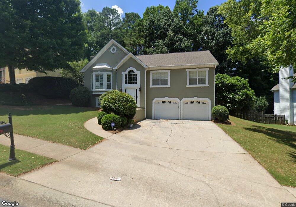
2024 Township Dr Unit I Woodstock, GA 30189
Oak Grove NeighborhoodEstimated Value: $450,000 - $465,311
4
Beds
4
Baths
2,484
Sq Ft
$184/Sq Ft
Est. Value
About This Home
This home is located at 2024 Township Dr Unit I, Woodstock, GA 30189 and is currently estimated at $457,656, approximately $184 per square foot. 2024 Township Dr Unit I is a home located in Cherokee County with nearby schools including Carmel Elementary School, Woodstock Middle School, and Woodstock High School.
Ownership History
Date
Name
Owned For
Owner Type
Purchase Details
Closed on
May 15, 2001
Sold by
Schudel John W
Bought by
Schudel John W and Schudel Lisa A
Current Estimated Value
Home Financials for this Owner
Home Financials are based on the most recent Mortgage that was taken out on this home.
Original Mortgage
$151,200
Interest Rate
7.11%
Mortgage Type
New Conventional
Purchase Details
Closed on
Aug 22, 1997
Sold by
Debrock Steven J
Bought by
Johnson Thomas F
Home Financials for this Owner
Home Financials are based on the most recent Mortgage that was taken out on this home.
Original Mortgage
$135,000
Interest Rate
7.43%
Mortgage Type
New Conventional
Purchase Details
Closed on
Feb 28, 1995
Sold by
Tedrick Enterpr Ises Inc
Bought by
Debrock Steven
Create a Home Valuation Report for This Property
The Home Valuation Report is an in-depth analysis detailing your home's value as well as a comparison with similar homes in the area
Home Values in the Area
Average Home Value in this Area
Purchase History
| Date | Buyer | Sale Price | Title Company |
|---|---|---|---|
| Schudel John W | -- | -- | |
| Schudel John W | $189,000 | -- | |
| Johnson Thomas F | $150,000 | -- | |
| Debrock Steven | $133,800 | -- |
Source: Public Records
Mortgage History
| Date | Status | Borrower | Loan Amount |
|---|---|---|---|
| Previous Owner | Schudel John W | $151,200 | |
| Previous Owner | Johnson Thomas F | $135,000 | |
| Closed | Debrock Steven | $0 |
Source: Public Records
Tax History Compared to Growth
Tax History
| Year | Tax Paid | Tax Assessment Tax Assessment Total Assessment is a certain percentage of the fair market value that is determined by local assessors to be the total taxable value of land and additions on the property. | Land | Improvement |
|---|---|---|---|---|
| 2024 | $3,700 | $158,448 | $35,600 | $122,848 |
| 2023 | $3,184 | $154,604 | $32,000 | $122,604 |
| 2022 | $3,094 | $127,924 | $28,000 | $99,924 |
| 2021 | $2,775 | $103,160 | $22,880 | $80,280 |
| 2020 | $2,752 | $102,040 | $21,200 | $80,840 |
| 2019 | $2,691 | $99,440 | $19,200 | $80,240 |
| 2018 | $2,562 | $93,280 | $16,800 | $76,480 |
| 2017 | $2,537 | $228,500 | $16,800 | $74,600 |
| 2016 | $2,550 | $227,300 | $16,800 | $74,120 |
| 2015 | $2,368 | $207,100 | $14,400 | $68,440 |
| 2014 | $2,105 | $184,400 | $14,400 | $59,360 |
Source: Public Records
Map
Nearby Homes
- 2018 Township Dr Unit 1
- 115 Township Ct
- 2004 Township Dr
- 1015 Legacy Walk
- 201 Vista Ln
- 1045 Legacy Walk
- 510 Scenic Pass
- 4054 Mount Vernon Dr Unit 2
- 615 Lexington Way Unit IV
- 525 Brooksdale Dr
- 353 Vista Ln
- 802 Eagle Glen Crossing
- 333 Etowah Valley Trace
- 705 Wind Song Trace
- 708 Wind Song Trace
- 110 Hearthstone Dr Unit I
- 510 Terrace Way
- 117 Wood Wind Station
- 2022 Township Dr
- 2020 Township Dr Unit 1
- 2028 Township Dr Unit 1
- 106 Township Ct
- 108 Township Ct
- 2023 Township Dr Unit 1
- 2021 Township Dr Unit 1
- 2025 Township Dr Unit 150
- 2025 Township Dr Unit 1
- 104 Township Ct
- 2030 Township Dr
- 2030 Township Dr Unit 1
- 2027 Township Dr
- 110 Township Ct
- 2019 Township Dr
- 2029 Township Dr
- 102 Township Ct
- 2016 Township Dr
- 2032 Township Dr Unit 1
- 2017 Township Dr Unit 1