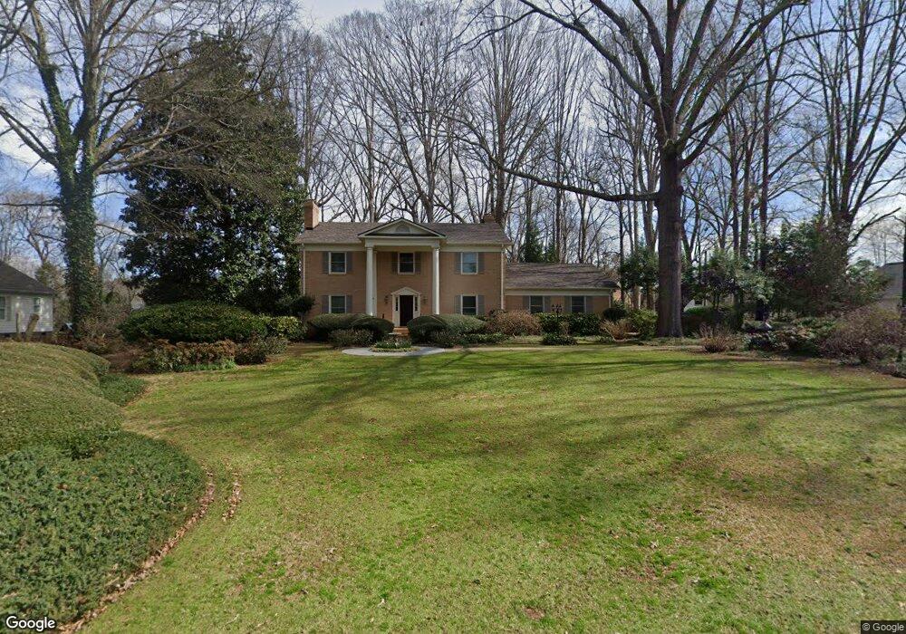
2024 Welborn St Rock Hill, SC 29732
Estimated Value: $700,000 - $844,000
--
Bed
--
Bath
4,850
Sq Ft
$153/Sq Ft
Est. Value
About This Home
This home is located at 2024 Welborn St, Rock Hill, SC 29732 and is currently estimated at $740,091, approximately $152 per square foot. 2024 Welborn St is a home located in York County with nearby schools including Ebinport Elementary School, W.C. Sullivan Middle School, and South Pointe High School.
Ownership History
Date
Name
Owned For
Owner Type
Purchase Details
Closed on
Jun 13, 2007
Sold by
Hogue Robert L and Hogue Charlotte W
Bought by
Yousefian Mehrdad and Yousefian Marzieh
Current Estimated Value
Home Financials for this Owner
Home Financials are based on the most recent Mortgage that was taken out on this home.
Original Mortgage
$80,000
Interest Rate
6.16%
Mortgage Type
Credit Line Revolving
Create a Home Valuation Report for This Property
The Home Valuation Report is an in-depth analysis detailing your home's value as well as a comparison with similar homes in the area
Home Values in the Area
Average Home Value in this Area
Purchase History
| Date | Buyer | Sale Price | Title Company |
|---|---|---|---|
| Yousefian Mehrdad | $405,000 | None Available |
Source: Public Records
Mortgage History
| Date | Status | Borrower | Loan Amount |
|---|---|---|---|
| Closed | Yousefian Mehrdad | $80,000 | |
| Closed | Yousefian Mehrdad | $324,000 |
Source: Public Records
Tax History Compared to Growth
Tax History
| Year | Tax Paid | Tax Assessment Tax Assessment Total Assessment is a certain percentage of the fair market value that is determined by local assessors to be the total taxable value of land and additions on the property. | Land | Improvement |
|---|---|---|---|---|
| 2024 | $2,475 | $17,664 | $1,992 | $15,672 |
| 2023 | $2,538 | $17,664 | $1,992 | $15,672 |
| 2022 | $2,547 | $17,664 | $1,992 | $15,672 |
| 2021 | -- | $17,664 | $1,992 | $15,672 |
| 2020 | $2,542 | $17,664 | $0 | $0 |
| 2019 | $2,315 | $15,360 | $0 | $0 |
| 2018 | $2,301 | $15,360 | $0 | $0 |
| 2017 | $2,169 | $15,360 | $0 | $0 |
| 2016 | $2,127 | $15,360 | $0 | $0 |
| 2014 | $1,975 | $15,360 | $2,000 | $13,360 |
| 2013 | $1,975 | $15,500 | $2,000 | $13,500 |
Source: Public Records
Map
Nearby Homes
- 1981 Hamptonwood Rd
- 2020 Malvern Rd
- 740 Tavern Ct Unit 7
- 2129 James Ct
- 2087 Poinsett Dr
- 606 Clouds Way
- 1780 Lumpkin Cir
- 405 Jenny Skip Ln
- 358 Rose Garden Ct
- 651 Melville Dr
- 420 Bly St
- 1585 Kallaramo Rd
- 448 Berryman Rd
- 1631 Wendover Ct
- Garland Plan at Allston
- Gable Plan at Allston
- 310 Ginsberg Rd
- 306 Ginsberg Rd
- 302 Ginsberg Rd
- 1845 Matthews Dr
- 2026 Welborn St
- 1957 Middleton Place
- 1963 Middleton Place
- 1953 Regency Ct
- 2029 Welborn St
- 2043 Welborn St
- 2058 Welborn St
- 1969 Middleton Place
- 1921 Regency Ct
- 1975 Regency Ct
- 2055 Welborn St
- 1958 Middleton Place
- 1993 Regency Ct
- 2005 Welborn St
- 2004 Welborn St
- 2011 Rosehaven Ln
- 1964 Middleton Place
- 2072 Welborn St
- 2005 Rosehaven Ln
- 2061 Welborn St