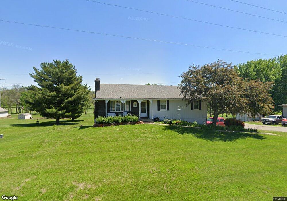
20247 State Rt Dd Hwy Saint Joseph, MO 64506
Estimated Value: $286,000 - $321,000
3
Beds
3
Baths
2,196
Sq Ft
$137/Sq Ft
Est. Value
About This Home
This home is located at 20247 State Rt Dd Hwy, Saint Joseph, MO 64506 and is currently estimated at $300,942, approximately $137 per square foot. 20247 State Rt Dd Hwy is a home located in Andrew County with nearby schools including Savannah High School.
Ownership History
Date
Name
Owned For
Owner Type
Purchase Details
Closed on
Jan 22, 2015
Sold by
Lindsey D Lindsey D and Stroud Brandon
Bought by
Wise Cody and Wise Nichole
Current Estimated Value
Purchase Details
Closed on
Jun 23, 2009
Sold by
Mckiddy Terry J and Mckiddy Ann O
Bought by
Stroud Lindsey D
Home Financials for this Owner
Home Financials are based on the most recent Mortgage that was taken out on this home.
Original Mortgage
$142,500
Outstanding Balance
$90,373
Interest Rate
4.84%
Estimated Equity
$210,569
Create a Home Valuation Report for This Property
The Home Valuation Report is an in-depth analysis detailing your home's value as well as a comparison with similar homes in the area
Home Values in the Area
Average Home Value in this Area
Purchase History
| Date | Buyer | Sale Price | Title Company |
|---|---|---|---|
| Wise Cody | -- | Preferredtitle Of St.Joe Llc | |
| Stroud Lindsey D | $150,000 | -- |
Source: Public Records
Mortgage History
| Date | Status | Borrower | Loan Amount |
|---|---|---|---|
| Open | Stroud Lindsey D | $142,500 |
Source: Public Records
Tax History Compared to Growth
Tax History
| Year | Tax Paid | Tax Assessment Tax Assessment Total Assessment is a certain percentage of the fair market value that is determined by local assessors to be the total taxable value of land and additions on the property. | Land | Improvement |
|---|---|---|---|---|
| 2024 | $1,545 | $24,110 | $2,390 | $21,720 |
| 2023 | $1,568 | $24,110 | $2,390 | $21,720 |
| 2022 | $1,565 | $24,110 | $2,390 | $21,720 |
| 2021 | $1,497 | $24,110 | $2,390 | $21,720 |
| 2020 | $1,476 | $24,110 | $2,390 | $21,720 |
| 2019 | $1,478 | $24,110 | $2,390 | $21,720 |
| 2018 | $1,476 | $24,110 | $2,390 | $21,720 |
| 2017 | $1,511 | $24,110 | $2,390 | $21,720 |
| 2016 | $1,336 | $21,400 | $2,390 | $19,010 |
| 2015 | -- | $21,400 | $2,390 | $19,010 |
| 2011 | -- | $112,360 | $12,600 | $99,760 |
Source: Public Records
Map
Nearby Homes
- 10287 County Road 378 N A
- 10287 Road 378
- Lot 20 Millstone Blvd
- 6004 Amazonia Rd
- 1110 NE County Line Rd
- 11109 Club View Dr
- 5507 NE Maxwell Rd
- 19151 County Rd 390 N A
- 4709 Maxwell Rd
- 411 Cook Rd
- 5411 Savannah Rd
- Lot 1 Bristol Ridge Dr
- Lot 2 Bristol Ridge Dr
- Lot 3 Bristol Ridge Dr
- Lot 4 Bristol Ridge Dr
- Lot 10 Bristol Ridge Dr
- Lot 13 Bristol Ridge Dr
- Lot 14 Bristol Ridge Dr
- 2411 Blackwell Rd
- 0 County Road 438
- 20225 State Rt K N A
- 00 State Route K N A
- 20368 State Route K
- 20765 Orchard Ln
- 20375 State Route K
- 20526 County Road 386
- 20551 County Road 386
- 20788 Orchard Ln
- 20431 State Route K
- 20738 Orchard Ln
- 20546 County Road 386
- 20711 Orchard Ln
- 20354 State Route K
- 20438 State Route K
- 20678 Orchard Ln
- 20597 County Road 386
- 20780 Orchard Ln
- 20597 Co Rd 386 N A
- 20298 State Route K
- 20653 Orchard Ln