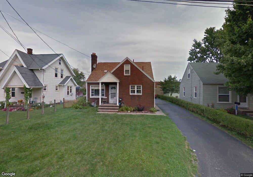
2025 29th St NE Canton, OH 44705
Fairmount NeighborhoodEstimated Value: $106,000 - $136,000
3
Beds
2
Baths
1,209
Sq Ft
$97/Sq Ft
Est. Value
About This Home
This home is located at 2025 29th St NE, Canton, OH 44705 and is currently estimated at $117,581, approximately $97 per square foot. 2025 29th St NE is a home located in Stark County with nearby schools including Frazer Elementary School, Glenwood Intermediate School, and GlenOak High School.
Ownership History
Date
Name
Owned For
Owner Type
Purchase Details
Closed on
Nov 14, 2002
Sold by
Jordan Ross R
Bought by
Luke Angela
Current Estimated Value
Home Financials for this Owner
Home Financials are based on the most recent Mortgage that was taken out on this home.
Original Mortgage
$63,200
Outstanding Balance
$26,627
Interest Rate
6.1%
Mortgage Type
Purchase Money Mortgage
Estimated Equity
$90,954
Create a Home Valuation Report for This Property
The Home Valuation Report is an in-depth analysis detailing your home's value as well as a comparison with similar homes in the area
Home Values in the Area
Average Home Value in this Area
Purchase History
| Date | Buyer | Sale Price | Title Company |
|---|---|---|---|
| Luke Angela | $79,000 | -- |
Source: Public Records
Mortgage History
| Date | Status | Borrower | Loan Amount |
|---|---|---|---|
| Open | Luke Angela | $63,200 | |
| Closed | Luke Angela | $15,800 |
Source: Public Records
Tax History
| Year | Tax Paid | Tax Assessment Tax Assessment Total Assessment is a certain percentage of the fair market value that is determined by local assessors to be the total taxable value of land and additions on the property. | Land | Improvement |
|---|---|---|---|---|
| 2025 | -- | $31,640 | $7,840 | $23,800 |
| 2024 | -- | $31,640 | $7,840 | $23,800 |
| 2023 | $1,040 | $22,300 | $3,990 | $18,310 |
| 2022 | $1,048 | $22,300 | $3,990 | $18,310 |
| 2021 | $1,052 | $22,300 | $3,990 | $18,310 |
| 2020 | $979 | $18,870 | $3,430 | $15,440 |
| 2019 | $970 | $18,870 | $3,430 | $15,440 |
| 2018 | $959 | $18,870 | $3,430 | $15,440 |
| 2017 | $899 | $16,250 | $3,470 | $12,780 |
| 2016 | $902 | $16,250 | $3,470 | $12,780 |
| 2015 | $872 | $16,250 | $3,470 | $12,780 |
| 2014 | $880 | $16,040 | $3,500 | $12,540 |
| 2013 | $431 | $16,040 | $3,500 | $12,540 |
Source: Public Records
Map
Nearby Homes
- 2616 Taft Ave NE
- 3002 Root Ave NE
- 1614 Colonial Blvd NE
- 1624 34th St NE
- 2111 21st St NE
- 1331 Spangler St NE
- 1410 Colonial Blvd NE
- 1610 23rd St NE
- 0 Dover Ave NE
- 2408 21st St NE
- 2228 Saint Elmo Ave NE
- 1528 22nd St NE
- 2333 Ivy Way St NE
- 1220 Havana Place NE
- 1825 Bernice Ct NE
- 1316 22nd St NE
- 1857 Maple Ave NE
- 1218 24th St NE
- 2010 18th St NE
- 1824 Root Ave NE
- 2029 29th St NE
- 2019 29th St NE
- 2033 29th St NE
- 2015 29th St NE
- 2920 Harrisburg Rd NE
- 2039 29th St NE
- 2024 29th St NE
- 2900 Harrisburg Rd NE
- 2018 29th St NE
- 2028 29th St NE
- 2032 29th St NE
- 2828 Harrisburg Rd NE
- 2036 29th St NE
- 2826 Harrisburg Rd NE
- 2822 Harrisburg Rd NE
- 2816 Harrisburg Rd NE
- 2025 28th St NE
- 2021 28th St NE
- 2033 28th St NE
- 2812 Harrisburg Rd NE
Your Personal Tour Guide
Ask me questions while you tour the home.