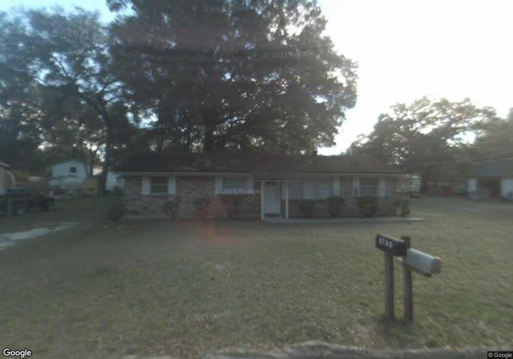
2025 Brock Rd Green Cove Springs, FL 32043
Estimated Value: $184,731 - $215,000
3
Beds
2
Baths
1,248
Sq Ft
$160/Sq Ft
Est. Value
About This Home
This home is located at 2025 Brock Rd, Green Cove Springs, FL 32043 and is currently estimated at $199,433, approximately $159 per square foot. 2025 Brock Rd is a home located in Clay County with nearby schools including Clay High School, Charles E. Bennett Elementary School, and Green Cove Springs Junior High School.
Ownership History
Date
Name
Owned For
Owner Type
Purchase Details
Closed on
May 12, 2017
Sold by
Stilianou Peter C and Stilianou Kitty
Bought by
Wetzstein William and Wetzstein June
Current Estimated Value
Home Financials for this Owner
Home Financials are based on the most recent Mortgage that was taken out on this home.
Original Mortgage
$86,827
Outstanding Balance
$72,286
Interest Rate
4.14%
Mortgage Type
New Conventional
Estimated Equity
$127,147
Purchase Details
Closed on
Dec 14, 2006
Sold by
Stilianou Peter and Stilianou Kitty
Bought by
Stilianou Peter
Home Financials for this Owner
Home Financials are based on the most recent Mortgage that was taken out on this home.
Original Mortgage
$80,000
Interest Rate
6.29%
Mortgage Type
New Conventional
Create a Home Valuation Report for This Property
The Home Valuation Report is an in-depth analysis detailing your home's value as well as a comparison with similar homes in the area
Home Values in the Area
Average Home Value in this Area
Purchase History
| Date | Buyer | Sale Price | Title Company |
|---|---|---|---|
| Wetzstein William | $85,000 | Landmark Title | |
| Stilianou Peter | $40,000 | Security Title Agency Inc |
Source: Public Records
Mortgage History
| Date | Status | Borrower | Loan Amount |
|---|---|---|---|
| Open | Wetzstein William | $86,827 | |
| Previous Owner | Stilianou Peter | $80,000 |
Source: Public Records
Tax History Compared to Growth
Tax History
| Year | Tax Paid | Tax Assessment Tax Assessment Total Assessment is a certain percentage of the fair market value that is determined by local assessors to be the total taxable value of land and additions on the property. | Land | Improvement |
|---|---|---|---|---|
| 2024 | $781 | $98,006 | -- | -- |
| 2023 | $781 | $95,152 | $0 | $0 |
| 2022 | $651 | $92,381 | $0 | $0 |
| 2021 | $1,012 | $89,691 | $0 | $0 |
| 2020 | $984 | $88,453 | $0 | $0 |
| 2019 | $964 | $86,465 | $0 | $0 |
| 2018 | $872 | $84,853 | $0 | $0 |
| 2017 | $648 | $60,382 | $0 | $0 |
| 2016 | $652 | $59,140 | $0 | $0 |
| 2015 | $681 | $58,729 | $0 | $0 |
| 2014 | $673 | $58,263 | $0 | $0 |
Source: Public Records
Map
Nearby Homes
- 2113 State Road 16 W
- 1732 Hagans Ridge Ct
- 1734 Harring St
- 1750 Harring St
- 1755 Colonial Dr
- 0 Harring St
- 0 Kirk St Unit 2082360
- 3668 Clubhouse Dr Unit A
- 2005 S County Road 16
- 1856 Colonial Dr
- 1839 Turnberry Ct
- 1534 Center St
- 100 El Dorado Dr
- 1677 Pebble Beach Blvd
- 3672 Saint Andrews Ct
- 3666 Cypress Point Ct
- 206 S Oakridge Ave
- 1935 Colonial Dr
- 3750 County Road 315a
- 3725 Co Rd 315a