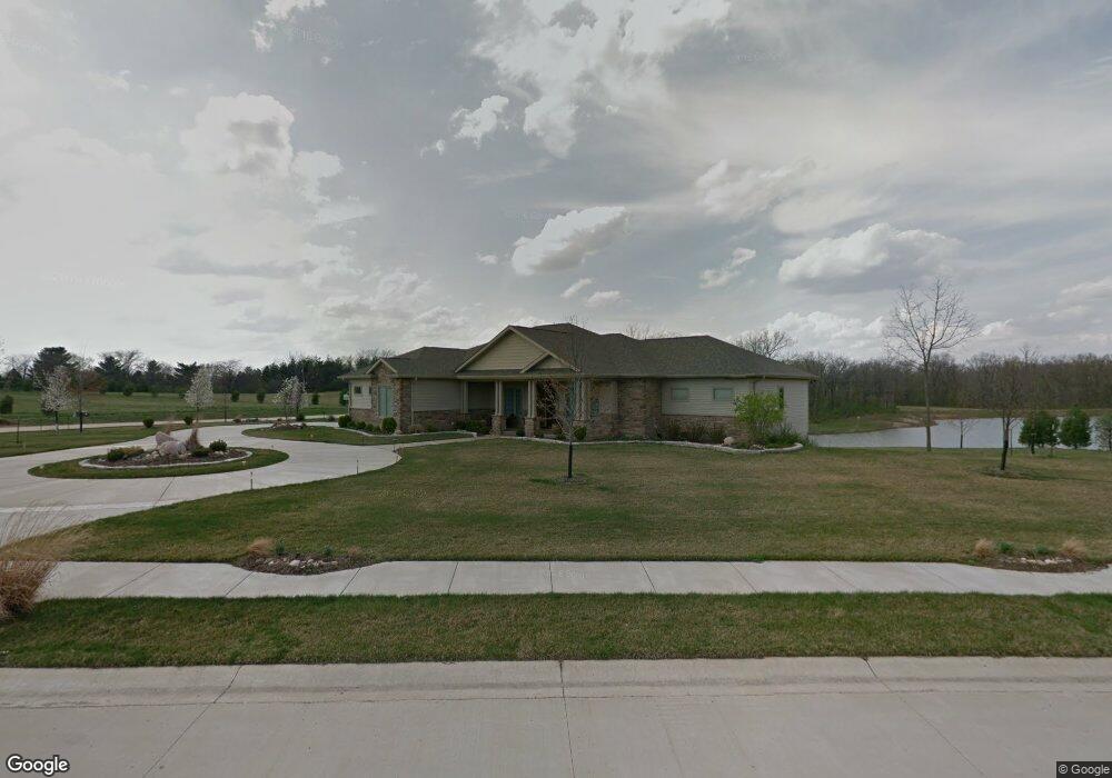
2025 Buckhead Ln Decatur, IL 62521
Estimated Value: $517,000 - $663,196
--
Bed
1
Bath
2,869
Sq Ft
$213/Sq Ft
Est. Value
About This Home
This home is located at 2025 Buckhead Ln, Decatur, IL 62521 and is currently estimated at $610,399, approximately $212 per square foot. 2025 Buckhead Ln is a home with nearby schools including McGaughey Elementary School, Mt. Zion Elementary School, and Mt. Zion Intermediate School.
Ownership History
Date
Name
Owned For
Owner Type
Purchase Details
Closed on
Mar 11, 2022
Sold by
Streckfuss George W and Streckfuss Carol D
Bought by
George W Strechfuss Trust and Streckfuss
Current Estimated Value
Purchase Details
Closed on
Sep 5, 2008
Sold by
Romano Family Ltd Pa
Bought by
Streckfuss George and Streckfuss Carol
Home Financials for this Owner
Home Financials are based on the most recent Mortgage that was taken out on this home.
Original Mortgage
$85,000
Interest Rate
6.66%
Mortgage Type
Future Advance Clause Open End Mortgage
Create a Home Valuation Report for This Property
The Home Valuation Report is an in-depth analysis detailing your home's value as well as a comparison with similar homes in the area
Home Values in the Area
Average Home Value in this Area
Purchase History
| Date | Buyer | Sale Price | Title Company |
|---|---|---|---|
| George W Strechfuss Trust | -- | None Listed On Document | |
| Streckfuss George | $99,000 | None Available |
Source: Public Records
Mortgage History
| Date | Status | Borrower | Loan Amount |
|---|---|---|---|
| Previous Owner | Streckfuss George | $85,000 |
Source: Public Records
Tax History Compared to Growth
Tax History
| Year | Tax Paid | Tax Assessment Tax Assessment Total Assessment is a certain percentage of the fair market value that is determined by local assessors to be the total taxable value of land and additions on the property. | Land | Improvement |
|---|---|---|---|---|
| 2024 | $12,835 | $193,750 | $42,163 | $151,587 |
| 2023 | $12,463 | $180,032 | $39,178 | $140,854 |
| 2022 | $11,750 | $169,275 | $36,837 | $132,438 |
| 2021 | $11,897 | $151,892 | $34,922 | $116,970 |
| 2020 | $11,447 | $145,168 | $33,376 | $111,792 |
| 2019 | $11,447 | $145,168 | $33,376 | $111,792 |
| 2018 | $11,138 | $141,988 | $32,645 | $109,343 |
| 2017 | $11,148 | $140,235 | $32,242 | $107,993 |
| 2016 | $11,196 | $140,151 | $32,223 | $107,928 |
| 2015 | $10,807 | $138,352 | $31,809 | $106,543 |
| 2014 | $10,407 | $138,352 | $31,809 | $106,543 |
| 2013 | $10,535 | $138,352 | $31,809 | $106,543 |
Source: Public Records
Map
Nearby Homes
- 2020 Buckhead Ln
- 2110 Buckhead Ln
- 2030 Buckhead Ln
- 2125 Buckhead Ave
- 2130 Buckhead Ave
- 1935 Buckhead Ct
- 1820 Buckhead Ln
- 50 Sundance Dr
- 3330 S Baltimore Ave
- 2675 S Lake Pkwy
- 1610 Robin Ct
- 4090 S Lake Ct
- 860 W Wildwood Dr
- 4115 Meadow Park Dr
- 3146 Lake Bluff Dr
- 925 S Wildwood Dr
- 2571 Lansdowne Dr
- 2554 S Nantucket Dr
- 3172 Redlich Dr
- 2504 S Nantucket Dr
- 1840 Buckhead Ln
- 2005 Buckhead Blvd
- 2120 Buckhead Ave
- 2015 Buckhead Ln
- 1980 Buckhead Ct
- 2235 Buckhead Ln
- 1910 Buckhead Ct
- 2135 Buckhead Ave
- 1920 Buckhead Ct
- 2140 Buckhead Ave
- 1930 Buckhead Ct
- 2040 Buckhead Ln
- 1850 Buckhead Ln
- 2245 Buckhead Ln
- 2220 Buckhead Ln
- 400 Southbrooke Dr
- 2260 Buckhead Ln
- 1915 Buckhead Ct
- 1925 Buckhead Ct
- 2240 Buckhead Ln