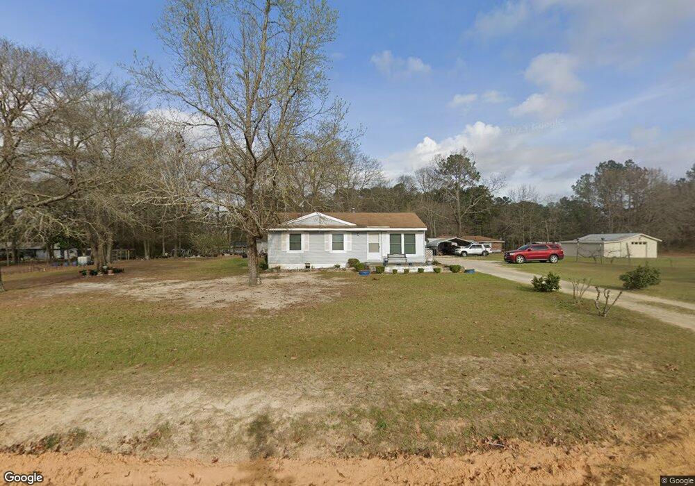
2025 Byrd Rd Thomson, GA 30824
Estimated Value: $118,253 - $205,000
3
Beds
2
Baths
912
Sq Ft
$187/Sq Ft
Est. Value
About This Home
This home is located at 2025 Byrd Rd, Thomson, GA 30824 and is currently estimated at $170,813, approximately $187 per square foot. 2025 Byrd Rd is a home located in McDuffie County with nearby schools including Thomson High School.
Ownership History
Date
Name
Owned For
Owner Type
Purchase Details
Closed on
Feb 25, 2005
Sold by
First National Bank & Trust
Bought by
Hudson H B
Current Estimated Value
Home Financials for this Owner
Home Financials are based on the most recent Mortgage that was taken out on this home.
Original Mortgage
$53,596
Interest Rate
5.6%
Mortgage Type
New Conventional
Purchase Details
Closed on
Dec 8, 2004
Sold by
Lunceford Joel Patrick
Bought by
First National Bank
Purchase Details
Closed on
Aug 28, 1998
Sold by
Lunceford Joel Patrick
Bought by
Lunceford Joel Patrick
Purchase Details
Closed on
Dec 22, 1994
Bought by
Holley Richard Terry
Create a Home Valuation Report for This Property
The Home Valuation Report is an in-depth analysis detailing your home's value as well as a comparison with similar homes in the area
Home Values in the Area
Average Home Value in this Area
Purchase History
| Date | Buyer | Sale Price | Title Company |
|---|---|---|---|
| Hudson H B | $55,000 | -- | |
| First National Bank | $60,600 | -- | |
| Lunceford Joel Patrick | $42,500 | -- | |
| Holley Richard Terry | $24,700 | -- |
Source: Public Records
Mortgage History
| Date | Status | Borrower | Loan Amount |
|---|---|---|---|
| Closed | Hudson H B | $53,596 |
Source: Public Records
Tax History
| Year | Tax Paid | Tax Assessment Tax Assessment Total Assessment is a certain percentage of the fair market value that is determined by local assessors to be the total taxable value of land and additions on the property. | Land | Improvement |
|---|---|---|---|---|
| 2025 | $925 | $37,976 | $2,418 | $35,558 |
| 2024 | $925 | $36,080 | $2,178 | $33,902 |
| 2023 | $894 | $34,752 | $2,178 | $32,574 |
| 2022 | $891 | $32,805 | $2,178 | $30,627 |
| 2021 | $730 | $26,317 | $1,520 | $24,797 |
| 2020 | $565 | $20,032 | $2,170 | $17,862 |
| 2019 | $571 | $20,032 | $2,170 | $17,862 |
| 2018 | $457 | $20,032 | $2,170 | $17,862 |
| 2017 | $441 | $20,032 | $2,170 | $17,862 |
| 2016 | $441 | $20,032 | $2,170 | $17,862 |
| 2015 | $476 | $23,010 | $2,800 | $20,210 |
| 2014 | $477 | $23,010 | $2,800 | $20,210 |
| 2013 | -- | $23,010 | $2,800 | $20,210 |
Source: Public Records
Map
Nearby Homes
- 1110 Boneville Rd
- 1110 Boneville Rd
- 1076 Boneville Rd
- 968 Boneville Rd
- 338 Devonshire Dr
- 219 Devonshire Dr
- 2592 White Oak Rd
- 168 Rivers Cir
- 227 Brentwood Dr
- A-00 Harrison Rd
- 273 Timberwood Dr
- 137 Willow Oak Cir
- 123 Willow Oak Cir
- 125 Willow Oak Cir
- 0 Randall Hunt Rd Unit 24088941
- 789 George McDuffie Rd
- 3104 White Oak Rd
- 2133 April Dawn Trail
- 2119 April Dawn Trail
- 2090 April Dawn Trail
- 1214 Moose Club Rd
- 1200 Moose Club Rd
- 2043 Byrd Rd
- 1238 Moose Club Rd
- 2058 Byrd Rd
- 1257 Moose Club Rd
- 1158 Moose Club Rd
- 2089 Byrd Rd
- 2089 Byrd Rd
- 2080 Byrd Rd
- 1280 Randall Hunt Rd
- 1159 Moose Club Rd
- 1273 Moose Club Rd
- 1300 Moose Club Rd
- 917 Margarets Rd
- 1173 Moose Club Rd
- 1285 Moose Club Rd
- 0 Moose Club Rd
- 919 Margarets Rd
- 1331 Randall Hunt Rd
Your Personal Tour Guide
Ask me questions while you tour the home.