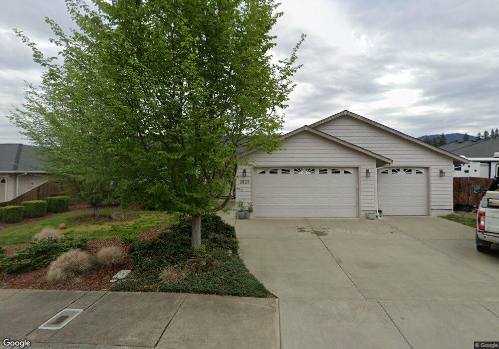
2025 Colorado Ln Grants Pass, OR 97527
Estimated Value: $422,977 - $441,000
3
Beds
2
Baths
1,684
Sq Ft
$257/Sq Ft
Est. Value
About This Home
This home is located at 2025 Colorado Ln, Grants Pass, OR 97527 and is currently estimated at $431,989, approximately $256 per square foot. 2025 Colorado Ln is a home located in Josephine County with nearby schools including Allen Dale Elementary School, South Middle School, and Grants Pass High School.
Ownership History
Date
Name
Owned For
Owner Type
Purchase Details
Closed on
Oct 8, 2025
Sold by
Reynolds Brittany and Angelini Robert
Bought by
Victor F And Susan L Jaramillo Living Trust and Jaramillo
Current Estimated Value
Purchase Details
Closed on
Sep 26, 2023
Sold by
Pares Tania Kathryn
Bought by
Reynolds Brittany and Angelini Robert
Home Financials for this Owner
Home Financials are based on the most recent Mortgage that was taken out on this home.
Original Mortgage
$155,000
Interest Rate
7.09%
Mortgage Type
New Conventional
Purchase Details
Closed on
Feb 24, 2009
Sold by
Smith Michael Ray and Pares Tania Kathryn
Bought by
Pares Tania Kathryn
Create a Home Valuation Report for This Property
The Home Valuation Report is an in-depth analysis detailing your home's value as well as a comparison with similar homes in the area
Home Values in the Area
Average Home Value in this Area
Purchase History
| Date | Buyer | Sale Price | Title Company |
|---|---|---|---|
| Victor F And Susan L Jaramillo Living Trust | $416,200 | Amerititle | |
| Victor F And Susan L Jaramillo Living Trust | $416,200 | Amerititle | |
| Reynolds Brittany | $425,000 | First American Title | |
| Reynolds Brittany | $425,000 | First American Title | |
| Pares Tania Kathryn | -- | None Available | |
| Pares Tania Kathryn | -- | None Available |
Source: Public Records
Mortgage History
| Date | Status | Borrower | Loan Amount |
|---|---|---|---|
| Previous Owner | Reynolds Brittany | $155,000 |
Source: Public Records
Tax History Compared to Growth
Tax History
| Year | Tax Paid | Tax Assessment Tax Assessment Total Assessment is a certain percentage of the fair market value that is determined by local assessors to be the total taxable value of land and additions on the property. | Land | Improvement |
|---|---|---|---|---|
| 2025 | $3,490 | $268,770 | -- | -- |
| 2024 | $3,490 | $260,950 | -- | -- |
| 2023 | $3,287 | $253,350 | $0 | $0 |
| 2022 | $3,303 | $245,980 | -- | -- |
| 2021 | $3,102 | $238,820 | $0 | $0 |
| 2020 | $3,013 | $231,870 | $0 | $0 |
| 2019 | $2,926 | $225,120 | $0 | $0 |
| 2018 | $2,977 | $218,570 | $0 | $0 |
| 2017 | $2,955 | $212,210 | $0 | $0 |
| 2016 | $2,598 | $206,030 | $0 | $0 |
| 2015 | $2,513 | $200,030 | $0 | $0 |
| 2014 | $2,444 | $194,210 | $0 | $0 |
Source: Public Records
Map
Nearby Homes
- 855 SW West Harbeck Rd
- 1048 W Harbeck Rd
- 1010 Hemlock Ln
- 681 W Harbeck Rd
- 0 Ramsey Southwest Ave SW Unit 220201654
- 1969 SW Allen Creek Rd
- 1830 SW Allen Creek Rd
- 15577 Oregon 238
- 1762 SW Allen Creek Rd
- 214 SE Sapphire Ct
- 1346 Sunny Slope Dr
- 109 Shoemaker Way
- 426 SE Cadet Ct
- 0 Sylvan Dr Unit Lot 10 220196204
- 2957 Sylvan Dr
- 2931 Harbeck Rd
- 2704 Denton Trail
- 2708 Denton Trail
- 2700 Denton Trail
- 1318 Andy Griffith Dr
- 932 SW Princess Cir
- 2013 Colorado Ln
- 2013 SW Colorado Ln
- 935 W Harbeck Rd
- 975 W Harbeck Rd
- 926 SW Princess Cir
- 927 W Harbeck Rd
- 2039 SW Nebraska Ave
- 2039 Nebraska Ave
- 2050 Colorado Ln
- 939 SW Princess Cir
- 927 SW Princess Cir
- 2051 Nebraska Ave
- 921 W Harbeck Rd
- 2056 SW Colorado Ln
- 2056 Colorado Ln
- 933 SW Princess Cir
- 946 W Harbeck Rd
- 2027 SW Nebraska Ave
- 2027 Nebraska Ave