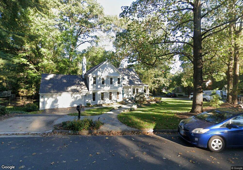
2025 Durand Dr Reston, VA 20191
Estimated Value: $812,000 - $970,000
4
Beds
3
Baths
1,807
Sq Ft
$503/Sq Ft
Est. Value
About This Home
This home is located at 2025 Durand Dr, Reston, VA 20191 and is currently estimated at $908,589, approximately $502 per square foot. 2025 Durand Dr is a home located in Fairfax County with nearby schools including Terraset Elementary, Langston Hughes Middle School, and South Lakes High School.
Ownership History
Date
Name
Owned For
Owner Type
Purchase Details
Closed on
Mar 11, 2025
Sold by
Wood Elizabeth J and Badgett Robert Bruce
Bought by
Elizabeth And Robert Badgett Living Trust and Badgett
Current Estimated Value
Purchase Details
Closed on
Aug 5, 1998
Sold by
Dyche Conron K
Bought by
Badgett Robert B
Home Financials for this Owner
Home Financials are based on the most recent Mortgage that was taken out on this home.
Original Mortgage
$205,000
Interest Rate
6.92%
Create a Home Valuation Report for This Property
The Home Valuation Report is an in-depth analysis detailing your home's value as well as a comparison with similar homes in the area
Home Values in the Area
Average Home Value in this Area
Purchase History
| Date | Buyer | Sale Price | Title Company |
|---|---|---|---|
| Elizabeth And Robert Badgett Living Trust | -- | None Listed On Document | |
| Elizabeth And Robert Badgett Living Trust | -- | None Listed On Document | |
| Badgett Robert B | $260,000 | -- |
Source: Public Records
Mortgage History
| Date | Status | Borrower | Loan Amount |
|---|---|---|---|
| Previous Owner | Badgett Robert B | $205,000 |
Source: Public Records
Tax History Compared to Growth
Tax History
| Year | Tax Paid | Tax Assessment Tax Assessment Total Assessment is a certain percentage of the fair market value that is determined by local assessors to be the total taxable value of land and additions on the property. | Land | Improvement |
|---|---|---|---|---|
| 2025 | $8,697 | $847,670 | $392,000 | $455,670 |
| 2024 | $8,697 | $721,460 | $332,000 | $389,460 |
| 2023 | $8,419 | $716,180 | $332,000 | $384,180 |
| 2022 | $8,526 | $716,180 | $332,000 | $384,180 |
| 2021 | $7,825 | $641,120 | $302,000 | $339,120 |
| 2020 | $7,889 | $641,120 | $302,000 | $339,120 |
| 2019 | $7,729 | $628,080 | $302,000 | $326,080 |
| 2018 | $6,804 | $591,690 | $272,000 | $319,690 |
| 2017 | $7,148 | $591,690 | $272,000 | $319,690 |
| 2016 | $7,252 | $601,580 | $272,000 | $329,580 |
| 2015 | $7,156 | $615,310 | $272,000 | $343,310 |
| 2014 | $7,141 | $615,310 | $272,000 | $343,310 |
Source: Public Records
Map
Nearby Homes
- 2015 Soapstone Dr
- 2029 Wethersfield Ct
- 2037 Wethersfield Ct
- 2050 Golf Course Dr
- 2015 Wethersfield Ct
- 1950 Weybridge Ln
- 11401 Turnmill Ln
- 11428 Purple Beech Dr
- 2134 Golf Course Dr
- 11301 Gatesborough Ln
- 11303 Harborside Cluster
- 2180 Golf Course Dr
- 11735 Ledura Ct Unit 201
- 11648 Ivystone Ct Unit 1B2
- 11332 Headlands Ct
- 2022 Headlands Cir
- 11564 Rolling Green Ct Unit 12/100B
- 2210 Coppersmith Square
- 11817 Coopers Ct
- 11825 Coopers Ct
- 2021 Durand Dr
- 2006 Homer Terrace
- 2007 Homer Terrace
- 2009 Homer Terrace
- 2026 Durand Dr
- 2022 Durand Dr
- 2005 Homer Terrace
- 2004 Homer Terrace
- 2033 Durand Dr
- 2030 Durand Dr
- 2003 Homer Terrace
- 2014 Homer Terrace
- 2002 Homer Terrace
- 2034 Durand Dr
- 2035 Durand Dr
- 2000 Winged Foot Ct
- 2002 Winged Foot Ct
- 2004 Winged Foot Ct
- 2006 Winged Foot Ct
- 2001 Winged Foot Ct
