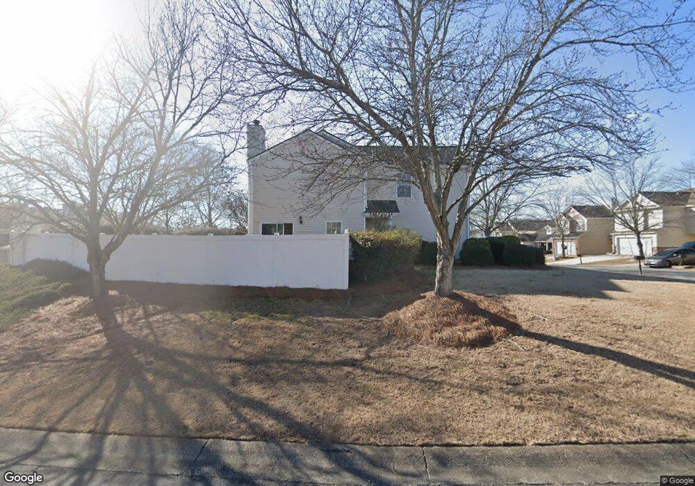
2025 Lexington Ln Cumming, GA 30040
Estimated Value: $367,000 - $383,425
3
Beds
3
Baths
1,360
Sq Ft
$274/Sq Ft
Est. Value
About This Home
This home is located at 2025 Lexington Ln, Cumming, GA 30040 and is currently estimated at $373,106, approximately $274 per square foot. 2025 Lexington Ln is a home located in Forsyth County with nearby schools including George W. Whitlow Elementary School, Otwell Middle School, and Forsyth Central High School.
Ownership History
Date
Name
Owned For
Owner Type
Purchase Details
Closed on
Dec 28, 2005
Sold by
Brown Robert W
Bought by
Padis Harry and Padis Myrna
Current Estimated Value
Purchase Details
Closed on
May 20, 1999
Sold by
Henderson Judy G
Bought by
Second Half Prop Llc
Purchase Details
Closed on
Mar 1, 1999
Sold by
Colony Homes At & Ta East Llc
Bought by
Brown Robert W
Home Financials for this Owner
Home Financials are based on the most recent Mortgage that was taken out on this home.
Original Mortgage
$115,800
Interest Rate
6.98%
Mortgage Type
FHA
Create a Home Valuation Report for This Property
The Home Valuation Report is an in-depth analysis detailing your home's value as well as a comparison with similar homes in the area
Home Values in the Area
Average Home Value in this Area
Purchase History
| Date | Buyer | Sale Price | Title Company |
|---|---|---|---|
| Padis Harry | $148,500 | -- | |
| Second Half Prop Llc | -- | -- | |
| Brown Robert W | $116,900 | -- |
Source: Public Records
Mortgage History
| Date | Status | Borrower | Loan Amount |
|---|---|---|---|
| Previous Owner | Brown Robert W | $115,800 |
Source: Public Records
Tax History Compared to Growth
Tax History
| Year | Tax Paid | Tax Assessment Tax Assessment Total Assessment is a certain percentage of the fair market value that is determined by local assessors to be the total taxable value of land and additions on the property. | Land | Improvement |
|---|---|---|---|---|
| 2025 | $3,497 | $145,588 | $66,000 | $79,588 |
| 2024 | $3,497 | $142,600 | $66,000 | $76,600 |
| 2023 | $3,097 | $125,812 | $62,000 | $63,812 |
| 2022 | $2,941 | $85,348 | $32,000 | $53,348 |
| 2021 | $2,357 | $85,348 | $32,000 | $53,348 |
| 2020 | $2,292 | $83,000 | $32,000 | $51,000 |
| 2019 | $2,134 | $77,172 | $32,000 | $45,172 |
| 2018 | $2,037 | $73,664 | $32,000 | $41,664 |
| 2017 | $1,887 | $67,980 | $32,000 | $35,980 |
| 2016 | $1,665 | $59,980 | $24,000 | $35,980 |
| 2015 | $1,501 | $53,980 | $18,000 | $35,980 |
| 2014 | $1,307 | $49,352 | $0 | $0 |
Source: Public Records
Map
Nearby Homes
- 1404 Lexington Ln
- 2545 Gatewater Ct
- 6165 Bennett Pkwy
- 6330 Turfway Dr Unit II
- 5510 Crestwick Way
- 4914 Sherwood Way
- 3210 Fitzgerald Way
- 5314 Sherwood Way
- 5875 Weddington Dr
- 6260 Sturbridge Ln
- 3211 Orwell Way Unit 4404
- 3211 Orwell Way Unit 4305
- 3321 Orwell Way Unit 3301
- 3321 Orwell Way Unit 3106
- 5825 Crestwick Way
- 980 Patriot Trail
- 2035 Lexington Ln
- 2040 Keenland Ct
- 2045 Lexington Ln
- 1975 Lexington Ln
- 2050 Keenland Ct
- 2055 Lexington Ln
- 2025 Keenland Ct
- 2035 Keenland Ct
- 2020 Lexington Ln
- 2045 Keenland Ct
- 2030 Lexington Ln
- 2060 Keenland Ct
- 2010 Lexington Ln
- 1955 Lexington Ln
- 2040 Lexington Ln
- 2065 Lexington Ln
- 1990 Lexington Ln
- 2055 Keenland Ct
- 2050 Lexington Ln
- 2115 Calumet Crossing