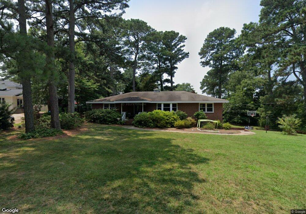
2025 Lone Pine Rd Unit X6752 Virginia Beach, VA 23451
Broad Bay Island NeighborhoodEstimated Value: $847,043 - $1,004,000
3
Beds
2
Baths
2,080
Sq Ft
$435/Sq Ft
Est. Value
About This Home
This home is located at 2025 Lone Pine Rd Unit X6752, Virginia Beach, VA 23451 and is currently estimated at $905,011, approximately $435 per square foot. 2025 Lone Pine Rd Unit X6752 is a home located in Virginia Beach City with nearby schools including John B. Dey Elementary School, Great Neck Middle School, and Frank W. Cox High School.
Ownership History
Date
Name
Owned For
Owner Type
Purchase Details
Closed on
May 24, 2024
Sold by
Surratt Anna H
Bought by
Holloway Alexander Grosvenor and Bohan Elizabeth Allen
Current Estimated Value
Home Financials for this Owner
Home Financials are based on the most recent Mortgage that was taken out on this home.
Original Mortgage
$766,125
Outstanding Balance
$755,824
Interest Rate
7.1%
Mortgage Type
VA
Estimated Equity
$149,187
Purchase Details
Closed on
Jul 17, 2018
Sold by
Surratt Matthew F and Surratt Anna H
Bought by
Surratt Anna H
Purchase Details
Closed on
Nov 7, 2016
Sold by
O'Berry Dorothy L
Bought by
Surratt Matthew F and Surratt Anna H
Create a Home Valuation Report for This Property
The Home Valuation Report is an in-depth analysis detailing your home's value as well as a comparison with similar homes in the area
Home Values in the Area
Average Home Value in this Area
Purchase History
| Date | Buyer | Sale Price | Title Company |
|---|---|---|---|
| Holloway Alexander Grosvenor | $780,000 | Fidelity National Title Insura | |
| Surratt Anna H | -- | None Available | |
| Surratt Matthew F | $430,000 | Attorney |
Source: Public Records
Mortgage History
| Date | Status | Borrower | Loan Amount |
|---|---|---|---|
| Open | Holloway Alexander Grosvenor | $766,125 |
Source: Public Records
Tax History Compared to Growth
Tax History
| Year | Tax Paid | Tax Assessment Tax Assessment Total Assessment is a certain percentage of the fair market value that is determined by local assessors to be the total taxable value of land and additions on the property. | Land | Improvement |
|---|---|---|---|---|
| 2025 | $6,451 | $831,700 | $558,600 | $273,100 |
| 2024 | $6,451 | $665,000 | $558,600 | $106,400 |
| 2023 | $6,342 | $640,600 | $539,000 | $101,600 |
| 2022 | $5,373 | $542,700 | $450,800 | $91,900 |
| 2021 | $4,723 | $477,100 | $387,100 | $90,000 |
| 2020 | $4,791 | $470,900 | $387,100 | $83,800 |
| 2019 | $4,742 | $444,500 | $367,500 | $77,000 |
| 2018 | $4,456 | $444,500 | $367,500 | $77,000 |
| 2017 | $4,289 | $427,800 | $352,800 | $75,000 |
| 2016 | $4,060 | $410,100 | $338,100 | $72,000 |
| 2015 | $4,011 | $405,200 | $338,100 | $67,100 |
| 2014 | $3,657 | $393,200 | $338,100 | $55,100 |
Source: Public Records
Map
Nearby Homes
- 2509 Lone Pine Point
- 2328 Spindrift Rd
- 2123 Wake Forest St
- 2637 Broad Bay Rd
- 2005 Bay Rd
- The Savannah Plan at Cape Story by The Sea - Capestory by The Sea
- The Newcastle Plan at Cape Story by The Sea - Capestory by The Sea
- 2204 Sandalwood Rd
- 2581 Shore Dr
- 2319 Kendall St
- 2219 Oak St
- 2323 First Landing Ln
- 2189 Creeks Edge Dr
- 2021 Thomas Bishop Ln
- 2264 Cape Arbor Dr
- 2365 Haversham Close
- 2508 Queens Elm Place
- 2911 Breezy Rd
- 2830 Shore Dr Unit 507
- 2830 Shore Dr Unit PH1
- 2008 Blueberry Rd
- 2004 Blueberry Rd
- 2012 Blueberry Rd
- 2500 Broad Bay Rd
- 2033 Lone Pine Rd
- 2016 Blueberry Rd
- 2504 Broad Bay Rd
- 2432 Spindrift Rd
- 2013 Blueberry Rd
- 2428 Spindrift Rd
- 2005 Blueberry Rd
- 2501 Broad Bay Rd
- 2009 Blueberry Rd
- 2512 Broad Bay Rd
- 2429 Broad Bay Rd
- 2424 Spindrift Rd
- 2425 Broad Bay Rd
- 2505 Broad Bay Rd
- 2004 Edmonds Rd
- 2116 E Admiral Dr