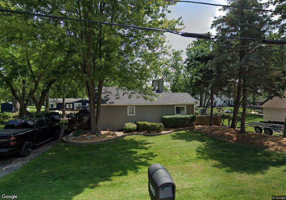
2025 Rosedale Dr West Bloomfield, MI 48324
Estimated Value: $298,658 - $378,000
2
Beds
1
Bath
1,100
Sq Ft
$316/Sq Ft
Est. Value
About This Home
This home is located at 2025 Rosedale Dr, West Bloomfield, MI 48324 and is currently estimated at $347,415, approximately $315 per square foot. 2025 Rosedale Dr is a home located in Oakland County with nearby schools including Waterford Montessori Academy, Our Lady Of Refuge School, and Lakecrest Baptist School.
Ownership History
Date
Name
Owned For
Owner Type
Purchase Details
Closed on
Dec 20, 2004
Sold by
Madigan Nancy L
Bought by
Zamler Ryan
Current Estimated Value
Home Financials for this Owner
Home Financials are based on the most recent Mortgage that was taken out on this home.
Original Mortgage
$176,000
Outstanding Balance
$88,669
Interest Rate
5.82%
Mortgage Type
Purchase Money Mortgage
Estimated Equity
$258,746
Purchase Details
Closed on
Jun 29, 2000
Sold by
Backalukas Michael A
Bought by
Madigan Nancy L
Create a Home Valuation Report for This Property
The Home Valuation Report is an in-depth analysis detailing your home's value as well as a comparison with similar homes in the area
Home Values in the Area
Average Home Value in this Area
Purchase History
| Date | Buyer | Sale Price | Title Company |
|---|---|---|---|
| Zamler Ryan | $220,000 | Mta | |
| Madigan Nancy L | $235,900 | -- |
Source: Public Records
Mortgage History
| Date | Status | Borrower | Loan Amount |
|---|---|---|---|
| Open | Zamler Ryan | $176,000 | |
| Closed | Madigan Nancy L | -- | |
| Closed | Zamler Ryan | $14,000 |
Source: Public Records
Tax History Compared to Growth
Tax History
| Year | Tax Paid | Tax Assessment Tax Assessment Total Assessment is a certain percentage of the fair market value that is determined by local assessors to be the total taxable value of land and additions on the property. | Land | Improvement |
|---|---|---|---|---|
| 2024 | $1,842 | $134,090 | $0 | $0 |
| 2022 | $1,764 | $106,800 | $50,040 | $56,760 |
| 2021 | $3,597 | $100,260 | $0 | $0 |
| 2020 | $1,728 | $98,280 | $50,040 | $48,240 |
| 2018 | $3,182 | $88,090 | $50,040 | $38,050 |
| 2015 | -- | $59,300 | $0 | $0 |
| 2014 | -- | $54,980 | $0 | $0 |
| 2011 | -- | $56,000 | $0 | $0 |
Source: Public Records
Map
Nearby Homes
- 2115 Aldwin Dr
- 5149 Latimer St
- 5145 Greer Rd
- 1677 Parkview Ave
- 4796 Dow Ridge Rd
- 4764 Dow Ridge Rd
- 1859 Poppleton Dr
- 1522 Oregon Ct
- 1844 Poppleton Dr
- 1753 Dawncrest Dr
- 2110 Peachtree Ct
- 5190 Westcombe Ln
- 2780 Orchard Place
- VAC Daron Ln
- 5699 Applegrove Dr
- 3102 Rose Ln
- Lots Green Lake Langtoft
- 2501 Doleman Dr
- 2140 Timberridge Ct
- 00000 Muskingum
- 2032 Allendale Ave
- 2051 Rosedale Dr
- 4859 Greer Rd
- 4840 Greer Rd
- 2056 Rosedale Dr
- 2061 Rosedale Dr
- 4863 Greer Rd
- 2056 Allendale Ave
- 1996 Allendale Ave
- 4770 Mapleview Ave
- 4781 Greer Rd
- 2085 Rosedale Dr
- 4789 Mapleview Ave
- 4881 Greer Rd Unit Bldg-Unit
- 4881 Greer Rd
- 4860 Lakeview Ave
- 1965 Rosedale St
- 1990 Allendale Ave
- 4779 Mapleview Ave
- 1959 Rosedale St