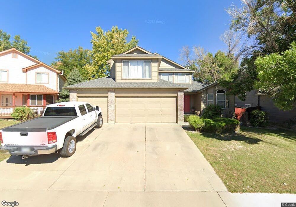
2025 W 134th Way Denver, CO 80234
Quail Ridge-Adams NeighborhoodEstimated Value: $569,558 - $578,000
4
Beds
3
Baths
2,050
Sq Ft
$280/Sq Ft
Est. Value
About This Home
This home is located at 2025 W 134th Way, Denver, CO 80234 and is currently estimated at $574,390, approximately $280 per square foot. 2025 W 134th Way is a home located in Adams County with nearby schools including Arapahoe Ridge Elementary School, Silver Hills Middle School, and Legacy High School.
Ownership History
Date
Name
Owned For
Owner Type
Purchase Details
Closed on
Aug 31, 2001
Sold by
Fratolill Girard R and Fratolill Ronald A
Bought by
Vang Bong and Moua Manivone
Current Estimated Value
Home Financials for this Owner
Home Financials are based on the most recent Mortgage that was taken out on this home.
Original Mortgage
$220,000
Outstanding Balance
$86,288
Interest Rate
7.07%
Estimated Equity
$488,102
Purchase Details
Closed on
Dec 15, 1994
Sold by
Melody Homes Inc
Bought by
Fratolill Girard R and Fratolill Ronald A
Home Financials for this Owner
Home Financials are based on the most recent Mortgage that was taken out on this home.
Original Mortgage
$135,600
Interest Rate
7.25%
Create a Home Valuation Report for This Property
The Home Valuation Report is an in-depth analysis detailing your home's value as well as a comparison with similar homes in the area
Home Values in the Area
Average Home Value in this Area
Purchase History
| Date | Buyer | Sale Price | Title Company |
|---|---|---|---|
| Vang Bong | $275,000 | North American Title Co | |
| Fratolill Girard R | $169,521 | Land Title |
Source: Public Records
Mortgage History
| Date | Status | Borrower | Loan Amount |
|---|---|---|---|
| Open | Vang Bong | $220,000 | |
| Previous Owner | Fratolill Girard R | $135,600 |
Source: Public Records
Tax History Compared to Growth
Tax History
| Year | Tax Paid | Tax Assessment Tax Assessment Total Assessment is a certain percentage of the fair market value that is determined by local assessors to be the total taxable value of land and additions on the property. | Land | Improvement |
|---|---|---|---|---|
| 2024 | $3,559 | $34,190 | $6,250 | $27,940 |
| 2023 | $3,521 | $39,920 | $6,430 | $33,490 |
| 2022 | $3,172 | $30,210 | $6,600 | $23,610 |
| 2021 | $3,276 | $30,210 | $6,600 | $23,610 |
| 2020 | $2,958 | $27,820 | $6,790 | $21,030 |
| 2019 | $2,964 | $27,820 | $6,790 | $21,030 |
| 2018 | $2,693 | $24,520 | $6,550 | $17,970 |
| 2017 | $2,437 | $24,520 | $6,550 | $17,970 |
| 2016 | $2,099 | $20,530 | $4,060 | $16,470 |
| 2015 | $2,096 | $20,530 | $4,060 | $16,470 |
| 2014 | -- | $18,950 | $3,500 | $15,450 |
Source: Public Records
Map
Nearby Homes
- 13112 Umatilla Ct
- 13146 Raritan Ct
- 2595 W 133rd Cir
- 2537 W 132nd Way
- 13735 Shoshone Ln
- 13699 Pecos Loop
- 13764 Shoshone Ln
- 1421 W 132nd Place
- 1735 W 130th Place
- 3083 W 134th Cir
- 13900 Lake Song Ln Unit J2
- 860 W 132nd Ave Unit 179
- 860 W 132nd Ave Unit 312
- 860 W 132nd Ave Unit 44
- 860 W 132nd Ave Unit 340
- 860 W 132nd Ave Unit 112
- 860 W 132nd Ave Unit 42
- 860 W 132nd Ave Unit 179
- 860 W 132nd Ave Unit 105
- 860 W 132nd Ave Unit 44
- 2015 W 134th Way
- 2055 W 134th Way
- 2050 W 135th Ave
- 2100 W 135th Ave
- 2030 W 135th Ave
- 2065 W 134th Way
- 13405 Tejon St
- 13455 Tejon St
- 13455 Tejon St
- 2020 W 134th Way
- 2070 W 134th Way
- 2180 W 135th Ave
- 2040 W 134th Way
- 13495 Tejon St
- 2010 W 134th Way
- 2060 W 134th Way
- 2190 W 135th Ave
- 2105 W 135th Ave
- 2045 W 135th Ave
- 2135 W 135th Ave