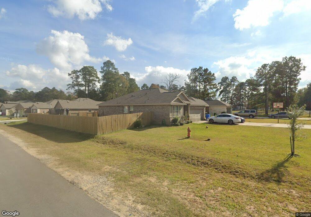
2025 Waukegan Rd Conroe, TX 77306
Estimated Value: $237,000 - $332,000
3
Beds
2
Baths
1,650
Sq Ft
$168/Sq Ft
Est. Value
About This Home
This home is located at 2025 Waukegan Rd, Conroe, TX 77306 and is currently estimated at $276,684, approximately $167 per square foot. 2025 Waukegan Rd is a home located in Montgomery County with nearby schools including Austin Elementary School, Moorhead Junior High School, and Caney Creek High School.
Ownership History
Date
Name
Owned For
Owner Type
Purchase Details
Closed on
Mar 14, 2019
Sold by
First America Homes Ltd
Bought by
Deras Johny and Deras Yadira
Current Estimated Value
Home Financials for this Owner
Home Financials are based on the most recent Mortgage that was taken out on this home.
Original Mortgage
$200,244
Outstanding Balance
$176,049
Interest Rate
4.4%
Mortgage Type
FHA
Estimated Equity
$100,635
Purchase Details
Closed on
Mar 5, 2019
Sold by
Lopez Rene Martinez and Almazan Castillo Alma Lilia
Bought by
Forest Trace Development Ltd
Home Financials for this Owner
Home Financials are based on the most recent Mortgage that was taken out on this home.
Original Mortgage
$200,244
Outstanding Balance
$176,049
Interest Rate
4.4%
Mortgage Type
FHA
Estimated Equity
$100,635
Create a Home Valuation Report for This Property
The Home Valuation Report is an in-depth analysis detailing your home's value as well as a comparison with similar homes in the area
Home Values in the Area
Average Home Value in this Area
Purchase History
| Date | Buyer | Sale Price | Title Company |
|---|---|---|---|
| Deras Johny | -- | Platinum Title | |
| Forest Trace Development Ltd | $42,000 | None Available |
Source: Public Records
Mortgage History
| Date | Status | Borrower | Loan Amount |
|---|---|---|---|
| Open | Deras Johny | $200,244 | |
| Closed | Forest Trace Development Ltd | $200,244 |
Source: Public Records
Tax History Compared to Growth
Tax History
| Year | Tax Paid | Tax Assessment Tax Assessment Total Assessment is a certain percentage of the fair market value that is determined by local assessors to be the total taxable value of land and additions on the property. | Land | Improvement |
|---|---|---|---|---|
| 2025 | $3,386 | $272,421 | $43,415 | $229,006 |
| 2024 | $4,898 | $290,704 | $43,415 | $247,289 |
| 2023 | $4,898 | $308,510 | $43,420 | $265,090 |
| 2022 | $4,906 | $281,610 | $43,420 | $238,190 |
| 2021 | $4,078 | $220,560 | $43,420 | $177,140 |
| 2020 | $4,077 | $209,700 | $43,420 | $166,280 |
| 2019 | $3,953 | $196,230 | $43,420 | $152,810 |
Source: Public Records
Map
Nearby Homes
- Caldwell Plan at Meadow Glen
- 855 Waukegan Rd
- 14951 N Ascot Bend Cir
- 15043 Meadow Glen N
- 14947 N Ascot Bend Cir
- 15059 Meadow Glen N
- 15068 Meadow Glen N
- 2702 Pheasant Hill Ct
- 15072 Meadow Glen N
- 14749 S Ascot Bend Cir
- 14744 S Ascot Bend Cir
- Oakridge Plan at Meadow Park
- Idlewood Plan at Meadow Park
- Kitson Plan at Meadow Park
- Whitetail Plan at Meadow Park
- Pinehollow Plan at Meadow Park
- 14896 N Ascot Bend Cir
- 14897 N Ascot Bend Cir
- 14892 N Ascot Bend Cir
- 3537 Korina Way
- 2165 Waukegan Rd
- 15108 Meadow Glen S
- 15108 Meadow Glen S
- 1635 Waukegan Rd
- 15112 Meadow Glen S
- 15113 Meadow Glen S
- 15116 Meadow Glen S
- 2801 Waukegan Rd
- 1325 Waukegan Rd
- 15117 Meadow Glen S
- 15120 Meadow Glen S
- 15012 Meadow Glen N
- 15012 Meadow Glen N
- 15121 Meadow Glen S
- 1175 Waukegan Rd
- 15124 Meadow Glen S
- 15016 Meadow Glen N
- 15125 Meadow Glen S
- 15128 Meadow Glen S
- 15020 Meadow Glen N